List of mountains in Big Horn County, Montana
This list is incomplete; you can help by expanding it.
There are at least 42 named mountains in Big Horn County, Montana.
- Abbots Urn, 45°41′57″N 107°25′08″W / 45.69917°N 107.41889°W, el. 3,442 feet (1,049 m)[1]
- Battle Ridge, 45°34′02″N 107°25′24″W / 45.56722°N 107.42333°W, el. 3,284 feet (1,001 m)[2]
- Black Gulch Point, 45°02′01″N 107°33′16″W / 45.03361°N 107.55444°W, el. 4,902 feet (1,494 m)[3]
- Buffalo Jump, 45°13′44″N 106°58′26″W / 45.22889°N 106.97389°W, el. 4,518 feet (1,377 m)[4]
- Buffalo Jump, 45°14′17″N 108°16′52″W / 45.23806°N 108.28111°W, el. 4,606 feet (1,404 m)[5]
- Busby Butte, 45°30′04″N 106°52′34″W / 45.50111°N 106.87611°W, el. 4,544 feet (1,385 m)[6]
- Calhoun Hill, 45°33′50″N 107°25′03″W / 45.56389°N 107.41750°W, el. 3,304 feet (1,007 m)[7]
- Castle Rock, 45°39′34″N 107°09′43″W / 45.65944°N 107.16194°W, el. 3,839 feet (1,170 m)[8]
- Chalk Butte, 45°11′55″N 107°18′49″W / 45.19861°N 107.31361°W, el. 3,730 feet (1,140 m)[9]
- Crown Butte, 45°15′20″N 108°30′41″W / 45.25556°N 108.51139°W, el. 6,880 feet (2,100 m)[10]
- Dead Indian Hill, 45°09′25″N 108°08′23″W / 45.15694°N 108.13972°W, el. 4,557 feet (1,389 m)[11]
- Eagle Butte, 45°41′18″N 107°17′59″W / 45.68833°N 107.29972°W, el. 3,547 feet (1,081 m)[12]
- Eagle Nest Peak, 45°12′43″N 106°59′56″W / 45.21194°N 106.99889°W, el. 4,514 feet (1,376 m)[13]
- Eagle Point, 45°02′14″N 107°36′53″W / 45.03722°N 107.61472°W, el. 5,007 feet (1,526 m)[14]
- Gracy Butte, 45°51′35″N 107°21′12″W / 45.85972°N 107.35333°W, el. 3,379 feet (1,030 m)[15]
- Grapevine Dome, 45°20′44″N 108°05′01″W / 45.34556°N 108.08361°W, el. 4,485 feet (1,367 m)[16]
- Half Moon Hill, 45°13′06″N 106°55′54″W / 45.21833°N 106.93167°W, el. 4,511 feet (1,375 m)[17]
- Hampton Butte, 45°00′58″N 106°24′20″W / 45.01611°N 106.40556°W, el. 3,957 feet (1,206 m)[18]
- Haystack Butte, 45°40′53″N 107°26′39″W / 45.68139°N 107.44417°W, el. 3,202 feet (976 m)[19]
- Haystack Butte, 45°47′28″N 107°23′12″W / 45.79111°N 107.38667°W, el. 3,632 feet (1,107 m)[20]
- Hellers Peak, 45°03′49″N 106°27′54″W / 45.06361°N 106.46500°W, el. 3,717 feet (1,133 m)[21]
- Hive Butte, 45°45′19″N 107°31′09″W / 45.75528°N 107.51917°W, el. 3,100 feet (940 m)[22]
- Horn Mountain, 45°18′31″N 106°53′10″W / 45.30861°N 106.88611°W, el. 4,731 feet (1,442 m)[23]
- Last Stand Hill, 45°34′13″N 107°25′37″W / 45.57028°N 107.42694°W, el. 3,304 feet (1,007 m)[24]
- Mission Buttes, 45°26′58″N 107°37′51″W / 45.44944°N 107.63083°W, el. 3,921 feet (1,195 m)[25]
- Old Flat Top, 45°05′42″N 106°29′47″W / 45.09500°N 106.49639°W, el. 3,930 feet (1,200 m)[26]
- Painted Hill, 45°36′44″N 106°50′40″W / 45.61222°N 106.84444°W, el. 3,740 feet (1,140 m)[27]
- Peyote Point, 45°07′53″N 107°55′24″W / 45.13139°N 107.92333°W, el. 7,218 feet (2,200 m)[28]
- Point Lookout, 45°06′53″N 107°53′08″W / 45.11472°N 107.88556°W, el. 7,247 feet (2,209 m)[29]
- Rattlesnake Butte, 45°16′31″N 107°40′08″W / 45.27528°N 107.66889°W, el. 4,213 feet (1,284 m)[30]
- Red Butte, 45°51′55″N 106°58′06″W / 45.86528°N 106.96833°W, el. 4,459 feet (1,359 m)[31]
- Red Hill, 45°37′13″N 106°56′23″W / 45.62028°N 106.93972°W, el. 4,019 feet (1,225 m)[32]
- Red Hills, 45°50′55″N 107°15′57″W / 45.84861°N 107.26583°W, el. 3,468 feet (1,057 m)[33]
- Sarpy Mountains, 45°38′45″N 106°59′04″W / 45.64583°N 106.98444°W, el. 4,544 feet (1,385 m)[34]
- Shortys Hill, 45°17′58″N 107°10′24″W / 45.29944°N 107.17333°W, el. 5,121 feet (1,561 m)[35]
- The Mesa, 45°00′42″N 107°42′12″W / 45.01167°N 107.70333°W, el. 5,777 feet (1,761 m)[36]
- The Pyramid, 45°04′52″N 106°19′21″W / 45.08111°N 106.32250°W, el. 3,989 feet (1,216 m)[37]
- Twin Peaks, 45°27′47″N 107°58′41″W / 45.46306°N 107.97806°W, el. 3,524 feet (1,074 m)[38]
- Walker Hill, 45°42′00″N 107°42′51″W / 45.70000°N 107.71417°W, el. 3,261 feet (994 m)[39]
- War Man Mountain, 45°15′03″N 107°53′47″W / 45.25083°N 107.89639°W, el. 5,184 feet (1,580 m)[40]
- Weir Point, 45°32′03″N 107°23′34″W / 45.53417°N 107.39278°W, el. 3,415 feet (1,041 m)[41]
- West Pryor Mountain, 45°19′15″N 108°36′44″W / 45.32083°N 108.61222°W, el. 6,680 feet (2,040 m)[42]
See also
Notes
- ↑ "Abbots Urn". Geographic Names Information System. United States Geological Survey.
- ↑ "Battle Ridge". Geographic Names Information System. United States Geological Survey.
- ↑ "Black Gulch Point". Geographic Names Information System. United States Geological Survey.
- ↑ "Buffalo Jump". Geographic Names Information System. United States Geological Survey.
- ↑ "Buffalo Jump". Geographic Names Information System. United States Geological Survey.
- ↑ "Busby Butte". Geographic Names Information System. United States Geological Survey.
- ↑ "Calhoun Hill". Geographic Names Information System. United States Geological Survey.
- ↑ "Castle Rock". Geographic Names Information System. United States Geological Survey.
- ↑ "Chalk Butte". Geographic Names Information System. United States Geological Survey.
- ↑ "Crown Butte". Geographic Names Information System. United States Geological Survey.
- ↑ "Dead Indian Hill". Geographic Names Information System. United States Geological Survey.
- ↑ "Eagle Butte". Geographic Names Information System. United States Geological Survey.
- ↑ "Eagle Nest Peak". Geographic Names Information System. United States Geological Survey.
- ↑ "Eagle Point". Geographic Names Information System. United States Geological Survey.
- ↑ "Gracy Butte". Geographic Names Information System. United States Geological Survey.
- ↑ "Grapevine Dome". Geographic Names Information System. United States Geological Survey.
- ↑ "Half Moon Hill". Geographic Names Information System. United States Geological Survey.
- ↑ "Hampton Butte". Geographic Names Information System. United States Geological Survey.
- ↑ "Haystack Butte". Geographic Names Information System. United States Geological Survey.
- ↑ "Haystack Butte". Geographic Names Information System. United States Geological Survey.
- ↑ "Hellers Peak". Geographic Names Information System. United States Geological Survey.
- ↑ "Hive Butte". Geographic Names Information System. United States Geological Survey.
- ↑ "Horn Mountain". Geographic Names Information System. United States Geological Survey.
- ↑ "Last Stand Hill". Geographic Names Information System. United States Geological Survey.
- ↑ "Mission Buttes". Geographic Names Information System. United States Geological Survey.
- ↑ "Old Flat Top". Geographic Names Information System. United States Geological Survey.
- ↑ "Painted Hill". Geographic Names Information System. United States Geological Survey.
- ↑ "Peyote Point". Geographic Names Information System. United States Geological Survey.
- ↑ "Point Lookout". Geographic Names Information System. United States Geological Survey.
- ↑ "Rattlesnake Butte". Geographic Names Information System. United States Geological Survey.
- ↑ "Red Butte". Geographic Names Information System. United States Geological Survey.
- ↑ "Red Hill". Geographic Names Information System. United States Geological Survey.
- ↑ "Red Hills". Geographic Names Information System. United States Geological Survey.
- ↑ "Sarpy Mountains". Geographic Names Information System. United States Geological Survey.
- ↑ "Shortys Hill". Geographic Names Information System. United States Geological Survey.
- ↑ "The Mesa". Geographic Names Information System. United States Geological Survey.
- ↑ "The Pyramid". Geographic Names Information System. United States Geological Survey.
- ↑ "Twin Peaks". Geographic Names Information System. United States Geological Survey.
- ↑ "Walker Hill". Geographic Names Information System. United States Geological Survey.
- ↑ "War Man Mountain". Geographic Names Information System. United States Geological Survey.
- ↑ "Weir Point". Geographic Names Information System. United States Geological Survey.
- ↑ "West Pryor Mountain". Geographic Names Information System. United States Geological Survey.
Municipalities and communities of Big Horn County, Montana, United States | ||
|---|---|---|
| City | 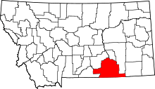 | |
| Town | ||
| CDPs | ||
| Unincorporated communities | ||
| Indian reservations | ||
| Footnotes | ‡This populated place also has portions in an adjacent county or counties | |
This article is issued from Wikipedia - version of the 7/1/2012. The text is available under the Creative Commons Attribution/Share Alike but additional terms may apply for the media files.