List of mountains in Lewis and Clark County, Montana
This list is incomplete; you can help by expanding it.
There are at least 149 named mountains in Lewis and Clark County, Montana.
- Allan Mountain, 47°33′42″N 112°48′07″W / 47.56167°N 112.80194°W, el. 7,812 feet (2,381 m)[1]
- Anaconda Hill, 47°02′48″N 112°20′13″W / 47.04667°N 112.33694°W, el. 7,149 feet (2,179 m)[2]
- Angle Point, 47°55′37″N 113°03′56″W / 47.92694°N 113.06556°W, el. 7,953 feet (2,424 m)[3]
- Ayres Peak, 47°25′05″N 113°02′01″W / 47.41806°N 113.03361°W, el. 7,815 feet (2,382 m)[4]
- Bald Butte, 46°43′14″N 112°20′32″W / 46.72056°N 112.34222°W, el. 6,995 feet (2,132 m)[5]
- Baldy Mountain, 46°54′16″N 112°37′58″W / 46.90444°N 112.63278°W, el. 6,371 feet (1,942 m)[6]
- Baldy Mountain, 46°49′51″N 112°07′39″W / 46.83083°N 112.12750°W, el. 6,129 feet (1,868 m)[7]
- Bear Den Mountain, 47°13′25″N 112°31′18″W / 47.22361°N 112.52167°W, el. 6,844 feet (2,086 m)[8]
- Beartooth Mountain, 46°53′48″N 111°58′16″W / 46.89667°N 111.97111°W, el. 6,033 feet (1,839 m)[9]
- Black Butte, 47°31′36″N 112°35′59″W / 47.52667°N 112.59972°W, el. 5,115 feet (1,559 m)[10]
- Black Mountain, 46°31′07″N 112°12′41″W / 46.51861°N 112.21139°W, el. 7,136 feet (2,175 m)[11]
- Black Mountain, 46°44′20″N 112°31′17″W / 46.73889°N 112.52139°W, el. 8,297 feet (2,529 m)[12]
- Black Rock, 47°14′49″N 112°09′20″W / 47.24694°N 112.15556°W, el. 4,767 feet (1,453 m)[13]
- Blowout Mountain, 47°11′24″N 112°27′38″W / 47.19000°N 112.46056°W, el. 7,657 feet (2,334 m)[14]
- Brewer Hill, 47°04′30″N 111°58′19″W / 47.07500°N 111.97194°W, el. 3,517 feet (1,072 m)[15]
- Bunyan Point, 47°23′08″N 112°51′00″W / 47.38556°N 112.85000°W, el. 7,280 feet (2,220 m)[16]
- Burn Top Mountain, 47°30′18″N 112°48′28″W / 47.50500°N 112.80778°W, el. 7,474 feet (2,278 m)[17]
- Butcher Mountain, 47°04′09″N 112°11′02″W / 47.06917°N 112.18389°W, el. 5,364 feet (1,635 m)[18]
- Candle Mountain, 46°53′38″N 111°47′01″W / 46.89389°N 111.78361°W, el. 7,408 feet (2,258 m)[19]
- Canyon Point, 47°13′42″N 113°01′11″W / 47.22833°N 113.01972°W, el. 7,533 feet (2,296 m)[20]
- Cap Mountain, 46°51′29″N 111°51′42″W / 46.85806°N 111.86167°W, el. 6,722 feet (2,049 m)[21]
- Carey Butte, 47°30′17″N 112°27′20″W / 47.50472°N 112.45556°W, el. 4,564 feet (1,391 m)[22]
- Caribou Peak, 47°11′18″N 112°34′25″W / 47.18833°N 112.57361°W, el. 8,737 feet (2,663 m)[23]
- Cemetery Hill, 46°38′03″N 111°42′23″W / 46.63417°N 111.70639°W, el. 3,812 feet (1,162 m)[24]
- Cigarette Rock, 47°21′58″N 112°51′06″W / 47.36611°N 112.85167°W, el. 8,235 feet (2,510 m)[25]
- Coburn Mountain, 47°08′40″N 112°01′22″W / 47.14444°N 112.02278°W, el. 5,105 feet (1,556 m)[26]
- Colorado Mountain, 46°30′14″N 112°12′30″W / 46.50389°N 112.20833°W, el. 7,218 feet (2,200 m)[27]
- Comb Rock, 47°13′50″N 112°10′17″W / 47.23056°N 112.17139°W, el. 4,291 feet (1,308 m)[28]
- Concord Mountain, 47°17′29″N 113°00′22″W / 47.29139°N 113.00611°W, el. 6,916 feet (2,108 m)[29]
- Copper Butte, 46°47′11″N 112°01′05″W / 46.78639°N 112.01806°W, el. 4,980 feet (1,520 m)[30]
- Crater Mountain, 46°55′27″N 112°30′22″W / 46.92417°N 112.50611°W, el. 7,123 feet (2,171 m)[31]
- Crown Mountain, 47°22′48″N 112°46′00″W / 47.38000°N 112.76667°W, el. 8,340 feet (2,540 m)[32]
- Cyanide Mountain, 47°25′15″N 112°45′38″W / 47.42083°N 112.76056°W, el. 7,825 feet (2,385 m)[33]
- Dalton Mountain, 46°50′51″N 112°42′58″W / 46.84750°N 112.71611°W, el. 6,768 feet (2,063 m)[34]
- Danaher Mountain, 47°16′02″N 113°02′44″W / 47.26722°N 113.04556°W, el. 8,041 feet (2,451 m)[35]
- Deadman Hill, 47°31′53″N 112°57′20″W / 47.53139°N 112.95556°W, el. 7,336 feet (2,236 m)[36]
- Denton Mountain, 47°04′17″N 112°16′38″W / 47.07139°N 112.27722°W, el. 6,132 feet (1,869 m)[37]
- Devils Tower, 46°47′08″N 111°50′22″W / 46.78556°N 111.83944°W, el. 5,095 feet (1,553 m)[38]
- Dreadnaught Hill, 46°40′15″N 112°13′30″W / 46.67083°N 112.22500°W, el. 5,292 feet (1,613 m)[39]
- Drumlummon Hill, 46°44′28″N 112°17′37″W / 46.74111°N 112.29361°W, el. 6,302 feet (1,921 m)[40]
- Edward Mountain, 46°45′48″N 112°18′42″W / 46.76333°N 112.31167°W, el. 6,716 feet (2,047 m)[41]
- Electric Mountain, 47°06′05″N 112°06′15″W / 47.10139°N 112.10417°W, el. 5,279 feet (1,609 m)[42]
- Elephant Head, 47°36′46″N 112°50′26″W / 47.61278°N 112.84056°W, el. 5,328 feet (1,624 m)[43]
- Elephant Mountain, 47°12′20″N 112°04′57″W / 47.20556°N 112.08250°W, el. 4,587 feet (1,398 m)[44]
- Evans Peak, 47°16′17″N 112°52′32″W / 47.27139°N 112.87556°W, el. 8,845 feet (2,696 m)[45]
- Fairview Mountain, 47°28′57″N 112°45′02″W / 47.48250°N 112.75056°W, el. 8,241 feet (2,512 m)[46]
- Falls Point, 47°13′16″N 112°54′21″W / 47.22111°N 112.90583°W, el. 7,520 feet (2,290 m)[47]
- Flint Mountain, 47°20′22″N 112°54′47″W / 47.33944°N 112.91306°W, el. 9,019 feet (2,749 m)[48]
- French Bar Mountain, 46°38′24″N 111°44′14″W / 46.64000°N 111.73722°W, el. 4,557 feet (1,389 m)[49]
- Galusha Peak, 47°12′25″N 112°47′27″W / 47.20694°N 112.79083°W, el. 8,504 feet (2,592 m)[50]
- Gilman Hill, 47°31′48″N 112°22′18″W / 47.53000°N 112.37167°W, el. 4,226 feet (1,288 m)[51]
- Gobblers Knob, 47°17′28″N 112°19′12″W / 47.29111°N 112.32000°W, el. 5,059 feet (1,542 m)[52]
- Goon Hill, 46°39′09″N 111°43′30″W / 46.65250°N 111.72500°W, el. 4,111 feet (1,253 m)[53]
- Granite Butte, 46°51′47″N 112°27′53″W / 46.86306°N 112.46472°W, el. 7,588 feet (2,313 m)[54]
- Grassy Hills, 47°16′08″N 112°40′29″W / 47.26889°N 112.67472°W, el. 6,611 feet (2,015 m)[55]
- Green Mountain, 47°07′37″N 112°25′28″W / 47.12694°N 112.42444°W, el. 7,444 feet (2,269 m)[56]
- Greenhorn Mountain, 46°41′43″N 112°18′47″W / 46.69528°N 112.31306°W, el. 7,510 feet (2,290 m)[57]
- Hahn Peak, 47°49′46″N 113°04′09″W / 47.82944°N 113.06917°W, el. 8,291 feet (2,527 m)[58]
- Halfmoon Peak, 47°20′58″N 112°48′17″W / 47.34944°N 112.80472°W, el. 8,100 feet (2,500 m)[59]
- Haystack Butte, 47°23′56″N 112°32′58″W / 47.39889°N 112.54944°W, el. 6,788 feet (2,069 m)[60]
- Hedges Mountain, 46°44′06″N 111°38′52″W / 46.73500°N 111.64778°W, el. 7,103 feet (2,165 m)[61]
- Hogback Mountain, 46°49′35″N 111°42′37″W / 46.82639°N 111.71028°W, el. 7,805 feet (2,379 m)[62]
- Horse Mountain, 47°20′17″N 112°36′29″W / 47.33806°N 112.60806°W, el. 6,368 feet (1,941 m)[63]
- Jackson Peak, 46°57′36″N 111°59′37″W / 46.96000°N 111.99361°W, el. 5,102 feet (1,555 m)[64]
- Joes Mountain, 47°08′12″N 112°16′28″W / 47.13667°N 112.27444°W, el. 5,892 feet (1,796 m)[65]
- Johnson Mountain, 47°09′40″N 112°16′36″W / 47.16111°N 112.27667°W, el. 5,919 feet (1,804 m)[66]
- Junction Mountain, 47°30′57″N 113°07′23″W / 47.51583°N 113.12306°W, el. 8,691 feet (2,649 m)[67]
- Kevan Mountain, 47°54′35″N 113°05′25″W / 47.90972°N 113.09028°W, el. 8,323 feet (2,537 m)[68]
- Lannigan Mountain, 47°04′15″N 112°12′32″W / 47.07083°N 112.20889°W, el. 5,394 feet (1,644 m)[69]
- Lee Mountain, 46°27′57″N 112°16′37″W / 46.46583°N 112.27694°W, el. 7,047 feet (2,148 m)[70]
- Lick Mountain, 47°50′57″N 113°01′43″W / 47.84917°N 113.02861°W, el. 7,667 feet (2,337 m)[71]
- Limekiln Mountain, 47°07′39″N 112°13′01″W / 47.12750°N 112.21694°W, el. 5,367 feet (1,636 m)[72]
- Lone Chief Mountain, 47°19′15″N 112°34′37″W / 47.32083°N 112.57694°W, el. 6,371 feet (1,942 m)[73]
- Lone Mountain, 47°06′49″N 112°36′30″W / 47.11361°N 112.60833°W, el. 6,749 feet (2,057 m)[74]
- Long Point, 46°56′45″N 112°47′17″W / 46.94583°N 112.78806°W, el. 5,128 feet (1,563 m)[75]
- Lookout Mountain, 47°47′31″N 113°01′36″W / 47.79194°N 113.02667°W, el. 8,159 feet (2,487 m)[76]
- Luttrell Peak, 46°25′58″N 112°16′50″W / 46.43278°N 112.28056°W, el. 7,723 feet (2,354 m)[77]
- McCarty Hill, 47°27′58″N 112°41′14″W / 47.46611°N 112.68722°W, el. 6,165 feet (1,879 m)[78]
- Meyer Hill, 47°30′31″N 112°18′35″W / 47.50861°N 112.30972°W, el. 4,163 feet (1,269 m)[79]
- Meyers Hill, 46°43′27″N 112°27′31″W / 46.72417°N 112.45861°W, el. 7,129 feet (2,173 m)[80]
- Middleman Mountain, 46°48′19″N 111°40′58″W / 46.80528°N 111.68278°W, el. 7,503 feet (2,287 m)[81]
- Midnight Hill, 47°03′17″N 112°22′06″W / 47.05472°N 112.36833°W, el. 6,060 feet (1,850 m)[82]
- Mitchell Mountain, 46°56′34″N 112°14′30″W / 46.94278°N 112.24167°W, el. 7,021 feet (2,140 m)[83]
- Monitor Mountain, 47°13′36″N 112°32′25″W / 47.22667°N 112.54028°W, el. 7,716 feet (2,352 m)[84]
- Moonlight Peak, 47°52′35″N 113°01′32″W / 47.87639°N 113.02556°W, el. 8,071 feet (2,460 m)[85]
- Moore Hill, 47°05′28″N 112°03′45″W / 47.09111°N 112.06250°W, el. 4,088 feet (1,246 m)[86]
- Moors Mountain, 46°53′30″N 111°44′21″W / 46.89167°N 111.73917°W, el. 7,979 feet (2,432 m)[87]
- Mount Ascension, 46°34′08″N 112°01′44″W / 46.56889°N 112.02889°W, el. 5,262 feet (1,604 m)[88]
- Mount Belmont, 46°44′53″N 112°19′54″W / 46.74806°N 112.33167°W, el. 7,323 feet (2,232 m)[89]
- Mount Helena, 46°35′16″N 112°03′55″W / 46.58778°N 112.06528°W, el. 5,433 feet (1,656 m)[90]
- Mount Rowe, 47°04′46″N 111°51′50″W / 47.07944°N 111.86389°W, el. 4,997 feet (1,523 m)[91]
- Observation Point, 47°20′45″N 112°56′01″W / 47.34583°N 112.93361°W, el. 8,507 feet (2,593 m)[92]
- Old Baldy Mountain, 46°24′55″N 112°16′11″W / 46.41528°N 112.26972°W, el. 8,195 feet (2,498 m)[93]
- Olson Peak, 47°13′01″N 112°45′43″W / 47.21694°N 112.76194°W, el. 8,825 feet (2,690 m)[94]
- Painted Hill, 47°07′52″N 112°12′08″W / 47.13111°N 112.20222°W, el. 5,187 feet (1,581 m)[95]
- Patrol Mountain, 47°27′01″N 112°53′32″W / 47.45028°N 112.89222°W, el. 7,936 feet (2,419 m)[96]
- Pyramid Peak, 47°11′48″N 112°44′33″W / 47.19667°N 112.74250°W, el. 8,684 feet (2,647 m)[97]
- Rabbit Butte, 47°50′53″N 112°58′11″W / 47.84806°N 112.96972°W, el. 6,361 feet (1,939 m)[98]
- Rattlesnake Mountain, 46°49′12″N 112°01′25″W / 46.82000°N 112.02361°W, el. 4,934 feet (1,504 m)[99]
- Red Butte, 47°35′26″N 113°06′35″W / 47.59056°N 113.10972°W, el. 8,576 feet (2,614 m)[100]
- Red Hill, 47°28′27″N 112°47′19″W / 47.47417°N 112.78861°W, el. 7,175 feet (2,187 m)[101]
- Red Mountain, 46°27′39″N 112°13′26″W / 46.46083°N 112.22389°W, el. 8,143 feet (2,482 m)[102]
- Red Mountain, 47°07′00″N 112°44′19″W / 47.11667°N 112.73861°W, el. 9,403 feet (2,866 m)[103]
- Red Mountain, 47°09′46″N 112°26′33″W / 47.16278°N 112.44250°W, el. 7,254 feet (2,211 m)[104]
- Red Slide Mountain, 47°20′53″N 112°46′12″W / 47.34806°N 112.77000°W, el. 7,690 feet (2,340 m)[105]
- Redhead Peak, 47°44′46″N 113°05′24″W / 47.74611°N 113.09000°W, el. 8,776 feet (2,675 m)[106]
- Renshaw Mountain, 47°30′48″N 112°49′55″W / 47.51333°N 112.83194°W, el. 8,261 feet (2,518 m)[107]
- Roberts Mountain, 47°05′48″N 112°14′25″W / 47.09667°N 112.24028°W, el. 6,411 feet (1,954 m)[108]
- Rogers Mountain, 47°00′14″N 112°11′53″W / 47.00389°N 112.19806°W, el. 6,926 feet (2,111 m)[109]
- Roost Hill, 47°30′41″N 112°40′22″W / 47.51139°N 112.67278°W, el. 6,739 feet (2,054 m)[110]
- Roundtop Mountain, 46°43′15″N 112°22′12″W / 46.72083°N 112.37000°W, el. 6,916 feet (2,108 m)[111]
- Sacajawea Mountain, 46°52′20″N 111°51′54″W / 46.87222°N 111.86500°W, el. 6,522 feet (1,988 m)[112]
- Sandy Butte, 47°29′51″N 112°29′04″W / 47.49750°N 112.48444°W, el. 4,613 feet (1,406 m)[113]
- Sawtooth Mountain, 46°50′36″N 111°47′57″W / 46.84333°N 111.79917°W, el. 5,909 feet (1,801 m)[114]
- Scapegoat Mountain, 47°18′36″N 112°49′45″W / 47.31000°N 112.82917°W, el. 9,186 feet (2,800 m)[115]
- Scarlet Mountain, 47°27′58″N 113°00′50″W / 47.46611°N 113.01389°W, el. 8,130 feet (2,480 m)[116]
- Scratchgravel Hills, 46°40′35″N 112°05′04″W / 46.67639°N 112.08444°W, el. 5,233 feet (1,595 m)[117]
- Sentinel Mountain, 47°23′06″N 113°03′09″W / 47.38500°N 113.05250°W, el. 6,942 feet (2,116 m)[118]
- Sheep Mountain, 46°51′29″N 111°45′20″W / 46.85806°N 111.75556°W, el. 7,356 feet (2,242 m)[119]
- Sheep Mountain, 47°19′41″N 112°31′02″W / 47.32806°N 112.51722°W, el. 6,686 feet (2,038 m)[120]
- Sheep Mountain, 47°38′36″N 112°56′31″W / 47.64333°N 112.94194°W, el. 8,012 feet (2,442 m)[121]
- Sheep Sheds, 47°31′22″N 112°47′51″W / 47.52278°N 112.79750°W, el. 7,618 feet (2,322 m)[122]
- Signal Mountain, 47°53′58″N 113°02′13″W / 47.89944°N 113.03694°W, el. 8,222 feet (2,506 m)[123]
- Silver King Mountain, 47°06′53″N 112°31′41″W / 47.11472°N 112.52806°W, el. 7,775 feet (2,370 m)[124]
- Slategoat Mountain, 47°40′28″N 113°00′09″W / 47.67444°N 113.00250°W, el. 8,881 feet (2,707 m)[125]
- Steamboat Mountain, 47°17′11″N 112°33′47″W / 47.28639°N 112.56306°W, el. 8,287 feet (2,526 m)[126]
- Stemwinder Hill, 46°37′35″N 112°08′38″W / 46.62639°N 112.14389°W, el. 4,580 feet (1,400 m)[127]
- Stonewall Mountain, 47°02′36″N 112°42′14″W / 47.04333°N 112.70389°W, el. 8,268 feet (2,520 m)[128]
- Stony Point, 46°51′14″N 111°56′53″W / 46.85389°N 111.94806°W, el. 5,528 feet (1,685 m)[129]
- Sugar Loaf, 47°31′05″N 112°43′37″W / 47.51806°N 112.72694°W, el. 6,079 feet (1,853 m)[130]
- Sugarloaf Mountain, 47°12′58″N 112°24′18″W / 47.21611°N 112.40500°W, el. 6,283 feet (1,915 m)[131]
- Sugarloaf Mountain, 47°24′16″N 112°56′45″W / 47.40444°N 112.94583°W, el. 8,642 feet (2,634 m)[132]
- Sun Butte, 47°38′06″N 112°51′54″W / 47.63500°N 112.86500°W, el. 5,646 feet (1,721 m)[133]
- Sunrise Hill, 47°10′33″N 112°20′34″W / 47.17583°N 112.34278°W, el. 5,600 feet (1,700 m)[134]
- Sunset Hill, 47°10′37″N 112°21′20″W / 47.17694°N 112.35556°W, el. 5,791 feet (1,765 m)[135]
- Sunset Mountain, 47°05′41″N 112°20′02″W / 47.09472°N 112.33389°W, el. 6,539 feet (1,993 m)[136]
- Table Mountain, 47°15′02″N 112°27′01″W / 47.25056°N 112.45028°W, el. 7,132 feet (2,174 m)[137]
- The Twin Sisters, 47°06′13″N 111°51′11″W / 47.10361°N 111.85306°W, el. 4,167 feet (1,270 m)[138]
- Three Sisters, 47°46′23″N 113°04′58″W / 47.77306°N 113.08278°W, el. 8,894 feet (2,711 m)[139]
- Timber Hill, 47°03′05″N 111°49′48″W / 47.05139°N 111.83000°W, el. 5,115 feet (1,559 m)[140]
- Toms Peak, 47°01′55″N 112°12′44″W / 47.03194°N 112.21222°W, el. 6,001 feet (1,829 m)[141]
- Trident Peaks, 47°20′58″N 112°58′10″W / 47.34944°N 112.96944°W, el. 7,605 feet (2,318 m)[142]
- Trinity Hill, 46°46′29″N 112°17′12″W / 46.77472°N 112.28667°W, el. 5,846 feet (1,782 m)[143]
- Twin Buttes, 47°15′06″N 112°31′15″W / 47.25167°N 112.52083°W, el. 7,474 feet (2,278 m)[144]
- Twin Peaks, 47°29′23″N 113°03′33″W / 47.48972°N 113.05917°W, el. 8,740 feet (2,660 m)[145]
- Ursus Hill, 47°22′05″N 113°01′21″W / 47.36806°N 113.02250°W, el. 6,968 feet (2,124 m)[146]
- War Eagle Hill, 46°38′18″N 112°12′36″W / 46.63833°N 112.21000°W, el. 5,007 feet (1,526 m)[147]
- Willow Mountain, 46°53′41″N 111°50′24″W / 46.89472°N 111.84000°W, el. 7,169 feet (2,185 m)[148]
- Wolf Creek Hill, 47°02′05″N 112°07′36″W / 47.03472°N 112.12667°W, el. 3,884 feet (1,184 m)[149]
See also
Notes
- ↑ "Allan Mountain". Geographic Names Information System. United States Geological Survey.
- ↑ "Anaconda Hill". Geographic Names Information System. United States Geological Survey.
- ↑ "Angle Point". Geographic Names Information System. United States Geological Survey.
- ↑ "Ayres Peak". Geographic Names Information System. United States Geological Survey.
- ↑ "Bald Butte". Geographic Names Information System. United States Geological Survey.
- ↑ "Baldy Mountain". Geographic Names Information System. United States Geological Survey.
- ↑ "Baldy Mountain". Geographic Names Information System. United States Geological Survey.
- ↑ "Bear Den Mountain". Geographic Names Information System. United States Geological Survey.
- ↑ "Beartooth Mountain". Geographic Names Information System. United States Geological Survey.
- ↑ "Black Butte". Geographic Names Information System. United States Geological Survey.
- ↑ "Black Mountain". Geographic Names Information System. United States Geological Survey.
- ↑ "Black Mountain". Geographic Names Information System. United States Geological Survey.
- ↑ "Black Rock". Geographic Names Information System. United States Geological Survey.
- ↑ "Blowout Mountain". Geographic Names Information System. United States Geological Survey.
- ↑ "Brewer Hill". Geographic Names Information System. United States Geological Survey.
- ↑ "Bunyan Point". Geographic Names Information System. United States Geological Survey.
- ↑ "Burn Top Mountain". Geographic Names Information System. United States Geological Survey.
- ↑ "Butcher Mountain". Geographic Names Information System. United States Geological Survey.
- ↑ "Candle Mountain". Geographic Names Information System. United States Geological Survey.
- ↑ "Canyon Point". Geographic Names Information System. United States Geological Survey.
- ↑ "Cap Mountain". Geographic Names Information System. United States Geological Survey.
- ↑ "Carey Butte". Geographic Names Information System. United States Geological Survey.
- ↑ "Caribou Peak". Geographic Names Information System. United States Geological Survey.
- ↑ "Cemetery Hill". Geographic Names Information System. United States Geological Survey.
- ↑ "Cigarette Rock". Geographic Names Information System. United States Geological Survey.
- ↑ "Coburn Mountain". Geographic Names Information System. United States Geological Survey.
- ↑ "Colorado Mountain". Geographic Names Information System. United States Geological Survey.
- ↑ "Comb Rock". Geographic Names Information System. United States Geological Survey.
- ↑ "Concord Mountain". Geographic Names Information System. United States Geological Survey.
- ↑ "Copper Butte". Geographic Names Information System. United States Geological Survey.
- ↑ "Crater Mountain". Geographic Names Information System. United States Geological Survey.
- ↑ "Crown Mountain". Geographic Names Information System. United States Geological Survey.
- ↑ "Cyanide Mountain". Geographic Names Information System. United States Geological Survey.
- ↑ "Dalton Mountain". Geographic Names Information System. United States Geological Survey.
- ↑ "Danaher Mountain". Geographic Names Information System. United States Geological Survey.
- ↑ "Deadman Hill". Geographic Names Information System. United States Geological Survey.
- ↑ "Denton Mountain". Geographic Names Information System. United States Geological Survey.
- ↑ "Devils Tower". Geographic Names Information System. United States Geological Survey.
- ↑ "Dreadnaught Hill". Geographic Names Information System. United States Geological Survey.
- ↑ "Drumlummon Hill". Geographic Names Information System. United States Geological Survey.
- ↑ "Edward Mountain". Geographic Names Information System. United States Geological Survey.
- ↑ "Electric Mountain". Geographic Names Information System. United States Geological Survey.
- ↑ "Elephant Head". Geographic Names Information System. United States Geological Survey.
- ↑ "Elephant Mountain". Geographic Names Information System. United States Geological Survey.
- ↑ "Evans Peak". Geographic Names Information System. United States Geological Survey.
- ↑ "Fairview Mountain". Geographic Names Information System. United States Geological Survey.
- ↑ "Falls Point". Geographic Names Information System. United States Geological Survey.
- ↑ "Flint Mountain". Geographic Names Information System. United States Geological Survey.
- ↑ "French Bar Mountain". Geographic Names Information System. United States Geological Survey.
- ↑ "Galusha Peak". Geographic Names Information System. United States Geological Survey.
- ↑ "Gilman Hill". Geographic Names Information System. United States Geological Survey.
- ↑ "Gobblers Knob". Geographic Names Information System. United States Geological Survey.
- ↑ "Goon Hill". Geographic Names Information System. United States Geological Survey.
- ↑ "Granite Butte". Geographic Names Information System. United States Geological Survey.
- ↑ "Grassy Hills". Geographic Names Information System. United States Geological Survey.
- ↑ "Green Mountain". Geographic Names Information System. United States Geological Survey.
- ↑ "Greenhorn Mountain". Geographic Names Information System. United States Geological Survey.
- ↑ "Hahn Peak". Geographic Names Information System. United States Geological Survey.
- ↑ "Halfmoon Peak". Geographic Names Information System. United States Geological Survey.
- ↑ "Haystack Butte". Geographic Names Information System. United States Geological Survey.
- ↑ "Hedges Mountain". Geographic Names Information System. United States Geological Survey.
- ↑ "Hogback Mountain". Geographic Names Information System. United States Geological Survey.
- ↑ "Horse Mountain". Geographic Names Information System. United States Geological Survey.
- ↑ "Jackson Peak". Geographic Names Information System. United States Geological Survey.
- ↑ "Joes Mountain". Geographic Names Information System. United States Geological Survey.
- ↑ "Johnson Mountain". Geographic Names Information System. United States Geological Survey.
- ↑ "Junction Mountain". Geographic Names Information System. United States Geological Survey.
- ↑ "Kevan Mountain". Geographic Names Information System. United States Geological Survey.
- ↑ "Lannigan Mountain". Geographic Names Information System. United States Geological Survey.
- ↑ "Lee Mountain". Geographic Names Information System. United States Geological Survey.
- ↑ "Lick Mountain". Geographic Names Information System. United States Geological Survey.
- ↑ "Limekiln Mountain". Geographic Names Information System. United States Geological Survey.
- ↑ "Lone Chief Mountain". Geographic Names Information System. United States Geological Survey.
- ↑ "Lone Mountain". Geographic Names Information System. United States Geological Survey.
- ↑ "Long Point". Geographic Names Information System. United States Geological Survey.
- ↑ "Lookout Mountain". Geographic Names Information System. United States Geological Survey.
- ↑ "Luttrell Peak". Geographic Names Information System. United States Geological Survey.
- ↑ "McCarty Hill". Geographic Names Information System. United States Geological Survey.
- ↑ "Meyer Hill". Geographic Names Information System. United States Geological Survey.
- ↑ "Meyers Hill". Geographic Names Information System. United States Geological Survey.
- ↑ "Middleman Mountain". Geographic Names Information System. United States Geological Survey.
- ↑ "Midnight Hill". Geographic Names Information System. United States Geological Survey.
- ↑ "Mitchell Mountain". Geographic Names Information System. United States Geological Survey.
- ↑ "Monitor Mountain". Geographic Names Information System. United States Geological Survey.
- ↑ "Moonlight Peak". Geographic Names Information System. United States Geological Survey.
- ↑ "Moore Hill". Geographic Names Information System. United States Geological Survey.
- ↑ "Moors Mountain". Geographic Names Information System. United States Geological Survey.
- ↑ "Mount Ascension". Geographic Names Information System. United States Geological Survey.
- ↑ "Mount Belmont". Geographic Names Information System. United States Geological Survey.
- ↑ "Mount Helena". Geographic Names Information System. United States Geological Survey.
- ↑ "Mount Rowe". Geographic Names Information System. United States Geological Survey.
- ↑ "Observation Point". Geographic Names Information System. United States Geological Survey.
- ↑ "Old Baldy Mountain". Geographic Names Information System. United States Geological Survey.
- ↑ "Olson Peak". Geographic Names Information System. United States Geological Survey.
- ↑ "Painted Hill". Geographic Names Information System. United States Geological Survey.
- ↑ "Patrol Mountain". Geographic Names Information System. United States Geological Survey.
- ↑ "Pyramid Peak". Geographic Names Information System. United States Geological Survey.
- ↑ "Rabbit Butte". Geographic Names Information System. United States Geological Survey.
- ↑ "Rattlesnake Mountain". Geographic Names Information System. United States Geological Survey.
- ↑ "Red Butte". Geographic Names Information System. United States Geological Survey.
- ↑ "Red Hill". Geographic Names Information System. United States Geological Survey.
- ↑ "Red Mountain". Geographic Names Information System. United States Geological Survey.
- ↑ "Red Mountain". Geographic Names Information System. United States Geological Survey.
- ↑ "Red Mountain". Geographic Names Information System. United States Geological Survey.
- ↑ "Red Slide Mountain". Geographic Names Information System. United States Geological Survey.
- ↑ "Redhead Peak". Geographic Names Information System. United States Geological Survey.
- ↑ "Renshaw Mountain". Geographic Names Information System. United States Geological Survey.
- ↑ "Roberts Mountain". Geographic Names Information System. United States Geological Survey.
- ↑ "Rogers Mountain". Geographic Names Information System. United States Geological Survey.
- ↑ "Roost Hill". Geographic Names Information System. United States Geological Survey.
- ↑ "Roundtop Mountain". Geographic Names Information System. United States Geological Survey.
- ↑ "Sacajawea Mountain". Geographic Names Information System. United States Geological Survey.
- ↑ "Sandy Butte". Geographic Names Information System. United States Geological Survey.
- ↑ "Sawtooth Mountain". Geographic Names Information System. United States Geological Survey.
- ↑ "Scapegoat Mountain". Geographic Names Information System. United States Geological Survey.
- ↑ "Scarlet Mountain". Geographic Names Information System. United States Geological Survey.
- ↑ "Scratchgravel Hills". Geographic Names Information System. United States Geological Survey.
- ↑ "Sentinel Mountain". Geographic Names Information System. United States Geological Survey.
- ↑ "Sheep Mountain". Geographic Names Information System. United States Geological Survey.
- ↑ "Sheep Mountain". Geographic Names Information System. United States Geological Survey.
- ↑ "Sheep Mountain". Geographic Names Information System. United States Geological Survey.
- ↑ "Sheep Sheds". Geographic Names Information System. United States Geological Survey.
- ↑ "Signal Mountain". Geographic Names Information System. United States Geological Survey.
- ↑ "Silver King Mountain". Geographic Names Information System. United States Geological Survey.
- ↑ "Slategoat Mountain". Geographic Names Information System. United States Geological Survey.
- ↑ "Steamboat Mountain". Geographic Names Information System. United States Geological Survey.
- ↑ "Stemwinder Hill". Geographic Names Information System. United States Geological Survey.
- ↑ "Stonewall Mountain". Geographic Names Information System. United States Geological Survey.
- ↑ "Stony Point". Geographic Names Information System. United States Geological Survey.
- ↑ "Sugar Loaf". Geographic Names Information System. United States Geological Survey.
- ↑ "Sugarloaf Mountain". Geographic Names Information System. United States Geological Survey.
- ↑ "Sugarloaf Mountain". Geographic Names Information System. United States Geological Survey.
- ↑ "Sun Butte". Geographic Names Information System. United States Geological Survey.
- ↑ "Sunrise Hill". Geographic Names Information System. United States Geological Survey.
- ↑ "Sunset Hill". Geographic Names Information System. United States Geological Survey.
- ↑ "Sunset Mountain". Geographic Names Information System. United States Geological Survey.
- ↑ "Table Mountain". Geographic Names Information System. United States Geological Survey.
- ↑ "The Twin Sisters". Geographic Names Information System. United States Geological Survey.
- ↑ "Three Sisters". Geographic Names Information System. United States Geological Survey.
- ↑ "Timber Hill". Geographic Names Information System. United States Geological Survey.
- ↑ "Toms Peak". Geographic Names Information System. United States Geological Survey.
- ↑ "Trident Peaks". Geographic Names Information System. United States Geological Survey.
- ↑ "Trinity Hill". Geographic Names Information System. United States Geological Survey.
- ↑ "Twin Buttes". Geographic Names Information System. United States Geological Survey.
- ↑ "Twin Peaks". Geographic Names Information System. United States Geological Survey.
- ↑ "Ursus Hill". Geographic Names Information System. United States Geological Survey.
- ↑ "War Eagle Hill". Geographic Names Information System. United States Geological Survey.
- ↑ "Willow Mountain". Geographic Names Information System. United States Geological Survey.
- ↑ "Wolf Creek Hill". Geographic Names Information System. United States Geological Survey.
Municipalities and communities of Lewis and Clark County, Montana, United States | ||
|---|---|---|
| City | 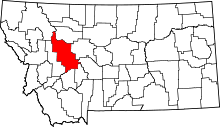 | |
| Town | ||
| CDPs | ||
| Other unincorporated communities | ||
This article is issued from Wikipedia - version of the 5/6/2016. The text is available under the Creative Commons Attribution/Share Alike but additional terms may apply for the media files.