List of mountains in Missoula County, Montana
This list is incomplete; you can help by expanding it.
There are at least 98 named mountains in Missoula County, Montana.
- Albert Point, 46°56′53″N 114°21′11″W / 46.94806°N 114.35306°W, el. 5,945 feet (1,812 m)[1]
- Baldy, 46°57′24″N 113°20′09″W / 46.95667°N 113.33583°W, el. 5,085 feet (1,550 m)[2]
- Baldy Mountain, 46°42′27″N 113°58′53″W / 46.70750°N 113.98139°W, el. 5,978 feet (1,822 m)[3]
- Bata Mountain, 46°56′09″N 113°18′46″W / 46.93583°N 113.31278°W, el. 5,850 feet (1,780 m)[4]
- Beavertail Hill, 46°43′16″N 113°35′11″W / 46.72111°N 113.58639°W, el. 4,078 feet (1,243 m)[5]
- Belmont Point, 47°03′49″N 113°36′08″W / 47.06361°N 113.60222°W, el. 6,657 feet (2,029 m)[6]
- Black Mountain, 46°52′12″N 114°12′21″W / 46.87000°N 114.20583°W, el. 5,863 feet (1,787 m)[7]
- Black Mountain, 47°02′51″N 113°40′31″W / 47.04750°N 113.67528°W, el. 6,919 feet (2,109 m)[8]
- Blacktail Peak, 47°16′18″N 113°50′06″W / 47.27167°N 113.83500°W, el. 7,999 feet (2,438 m)[9]
- Blue Mountain, 46°48′57″N 114°11′10″W / 46.81583°N 114.18611°W, el. 6,437 feet (1,962 m)[10]
- Blue Point, 46°56′18″N 113°51′23″W / 46.93833°N 113.85639°W, el. 6,798 feet (2,072 m)[11]
- Boles Point, 47°06′47″N 113°40′34″W / 47.11306°N 113.67611°W, el. 6,368 feet (1,941 m)[12]
- Bonner Mountain, 46°51′50″N 113°47′47″W / 46.86389°N 113.79639°W, el. 6,808 feet (2,075 m)[13]
- Boulder Point, 47°04′08″N 113°50′07″W / 47.06889°N 113.83528°W, el. 7,293 feet (2,223 m)[14]
- Boyd Mountain, 47°03′47″N 113°22′36″W / 47.06306°N 113.37667°W, el. 4,921 feet (1,500 m)[15]
- Burnt Fork Pinnacle, 47°15′09″N 114°36′42″W / 47.25250°N 114.61167°W, el. 6,624 feet (2,019 m)[16]
- Carmine Peak, 47°26′34″N 113°32′24″W / 47.44278°N 113.54000°W, el. 8,474 feet (2,583 m)[17]
- Cayuse Hill, 47°01′49″N 114°22′18″W / 47.03028°N 114.37167°W, el. 3,658 feet (1,115 m)[18]
- Charity Peak, 47°04′47″N 114°07′38″W / 47.07972°N 114.12722°W, el. 6,535 feet (1,992 m)[19]
- Ch-paa-qn Peak, 47°09′28″N 114°21′21″W / 47.15778°N 114.35583°W, el. 7,989 feet (2,435 m)[20]
- Cooney Mountain, 47°34′45″N 113°37′12″W / 47.57917°N 113.62000°W, el. 8,671 feet (2,643 m)[21]
- Council Hill, 46°52′17″N 114°06′10″W / 46.87139°N 114.10278°W, el. 3,291 feet (1,003 m)[22]
- Daughter of the Sun Mountain, 47°20′41″N 113°50′59″W / 47.34472°N 113.84972°W, el. 8,668 feet (2,642 m)[23]
- Davis Point, 46°43′01″N 113°56′44″W / 46.71694°N 113.94556°W, el. 5,623 feet (1,714 m)[24]
- Diamond Mountain, 46°54′03″N 113°40′21″W / 46.90083°N 113.67250°W, el. 4,304 feet (1,312 m)[25]
- Diamond Point, 46°53′29″N 114°18′17″W / 46.89139°N 114.30472°W, el. 4,977 feet (1,517 m)[26]
- Edith Peak, 47°07′15″N 114°15′14″W / 47.12083°N 114.25389°W, el. 6,768 feet (2,063 m)[27]
- Elk Creek Point, 47°29′57″N 113°48′28″W / 47.49917°N 113.80778°W, el. 4,849 feet (1,478 m)[28]
- Elk Mountain, 46°44′08″N 113°47′06″W / 46.73556°N 113.78500°W, el. 6,115 feet (1,864 m)[29]
- Ellis Mountain, 47°02′02″N 114°27′08″W / 47.03389°N 114.45222°W, el. 5,932 feet (1,808 m)[30]
- Fawn Peak, 47°11′00″N 113°37′43″W / 47.18333°N 113.62861°W, el. 5,689 feet (1,734 m)[31]
- Fisher Peak, 47°21′54″N 113°29′44″W / 47.36500°N 113.49556°W, el. 8,819 feet (2,688 m)[32]
- Ginny Mountain, 46°49′58″N 113°56′55″W / 46.83278°N 113.94861°W, el. 4,695 feet (1,431 m)[33]
- Goat Mountain, 47°19′42″N 113°51′54″W / 47.32833°N 113.86500°W, el. 8,169 feet (2,490 m)[34]
- Gold Creek Peak, 47°04′01″N 113°41′57″W / 47.06694°N 113.69917°W, el. 7,214 feet (2,199 m)[35]
- Gyp Mountain, 47°31′59″N 113°29′55″W / 47.53306°N 113.49861°W, el. 7,989 feet (2,435 m)[36]
- Hemlock Point, 47°27′31″N 113°50′30″W / 47.45861°N 113.84167°W, el. 7,766 feet (2,367 m)[37]
- Holland Peak, 47°32′06″N 113°34′56″W / 47.53500°N 113.58222°W, el. 9,308 feet (2,837 m)[38]
- Horsehead Peak, 47°10′16″N 114°39′00″W / 47.17111°N 114.65000°W, el. 6,693 feet (2,040 m)[39]
- Iris Point, 46°42′39″N 113°44′22″W / 46.71083°N 113.73944°W, el. 6,421 feet (1,957 m)[40]
- Lindy Peak, 47°21′15″N 113°49′22″W / 47.35417°N 113.82278°W, el. 8,353 feet (2,546 m)[41]
- Little Belmont Point, 46°58′37″N 113°36′46″W / 46.97694°N 113.61278°W, el. 5,256 feet (1,602 m)[42]
- Little Carmine Peak, 47°26′52″N 113°31′42″W / 47.44778°N 113.52833°W, el. 7,867 feet (2,398 m)[43]
- Lockwood Point, 46°54′59″N 113°46′40″W / 46.91639°N 113.77778°W, el. 6,663 feet (2,031 m)[44]
- Lolo Peak, 46°40′29″N 114°14′40″W / 46.67472°N 114.24444°W, el. 9,140 feet (2,790 m)[45]
- Lost Mountain, 47°19′25″N 113°51′33″W / 47.32361°N 113.85917°W, el. 8,146 feet (2,483 m)[46]
- Martin Point, 46°57′31″N 114°29′19″W / 46.95861°N 114.48861°W, el. 6,017 feet (1,834 m)[47]
- McCauley Butte, 46°50′28″N 114°05′12″W / 46.84111°N 114.08667°W, el. 3,438 feet (1,048 m)[48]
- McLeod Peak, 47°05′43″N 113°55′22″W / 47.09528°N 113.92278°W, el. 8,632 feet (2,631 m)[49]
- Miller Peak, 46°45′27″N 113°53′14″W / 46.75750°N 113.88722°W, el. 7,027 feet (2,142 m)[50]
- Mineral Peak, 47°00′13″N 113°48′46″W / 47.00361°N 113.81278°W, el. 7,451 feet (2,271 m)[51]
- Mitten Mountain, 46°48′07″N 113°57′06″W / 46.80194°N 113.95167°W, el. 6,007 feet (1,831 m)[52]
- Mormon Peak, 46°43′22″N 114°10′52″W / 46.72278°N 114.18111°W, el. 6,047 feet (1,843 m)[53]
- Morrison Peak, 46°55′30″N 113°32′58″W / 46.92500°N 113.54944°W, el. 5,627 feet (1,715 m)[54]
- Mosquito Peak, 47°02′28″N 113°55′58″W / 47.04111°N 113.93278°W, el. 8,018 feet (2,444 m)[55]
- Mount Dean Stone, 46°48′08″N 113°58′22″W / 46.80222°N 113.97278°W, el. 6,204 feet (1,891 m)[56]
- Mount Henry, 47°15′14″N 113°41′38″W / 47.25389°N 113.69389°W, el. 7,096 feet (2,163 m)[57]
- Mount Jumbo, 46°52′45″N 113°57′23″W / 46.87917°N 113.95639°W, el. 4,764 feet (1,452 m)[58]
- Mount Sentinel, 46°51′09″N 113°57′48″W / 46.85250°N 113.96333°W, el. 5,131 feet (1,564 m)[59]
- Mount Shoemaker, 47°21′02″N 113°52′46″W / 47.35056°N 113.87944°W, el. 7,940 feet (2,420 m)[60]
- Murphy Peak, 47°03′26″N 113°58′29″W / 47.05722°N 113.97472°W, el. 8,163 feet (2,488 m)[61]
- North Jocko Peak, 47°16′28″N 113°48′43″W / 47.27444°N 113.81194°W, el. 7,700 feet (2,300 m)[62]
- Olson Peak, 46°52′06″N 113°44′49″W / 46.86833°N 113.74694°W, el. 6,214 feet (1,894 m)[63]
- Petty Mountain, 46°54′41″N 114°24′20″W / 46.91139°N 114.40556°W, el. 7,257 feet (2,212 m)[64]
- Pilot Knob, 46°43′35″N 114°38′47″W / 46.72639°N 114.64639°W, el. 7,231 feet (2,204 m)[65]
- Point Saint Charles, 47°22′05″N 113°51′53″W / 47.36806°N 113.86472°W, el. 8,330 feet (2,540 m)[66]
- Point Six, 47°02′28″N 113°59′10″W / 47.04111°N 113.98611°W, el. 7,940 feet (2,420 m)[67]
- Ptarmigan Mountain, 47°24′41″N 113°31′15″W / 47.41139°N 113.52083°W, el. 8,599 feet (2,621 m)[68]
- Red Butte, 47°24′08″N 113°49′46″W / 47.40222°N 113.82944°W, el. 7,654 feet (2,333 m)[69]
- Richmond Peak, 47°19′24″N 113°30′00″W / 47.32333°N 113.50000°W, el. 7,113 feet (2,168 m)[70]
- Rocky Peak, 46°42′44″N 114°37′29″W / 46.71222°N 114.62472°W, el. 6,680 feet (2,040 m)[71]
- Rocky Point, 46°39′39″N 114°19′57″W / 46.66083°N 114.33250°W, el. 7,775 feet (2,370 m)[72]
- Sheep Mountain, 46°56′52″N 113°48′24″W / 46.94778°N 113.80667°W, el. 7,651 feet (2,332 m)[73]
- Skookum Butte, 46°39′53″N 114°23′42″W / 46.66472°N 114.39500°W, el. 7,234 feet (2,205 m)[74]
- Stuart Peak, 47°00′24″N 113°55′11″W / 47.00667°N 113.91972°W, el. 7,867 feet (2,398 m)[75]
- Sugarloaf Mountain, 47°19′31″N 113°50′56″W / 47.32528°N 113.84889°W, el. 7,982 feet (2,433 m)[76]
- Sunday Mountain, 47°20′57″N 113°28′58″W / 47.34917°N 113.48278°W, el. 8,123 feet (2,476 m)[77]
- Sunflower Mountain, 46°58′18″N 113°39′30″W / 46.97167°N 113.65833°W, el. 5,673 feet (1,729 m)[78]
- Sunset Crags, 47°17′47″N 113°49′51″W / 47.29639°N 113.83083°W, el. 8,202 feet (2,500 m)[79]
- Sunset Hill, 46°55′37″N 113°24′10″W / 46.92694°N 113.40278°W, el. 3,875 feet (1,181 m)[80]
- Sunset Peak, 47°18′16″N 113°50′20″W / 47.30444°N 113.83889°W, el. 8,291 feet (2,527 m)[81]
- Sunset Peak, 47°19′11″N 113°41′37″W / 47.31972°N 113.69361°W, el. 7,142 feet (2,177 m)[82]
- Tango Point, 47°32′01″N 113°33′16″W / 47.53361°N 113.55444°W, el. 7,657 feet (2,334 m)[83]
- Telephone Butte, 46°51′06″N 114°20′45″W / 46.85167°N 114.34583°W, el. 6,883 feet (2,098 m)[84]
- Three Summit Peak, 47°17′44″N 113°52′10″W / 47.29556°N 113.86944°W, el. 7,972 feet (2,430 m)[85]
- Triangle Peak, 47°05′36″N 113°52′28″W / 47.09333°N 113.87444°W, el. 7,792 feet (2,375 m)[86]
- TV Mountain, 47°01′03″N 114°00′50″W / 47.01750°N 114.01389°W, el. 6,821 feet (2,079 m)[87]
- University Mountain, 46°51′08″N 113°56′07″W / 46.85222°N 113.93528°W, el. 5,705 feet (1,739 m)[88]
- Wagon Mountain, 46°39′37″N 114°33′55″W / 46.66028°N 114.56528°W, el. 5,728 feet (1,746 m)[89]
- Waldbillig Mountain, 47°28′08″N 113°30′39″W / 47.46889°N 113.51083°W, el. 8,212 feet (2,503 m)[90]
- Waterworks Hill, 46°52′31″N 113°59′04″W / 46.87528°N 113.98444°W, el. 3,402 feet (1,037 m)[91]
- Weather Peak, 47°16′41″N 113°50′48″W / 47.27806°N 113.84667°W, el. 8,179 feet (2,493 m)[92]
- West Fork Butte, 46°44′09″N 114°24′56″W / 46.73583°N 114.41556°W, el. 6,145 feet (1,873 m)[93]
- West Fork Point, 47°18′18″N 113°39′33″W / 47.30500°N 113.65917°W, el. 6,243 feet (1,903 m)[94]
- Wild Horse Point, 46°55′38″N 114°19′15″W / 46.92722°N 114.32083°W, el. 5,800 feet (1,800 m)[95]
- Wishard Peak, 47°17′35″N 115°30′32″W / 47.29306°N 115.50889°W, el. 6,368 feet (1,941 m)[96]
- Wolverine Peak, 47°25′36″N 113°32′10″W / 47.42667°N 113.53611°W, el. 8,770 feet (2,670 m)[97]
- Woody Mountain, 46°54′02″N 113°52′33″W / 46.90056°N 113.87583°W, el. 6,201 feet (1,890 m)[98]
See also
Notes
- ↑ "Albert Point". Geographic Names Information System. United States Geological Survey.
- ↑ "Baldy". Geographic Names Information System. United States Geological Survey.
- ↑ "Baldy Mountain". Geographic Names Information System. United States Geological Survey.
- ↑ "Bata Mountain". Geographic Names Information System. United States Geological Survey.
- ↑ "Beavertail Hill". Geographic Names Information System. United States Geological Survey.
- ↑ "Belmont Point". Geographic Names Information System. United States Geological Survey.
- ↑ "Black Mountain". Geographic Names Information System. United States Geological Survey.
- ↑ "Black Mountain". Geographic Names Information System. United States Geological Survey.
- ↑ "Blacktail Peak". Geographic Names Information System. United States Geological Survey.
- ↑ "Blue Mountain". Geographic Names Information System. United States Geological Survey.
- ↑ "Blue Point". Geographic Names Information System. United States Geological Survey.
- ↑ "Boles Point". Geographic Names Information System. United States Geological Survey.
- ↑ "Bonner Mountain". Geographic Names Information System. United States Geological Survey.
- ↑ "Boulder Point". Geographic Names Information System. United States Geological Survey.
- ↑ "Boyd Mountain". Geographic Names Information System. United States Geological Survey.
- ↑ "Burnt Fork Pinnacle". Geographic Names Information System. United States Geological Survey.
- ↑ "Carmine Peak". Geographic Names Information System. United States Geological Survey.
- ↑ "Cayuse Hill". Geographic Names Information System. United States Geological Survey.
- ↑ "Charity Peak". Geographic Names Information System. United States Geological Survey.
- ↑ "Ch-paa-qn Peak". Geographic Names Information System. United States Geological Survey.
- ↑ "Cooney Mountain". Geographic Names Information System. United States Geological Survey.
- ↑ "Council Hill". Geographic Names Information System. United States Geological Survey.
- ↑ "Daughter of the Sun Mountain". Geographic Names Information System. United States Geological Survey.
- ↑ "Davis Point". Geographic Names Information System. United States Geological Survey.
- ↑ "Diamond Mountain". Geographic Names Information System. United States Geological Survey.
- ↑ "Diamond Point". Geographic Names Information System. United States Geological Survey.
- ↑ "Edith Peak". Geographic Names Information System. United States Geological Survey.
- ↑ "Elk Creek Point". Geographic Names Information System. United States Geological Survey.
- ↑ "Elk Mountain". Geographic Names Information System. United States Geological Survey.
- ↑ "Ellis Mountain". Geographic Names Information System. United States Geological Survey.
- ↑ "Fawn Peak". Geographic Names Information System. United States Geological Survey.
- ↑ "Fisher Peak". Geographic Names Information System. United States Geological Survey.
- ↑ "Ginny Mountain". Geographic Names Information System. United States Geological Survey.
- ↑ "Goat Mountain". Geographic Names Information System. United States Geological Survey.
- ↑ "Gold Creek Peak". Geographic Names Information System. United States Geological Survey.
- ↑ "Gyp Mountain". Geographic Names Information System. United States Geological Survey.
- ↑ "Hemlock Point". Geographic Names Information System. United States Geological Survey.
- ↑ "Holland Peak". Geographic Names Information System. United States Geological Survey.
- ↑ "Horsehead Peak". Geographic Names Information System. United States Geological Survey.
- ↑ "Iris Point". Geographic Names Information System. United States Geological Survey.
- ↑ "Lindy Peak". Geographic Names Information System. United States Geological Survey.
- ↑ "Little Belmont Point". Geographic Names Information System. United States Geological Survey.
- ↑ "Little Carmine Peak". Geographic Names Information System. United States Geological Survey.
- ↑ "Lockwood Point". Geographic Names Information System. United States Geological Survey.
- ↑ "Lolo Peak". Geographic Names Information System. United States Geological Survey.
- ↑ "Lost Mountain". Geographic Names Information System. United States Geological Survey.
- ↑ "Martin Point". Geographic Names Information System. United States Geological Survey.
- ↑ "McCauley Butte". Geographic Names Information System. United States Geological Survey.
- ↑ "McLeod Peak". Geographic Names Information System. United States Geological Survey.
- ↑ "Miller Peak". Geographic Names Information System. United States Geological Survey.
- ↑ "Mineral Peak". Geographic Names Information System. United States Geological Survey.
- ↑ "Mitten Mountain". Geographic Names Information System. United States Geological Survey.
- ↑ "Mormon Peak". Geographic Names Information System. United States Geological Survey.
- ↑ "Morrison Peak". Geographic Names Information System. United States Geological Survey.
- ↑ "Mosquito Peak". Geographic Names Information System. United States Geological Survey.
- ↑ "Mount Dean Stone". Geographic Names Information System. United States Geological Survey.
- ↑ "Mount Henry". Geographic Names Information System. United States Geological Survey.
- ↑ "Mount Jumbo". Geographic Names Information System. United States Geological Survey.
- ↑ "Mount Sentinel". Geographic Names Information System. United States Geological Survey.
- ↑ "Mount Shoemaker". Geographic Names Information System. United States Geological Survey.
- ↑ "Murphy Peak". Geographic Names Information System. United States Geological Survey.
- ↑ "North Jocko Peak". Geographic Names Information System. United States Geological Survey.
- ↑ "Olson Peak". Geographic Names Information System. United States Geological Survey.
- ↑ "Petty Mountain". Geographic Names Information System. United States Geological Survey.
- ↑ "Pilot Knob". Geographic Names Information System. United States Geological Survey.
- ↑ "Point Saint Charles". Geographic Names Information System. United States Geological Survey.
- ↑ "Point Six". Geographic Names Information System. United States Geological Survey.
- ↑ "Ptarmigan Mountain". Geographic Names Information System. United States Geological Survey.
- ↑ "Red Butte". Geographic Names Information System. United States Geological Survey.
- ↑ "Richmond Peak". Geographic Names Information System. United States Geological Survey.
- ↑ "Rocky Peak". Geographic Names Information System. United States Geological Survey.
- ↑ "Rocky Point". Geographic Names Information System. United States Geological Survey.
- ↑ "Sheep Mountain". Geographic Names Information System. United States Geological Survey.
- ↑ "Skookum Butte". Geographic Names Information System. United States Geological Survey.
- ↑ "Stuart Peak". Geographic Names Information System. United States Geological Survey.
- ↑ "Sugarloaf Mountain". Geographic Names Information System. United States Geological Survey.
- ↑ "Sunday Mountain". Geographic Names Information System. United States Geological Survey.
- ↑ "Sunflower Mountain". Geographic Names Information System. United States Geological Survey.
- ↑ "Sunset Crags". Geographic Names Information System. United States Geological Survey.
- ↑ "Sunset Hill". Geographic Names Information System. United States Geological Survey.
- ↑ "Sunset Peak". Geographic Names Information System. United States Geological Survey.
- ↑ "Sunset Peak". Geographic Names Information System. United States Geological Survey.
- ↑ "Tango Point". Geographic Names Information System. United States Geological Survey.
- ↑ "Telephone Butte". Geographic Names Information System. United States Geological Survey.
- ↑ "Three Summit Peak". Geographic Names Information System. United States Geological Survey.
- ↑ "Triangle Peak". Geographic Names Information System. United States Geological Survey.
- ↑ "TV Mountain". Geographic Names Information System. United States Geological Survey.
- ↑ "University Mountain". Geographic Names Information System. United States Geological Survey.
- ↑ "Wagon Mountain". Geographic Names Information System. United States Geological Survey.
- ↑ "Waldbillig Mountain". Geographic Names Information System. United States Geological Survey.
- ↑ "Waterworks Hill". Geographic Names Information System. United States Geological Survey.
- ↑ "Weather Peak". Geographic Names Information System. United States Geological Survey.
- ↑ "West Fork Butte". Geographic Names Information System. United States Geological Survey.
- ↑ "West Fork Point". Geographic Names Information System. United States Geological Survey.
- ↑ "Wild Horse Point". Geographic Names Information System. United States Geological Survey.
- ↑ "Wishard Peak". Geographic Names Information System. United States Geological Survey.
- ↑ "Wolverine Peak". Geographic Names Information System. United States Geological Survey.
- ↑ "Woody Mountain". Geographic Names Information System. United States Geological Survey.
Municipalities and communities of Missoula County, Montana, United States | ||
|---|---|---|
| City | 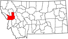 | |
| CDPs | ||
| Unincorporated communities | ||
| Ghost towns | ||
| Indian reservation | ||
| Footnotes | ‡This populated place also has portions in an adjacent county or counties | |
This article is issued from Wikipedia - version of the 12/23/2015. The text is available under the Creative Commons Attribution/Share Alike but additional terms may apply for the media files.