List of state highways in Missouri
| United States Numbered Highways of the Missouri Highway System | |
|---|---|
|
| |
| System information | |
| Maintained by MDOT | |
| Highway names | |
| State: | Route nn |
| System links | |
The following is a list of state highways in Missouri. State highways in Missouri are the responsibility of the Missouri Department of Transportation.
Current
| Number | Length (mi) | Length (km) | Southern or western terminus | Northern or eastern terminus | Formed | Removed | Notes |
|---|---|---|---|---|---|---|---|
 Route 1 Route 1 |
7.253 | 11.673 | Route 210 in North Kansas City | Route 152 in Kansas City | 1922 | current | |
 Route 2 Route 2 |
69.478 | 111.814 | K-68 at the Kansas state line | Route 52 in Windsor | 1926 | current | |
 Route 3 Route 3 |
73.738 | 118.670 | Route 11 near Kirksville | Route 5 / Route 240 near Fayette | — | — | |
 Route 5 Route 5 |
352.833 | 567.830 | AR 5 at the Arkansas state line | Iowa 5 at the Iowa state line | 1922 | current | The only Missouri state highway to run all the way from state line to state line (Iowa to Arkansas), plus continues with the same route number in both Iowa and Arkansas |
 Route 6 Route 6 |
208.551 | 335.630 | Loop 29 / US 169 in St. Joseph | US 24 / US 61 near Taylor | 1922 | current | |
 Route 7 Route 7 |
186.476 | 300.104 | I-44 near Laquey | US 24 near Independence | 1926 | current | |
 Route 8 Route 8 |
72.059 | 115.968 | I-44 / Route 8 in St. James | US 67 in Desloge | 1926 | current | |
 Route 9 Route 9 |
14.273 | 22.970 | I-35 / I-70 / US 24 / US 40 in Kansas City | I-29 / US 71 in Kansas City | — | — | |
 Route 10 Route 10 |
47.780 | 76.894 | US 69 in Excelsior Springs | US 24 / US 65 near Carrollton | 1922 | current | |
 Route 11 Route 11 |
100.176 | 161.218 | US 24 near Brunswick | Route 15 near Baring | — | — | |
 Route 12 Route 12 |
3.787 | 6.095 | I-435 in Kansas City | Spring Street in Independence | — | — | |
 Route 13 Route 13 |
290.608 | 467.688 | AR 21 at the Arkansas state line | US 69 / US 136 in Bethany | 1922 | current | |
 Route 14 Route 14 |
119.932 | 193.012 | US 60 in Marionville | US 63 near West Plains | 1926 | current | |
 Route 15 Route 15 |
121.249 | 195.131 | US 54 in Mexico | CR V56 at the Iowa state line | 1922 | current | |
 Route 16 Route 16 |
16.709 | 26.891 | Route 6 near Lewistown | US 61 Business in Canton | 1941 | current | |
 Route 17 Route 17 |
186.870 | 300.738 | AR 395 at the Arkansas state line | US 54 near Eldon | 1922 | current | |
 Route 18 Route 18 |
56.054 | 90.210 | CR 259 at the Kansas state line | Route 7 / Route 13 / Route 52 in Clinton | — | — | |
 Route 19 Route 19 |
264.909 | 426.330 | US 63 in Thayer | US 61 in Bowling Green | 1922 | current | |
 Route 20 Route 20 |
31.609 | 50.870 | Route 13 near Higginsville | US 65 Business in Marshall | 1922 | current | |
 Route 21 Route 21 |
194.127 | 312.417 | AR 115 at the Arkansas state line | Route 30 in Affton | 1922 | current | |
 Route 22 Route 22 |
28.797 | 46.344 | US 63 near Clark | US 54 / Route 15 near Mexico | 1922 | current | |
 Route 23 Route 23 |
49.880 | 80.274 | Route 2 near Windsor | US 24 near Waverly | — | — | |
 Route 25 Route 25 |
91.180 | 146.740 | US 412 / Route 84 in Kennett | Loop 55 / US 61 / Route 34 / Route 72 in Jackson | 1922 | current | |
 Route 27 Route 27 |
7.387 | 11.888 | US 61 near Wayland | Iowa 27 at the Iowa state line | 2004 | current | Avenue of the Saints |
 Route 28 Route 28 |
71.267 | 114.693 | I-44 near St. Robert | US 50 in Rosebud | 1922 | current | |
 Route 30 Route 30 |
52.718 | 84.841 | I-44 in St. Clair | I-44 / I-55 in St. Louis | 1922 | current | Known as Gravois Road throughout the entirety. |
 Route 31 Route 31 |
26.852 | 43.214 | US 169 near Gower | US 169 near Union Star | 1922 | current | |
 Route 32 Route 32 |
282.838 | 455.184 | US 54 in El Dorado Springs | Fourth Street in Ste. Genevieve | 1922 | current | |
 Route 33 Route 33 |
54.980 | 88.482 | Route 291 in Liberty | Route 6 in Maysville | 1922 | current | |
 Route 34 Route 34 |
103.378 | 166.371 | US 60 / Route 21 near Van Buren | IL 146 at the Illinois state line | 1922 | current | |
 Route 37 Route 37 |
78.683 | 126.628 | AR 37 at the Arkansas state line | US 160 / Route 126 in Golden City | 1922 | current | |
 Route 38 Route 38 |
80.561 | 129.650 | US 65 near Buffalo | Route 17 near Houston | — | — | |
 Route 39 Route 39 |
111.251 | 179.041 | AR 221 at the Arkansas state line | US 54 at Cedar Springs | 1922 | current | |
 Route 41 Route 41 |
45.981 | 73.999 | I-70 / US 40 / Route 135 near Boonville | US 24 near Brunswick | 1922 | current | |
 Route 42 Route 42 |
60.410 | 97.220 | US 54 in Osage Beach | Route 28 near Belle | — | — | |
 Route 43 Route 43 |
98.366 | 158.305 | SH-20 / AR 43 at the Oklahoma–Arkansas–Missouri tripoint | US 54 near Nevada | — | — | |
 Route 45 Route 45 |
— | — | — | — | — | — | |
 Route 46 Route 46 |
— | — | — | — | — | — | |
 Route 47 Route 47 |
— | — | Route 79 in Winfield | US 67 in Bonne Terre | — | — | Continues east of US 67 in Bonne Terre as Highway K |
 Route 48 Route 48 |
— | — | — | — | — | — | |
 Route 49 Route 49 |
— | — | — | — | — | — | |
 Route 51 Route 51 |
— | — | — | — | — | — | |
 Route 52 Route 52 |
— | — | — | — | — | — | |
 Route 53 Route 53 |
— | — | — | — | — | — | |
 Route 58 Route 58 |
— | — | — | — | — | — | |
 Route 59 Route 59 |
— | — | — | — | — | — | |
 Route 64 Route 64 |
— | — | — | — | — | — | |
 Route 64A Route 64A |
— | — | — | — | — | — | |
 Route 64B Route 64B |
— | — | — | — | — | — | |
 Route 66 Route 66 |
— | — | — | — | — | — | |
 Route 68 Route 68 |
— | — | — | — | — | — | |
 Route 72 Route 72 |
— | — | — | — | — | — | |
 Route 73 Route 73 |
— | — | — | — | — | — | |
 Route 74 Route 74 |
— | — | — | — | — | — | |
 Route 75 Route 75 |
— | — | — | — | — | — | |
 Route 76 Route 76 |
— | — | — | — | — | — | |
 Route 77 Route 77 |
— | — | — | — | — | — | |
 Route 78 Route 78 |
— | — | — | — | — | — | |
 Route 79 Route 79 |
— | — | I-70 Exit 220 in O'Fallon | Route 110/US 36/I-72 Exit 157 in Hannibal | — | — | Continues southbound as Salt Lick Road in O'Fallon. Continues northbound as Harrison Hill Road in Hannibal. |
 Route 80 Route 80 |
— | — | — | — | — | — | |
 Route 81 Route 81 |
— | — | — | — | — | — | |
 Route 82 Route 82 |
— | — | — | — | — | — | |
 Route 83 Route 83 |
— | — | — | — | — | — | |
 Route 84 Route 84 |
— | — | — | — | — | — | |
 Route 85 Route 85 |
— | — | — | — | — | — | |
 Route 86 Route 86 |
— | — | — | — | — | — | |
 Route 87 Route 87 |
— | — | — | — | — | — | |
 Route 89 Route 89 |
— | — | — | — | — | — | |
 Route 90 Route 90 |
— | — | — | — | — | — | |
 Route 91 Route 91 |
— | — | — | — | — | — | |
 Route 92 Route 92 |
— | — | — | — | — | — | |
 Route 94 Route 94 |
— | — | US 67 in West Alton | US 63/US 54 in Jefferson City | — | — | |
 Route 95 Route 95 |
— | — | — | — | — | — | |
 Route 96 Route 96 |
— | — | — | — | — | — | |
 Route 97 Route 97 |
— | — | — | — | — | — | |
 Route 98 Route 98 |
— | — | — | — | — | — | |
 Route 99 Route 99 |
— | — | — | — | — | — | |
 Route 100 Route 100 |
— | — | S. 4th Street in St. Louis as Chouteau Avenue | US 50 in Linn | — | — | Part of US 66 between S. 7th Street in St. Louis and I-44/US 50 in Gray Summit |
 Route 101 Route 101 |
— | — | — | — | — | — | |
 Route 102 Route 102 |
— | — | — | — | — | — | |
 Route 103 Route 103 |
— | — | — | — | — | — | |
 Route 104 Route 104 |
— | — | — | — | — | — | |
 Route 105 Route 105 |
— | — | — | — | — | — | |
 Route 106 Route 106 |
— | — | — | — | — | — | |
 Route 107 Route 107 |
— | — | — | — | — | — | |
 Route 108 Route 108 |
— | — | — | — | — | — | |
 Route 109 Route 109 |
— | — | SR FF/SR W in Eureka | Wild Horse Creek Rd. in Wildwood | — | — | Continues northbound past Wild Horse Creek Road as S. Eartherton Rd. |
 Route 110 Route 110 |
— | — | US 36/I-72 Mark Twain Memorial Bridge in Hannibal | I-35 Exit 12 / I-435 Exit 52 in Claycomo | — | — | Part of the Chicago-Kansas City Expressway (CKC), it follows US 36 until it reaches I-35 in Cameron. In the future, US 36 may be upgraded to I-72 between St. Joseph and Hannibal. |
 Route 111 Route 111 |
— | — | — | — | — | — | |
 Route 112 Route 112 |
— | — | — | — | — | — | |
 Route 113 Route 113 |
— | — | — | — | — | — | |
 Route 114 Route 114 |
— | — | — | — | — | — | |
 Route 115 Route 115 |
— | — | I-70 Exit 237 in Berkeley | N. 11th Street/N. 9th Street/McKinley Street/I-70 Exit 248A as Salisbury Street, in St. Louis, with access to the McKinley Bridge to Illinois. | — | — | Most of the road is known as Natural Bridge Avenue west of Parnell Street until turning onto Salisbury Street. At the City-County border where Jennings Station Road/Kienlen Avenue, It becomes Natural Bridge Road. Because of Lambert Airport expansions and the demolition of its namesake bridge between Bridgeton and St. Charles, Route 115 became a lot shorter after the 1990s. |
 Route 116 Route 116 |
— | — | — | — | — | — | |
 Route 117 Route 117 |
— | — | — | — | — | — | |
 Route 118 Route 118 |
— | — | — | — | — | — | |
 Route 119 Route 119 |
— | — | — | — | — | — | |
 Route 120 Route 120 |
— | — | — | — | — | — | |
 Route 121 Route 121 |
— | — | — | — | — | — | |
 Route 122 Route 122 |
— | — | — | — | — | — | |
 Route 123 Route 123 |
— | — | — | — | — | — | |
 Route 124 Route 124 |
— | — | — | — | — | — | |
 Route 125 Route 125 |
— | — | — | — | — | — | |
 Route 126 Route 126 |
— | — | — | — | — | — | |
 Route 127 Route 127 |
— | — | — | — | — | — | |
 Route 128 Route 128 |
— | — | — | — | — | — | |
 Route 129 Route 129 |
— | — | — | — | — | — | |
 Route 130 Route 130 |
— | — | — | — | — | — | |
 Route 131 Route 131 |
— | — | — | — | — | — | |
 Route 133 Route 133 |
— | — | — | — | — | — | |
 Route 134 Route 134 |
— | — | — | — | — | — | |
 Route 135 Route 135 |
— | — | — | — | — | — | |
 Route 137 Route 137 |
44 | 71 | US 60 / US 63 / Route 76 near Willow Springs | Route 32 near Licking | — | — | Originally signed as supplemental route J |
 Route 138 Route 138 |
— | — | — | — | — | — | |
 Route 139 Route 139 |
— | — | — | — | — | — | |
 Route 141 Route 141 |
— | — | Route 370 Exit 9 in Bridgeton | US 61/US 67 in Arnold east of I-55 Exit 191. | — | — | Plans for expansion through Hazelwood to Florissant could happen in the next decade completing an outerbelt in St. Louis and Jefferson Counties. |
 Route 142 Route 142 |
— | — | — | — | — | — | |
 Route 143 Route 143 |
— | — | — | — | — | — | |
 Route 144 Route 144 |
— | — | — | — | — | — | |
 Route 145 Route 145 |
— | — | — | — | — | — | |
 Route 146 Route 146 |
— | — | — | — | — | — | |
 Route 147 Route 147 |
— | — | — | — | — | — | |
 Route 148 Route 148 |
— | — | — | — | — | — | |
 Route 149 Route 149 |
— | — | — | — | — | — | |
 Route 150 Route 150 |
— | — | — | — | — | — | |
 Route 151 Route 151 |
— | — | — | — | — | — | |
 Route 152 Route 152 |
— | — | — | — | — | — | |
 Route 153 Route 153 |
— | — | — | — | — | — | |
 Route 154 Route 154 |
— | — | — | — | — | — | |
 Route 156 Route 156 |
— | — | — | — | — | — | |
 Route 157 Route 157 |
— | — | — | — | — | — | |
 Route 158 Route 158 |
— | — | — | — | — | — | |
 Route 161 Route 161 |
— | — | — | — | — | — | |
 Route 162 Route 162 |
— | — | — | — | — | — | |
 Route 163 Route 163 |
— | — | — | — | — | — | |
 Route 164 Route 164 |
— | — | — | — | — | — | |
 Route 165 Route 165 |
— | — | — | — | — | — | |
 Route 168 Route 168 |
— | — | — | — | — | — | |
 Route 171 Route 171 |
— | — | — | — | — | — | |
 Route 172 Route 172 |
— | — | — | — | — | — | |
 Route 173 Route 173 |
— | — | — | — | — | — | |
 Route 174 Route 174 |
— | — | — | — | — | — | |
 Route 175 Route 175 |
— | — | — | — | — | — | |
 Route 176 Route 176 |
— | — | — | — | — | — | |
 Route 177 Route 177 |
— | — | — | — | — | — | |
 Route 179 Route 179 |
— | — | — | — | — | — | |
 Route 180 Route 180 |
— | — | Pennridge Drive, just west of I-270 Exit 20C, Bridgeton | Page Blvd/Hwy. D, St. Louis | — | — | St. Charles Rock Road in St. Louis County except in Wellston, where east of Lucas-Hunt Road, it becomes Dr. Martin Luther King, Jr. Drive in Wellston and St. Louis. There is a Route 180 Spur that is Pennsylvania Avenue in Pagedale between St. Charles Rock Road and Page Avenue |
 Route 181 Route 181 |
— | — | — | — | — | — | |
 Route 185 Route 185 |
— | — | — | — | — | — | |
 Route 187 Route 187 |
— | — | — | — | — | — | |
 Route 190 Route 190 |
— | — | — | — | — | — | |
 Route 202 Route 202 |
— | — | — | — | — | — | |
 Route 210 Route 210 |
— | — | — | — | — | — | |
 Route 213 Route 213 |
— | — | — | — | — | — | |
 Route 215 Route 215 |
— | — | — | — | — | — | |
 Route 221 Route 221 |
— | — | — | — | — | — | |
 Route 224 Route 224 |
— | — | — | — | — | — | |
 Route 231 Route 231 |
— | — | River City Casino Blvd., just south of the River Des Peres at the St. Louis City/County border | Jeffco Blvd/US 61/US 67 in Arnold | — | — | S. Broadway/Kingston Drive/Telegraph Road |
 Route 240 Route 240 |
— | — | — | — | — | — | |
 Route 242 Route 242 |
— | — | — | — | — | — | |
 Route 245 Route 245 |
— | — | — | — | — | — | |
 Route 246 Route 246 |
— | — | — | — | — | — | |
 Route 248 Route 248 |
— | — | — | — | — | — | |
 Route 249 Route 249 |
— | — | — | — | — | — | |
 Route 254 Route 254 |
— | — | — | — | — | — | |
 Route 265 Route 265 |
— | — | — | — | — | — | |
 Route 266 Route 266 |
— | — | — | — | — | — | |
 Route 267 Route 267 |
— | — | River City Casino Blvd., just south of the River Des Peres at the St. Louis City/County border | US 61/US 67 near the in Mehlville | — | — | |
 Route 269 Route 269 |
— | — | — | — | — | — | |
 Route 273 Route 273 |
— | — | — | — | — | — | |
 Route 283 Route 283 |
— | — | — | — | — | — | |
 Route 291 Route 291 |
— | — | — | — | — | — | |
 Route 340 Route 340 |
— | — | Route 100/Manchester Road in Ellisville | Skinker Blvd in St. Louis | — | — | |
 Route 350 Route 350 |
— | — | — | — | — | — | |
 Route 360 Route 360 |
— | — | — | — | — | — | |
 Route 364 Route 364 |
— | — | I-64/US 40/US 61 Exit 4 in Lake St. Louis | I-270 Exit 16 in Maryland Heights | — | — | Page Avenue Extension;Continues west as Hwy N in Lake St. Louis; Continues east as Page Ave/Hwy D in Maryland Heights. |
 Route 366 Route 366 |
— | — | Route 30/Gravois Road in St. Louis | I-44/US 50 (MO) Exit 276 at S. Geyer Road in Sunset Hills | — | — | Part of old US 66. |
 Route 367 Route 367 |
— | — | I-70 Exit 243C in St. Louis | US 67 in Spanish Lake | — | — | Riverview Blvd south of the Halls Ferry Circle, Lewis & Clark Blvd north of the New Halls Ferry Circle. |
 Route 370 Route 370 |
— | — | I-70 Exit 224 in St. Peters | I-270 Exit 22A in Bridgeton | — | — | Little Hills Expressway |
 Route 371 Route 371 |
— | — | — | — | — | — | |
 Route 376 Route 376 |
— | — | — | — | — | — | |
 Route 413 Route 413 |
— | — | — | — | — | — | |
 Route 465 Route 465 |
— | — | — | — | — | — | |
 Route 571 Route 571 |
— | — | — | — | — | — | |
 Route 740 Route 740 |
— | — | — | — | — | — | |
 Route 744 Route 744 |
— | — | — | — | — | — | |
 Route 752 Route 752 |
— | — | — | — | — | — | |
 Route 759 Route 759 |
— | — | — | — | — | — | |
 Route 763 Route 763 |
— | — | — | — | — | — | |
 Route 765 Route 765 |
— | — | — | — | — | — | |
 Route 799 Route 799 |
— | — | — | — | — | — |
Former
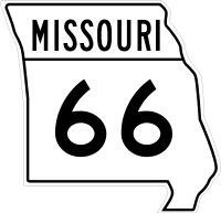
The old cut-out style markers once used in Missouri.
This is a list of former highways as assigned in 1922. All numbers from Route 1 to Route 72 were issued. From Route 72 to Route 98, only even numbers were issued.
In 1926, the U.S. Highway system was created and many of the highways listed below became part of a new U.S. Highway; in some cases, a highway's number was changed so as not to conflict with a U.S. Highway number (or, later, an Interstate Highway number) which came through Missouri.
- Route 1, Arkansas to Iowa via Kansas City: still exists near Kansas City
- Route 1A, Rock Port to Phelps City: became US 136
- Route 1B, branch to Craig: not built, since Route 1 (US 59) was routed through Craig
- Route 1C, Mound City to Bigelow: became Route 118
- Route 1D, Mound City to Skidmore: became Route 113
- Route 1E, branch to New Point: became Route 120
- Route 1F, Oregon to Forest City: became Route 111
- Route 1F, Joplin to Kansas: became US 66
- Route 2, Kansas City to St. Louis via Columbia: became US 40
- Route 3, Arkansas to Iowa via Springfield: became US 65
- Route 4, St. Joseph to Alexandria: became US 136
- Route 4A, Albany to Evona: became Route 85
- Route 5, Arkansas to Iowa via Boonville: still exists
- Route 5A, Wasola to Longrun: became Route 95
- Route 6, St. Joseph to Canton: still exists
- Route 7, Arkansas to Iowa via Jefferson City: became US 63
- Route 8, St. Joseph to Hannibal: became US 36
- Route 9, Arkansas to Iowa via St. Louis: became US 61
- Route 9A, Palmyra to Philadelphia: became Route 168
- Route 10, Kansas City to Monroe City: still exists west of Carrollton
- Route 11, Kansas City to Iowa: became US 69
- Route 12, Kansas City to St. Louis via Jefferson City: became US 50
- Route 13, Bolivar to Gallatin: still exists
- Route 14, Carthage to St. Louis: became US 66
- Route 15, Buffalo to Iowa via Jefferson City: still exists north of Mexico
- Route 16, Oklahoma to Kentucky via Springfield: became US 60
- Route 17, Arkansas State Line (North of Salem, AR) to Eugene: still exists
- Route 18, Tarkio to Stanberry: became US 136
- Route 19, Thayer to Cuba: still exists
- Route 20, Kansas City to Huntsville: still exists (realigned) west of Marshall
- Route 21, Arkansas to De Soto: still exists
- Route 22, Clark to Illinois: still exists west of Mexico
- Route 23, Arkansas to Fredericktown: became US 67
- Route 24, Kansas to Tuscumbia: became Route 52
- Route 25, Arkansas to Festus: still exists south of Jackson
- Route 26, Kansas to Osceola: became Route 82
- Route 27, Savannah to Iowa: became US 71 and Route 148
- Route 28, Waynesville to Rosebud: still exists
- Route 29, Stanberry to Iowa: became US 169
- Route 30, St. Clair to St. Louis: still exists
- Route 31, Clarksdale to King City: still exists
- Route 32, Licking to Flat River: still exists
- Route 33, Kansas City to Osborn: still exists
- Route 33A, Plattsburg to Lathrop: became Route 116
- Route 34, Garwood to Jackson: still exists
- Route 35, Harrisonville to Kansas City: swapped with US 71 and later became Route 291
- Route 36, Kansas to Springfield: became US 160
- Route 37, Arkansas to Monett: still exists
- Route 38, Carthage to Republic: became US 166
- Route 39, Pennsboro to Stockton: still exists
- Route 40, Billings to near West Plains: became Route 14
- Route 41, Lamine to De Witt: still exists
- Route 42, Alton to Poplar Bluff: became US 160
- Route 43, Arkansas to Marionville: became Route 13
- Route 44, Anderson to Spokane: became Route 76
- Route 45, Drake to Martinsburg: became Route 19
- Route 46, through Grant City: still exists
- Route 47, Villa Ridge to Troy: still exists
- Route 48, Rosendale to King City: still exists
- Route 49, Piedmont to Glover: still exists
- Route 50, St. Joseph to Grayson: became US 169
- Route 51, Advance to Illinois: still exists
- Route 51A, Dongola to Puxico: became Route 51
- Route 52, Kansas to St. Joseph: became US 59
- Route 52A, branch to Lewis and Clark Lake: became Route 45
- Route 53, Kennett to Poplar Bluff: still exists
- Route 54, Paris to New London: became Route 26; now Routes 154 and 19
- Route 54A, Perry to Hutchison: became Route 19
- Route 55, Wolf Island to Benton: became Route 77
- Route 55A, Charleston to East Prairie: became Route 105
- Route 56, Troy to O'Fallon: became Routes 47 and 79
- Route 57, Webb City to Kansas: became Route 171
- Route 58, Pleasant Hill to Warrensburg: still exists
- Route 59, Kansas City to Platte City: became Route 9
- Route 60, Leeton to Windsor: became Route 2
- Route 61, Tarkio to Iowa: became US 59
- Route 62, Steelville to Potosi: became Route 8
- Route 63, Harrisonville to Lees Summit: became Route 7
- Route 64, Collins to Preston: still exists east of Hermitage
- Route 64A, Wheatland to Quincy: became Route 83
- Route 65, St. James to Hawkins Store: became Route 68
- Route 66, El Dorado Springs to Fair Play: became US 54; now Route 32
- Route 67, Rocheport to Fayette: became Route 240
- Route 68, Farmington to Sainte Genevieve: became Route 32
- Route 69, Springfield to Bolivar: became Route 13
- Route 70, Ironton to Fredericktown: became Route 72
- Route 71, Springfield to Preston: absorbed by Route 3 (US 65) when its portion here was not built
- Route 72, Salem to Centerville: still exists
- Route 74, Dutchtown to Cape Girardeau: still exists
- Route 76, Spokane to Forsyth: still exists, though on a different alignment
- Route 78, Branson to Brownbranch: became Route 76
- Route 80, Gainesville to West Plains: became US 160
- Route 82, Malden to New Madrid: became US 62
- Route 84, Arkansas to Caruthersville: still exists
- Route 86, Blue Eye to Hollister: still exists
- Route 88, Lanagan to Arkansas: became US 71 when Route 59 was formed
- Route 90, Oklahoma to Noel: still exists
- Route 92, Kansas to Smithville: still exists
- Route 94, Cedar City to West Alton: still exists
- Route 96, Odessa to Marshall: not built, but now partly Route 20
- Route 98, Boonville to Overton: still exists
Later routes
The following routes were added after 1922, but no longer exist.
- Route 4B
- Route 9
- Route 12 (1926)
- Route 12 (1934)
- Route 12 (1940s)
- Route 16
- Route 17A
- Route 18
- Route 19A
- Route 21A
- Route 26 (1927)
- Route 26 (1950s)
- Route 29
- Route 38N
- Route 49A
- Route 56
- Route 62
- Route 76A
- Route 77
- Route 88
- Route 96
- Route 99
- Route 101
- Route 102
- Route 104
- Route 111
- Route 114
- Route 118
- Route 132
- Route 140
- Route 144
- Route 148 (1950s)
- Route 148 (1960s)
- Route 155
- Route 170
- Route 175
- Route 178
- Route 266
- Route 271
- Route 354
- Route 725
- Route 750
Proposed
Missouri highways proposed, but for some reason were never built.
See also
 Missouri portal
 U.S. Roads portal
References
External links
 Media related to State highways in Missouri at Wikimedia Commons
This article is issued from Wikipedia - version of the 9/14/2016. The text is available under the Creative Commons Attribution/Share Alike but additional terms may apply for the media files.