M-157 (Michigan highway)
| ||||
|---|---|---|---|---|
| Roscommon Road | ||||
|
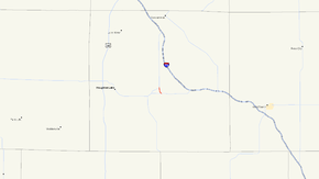
M-157 highlighted in red | ||||
| Route information | ||||
| Maintained by MDOT | ||||
| Length: | 1.193 mi[1] (1.920 km) | |||
| Existed: | 1932[2][3] – present | |||
| Major junctions | ||||
| South end: |
 M-55 near Prudenville M-55 near Prudenville | |||
| North end: |
 M-18 near Prudenville M-18 near Prudenville | |||
| Location | ||||
| Counties: | Roscommon | |||
| Highway system | ||||
| ||||



M-157 is a short state trunkline highway in the US state of Michigan. The highway is entirely within Roscommon County in the Lower Peninsula. It is the fourth-shortest state highway in the system,[1] and it serves as a connector route between M-18 and M-55 just east of Prudenville. The current roadway was built and designated as M-157 in the 1930s.
Route description
M-157 begins at an intersection with M-55 east of Prudenville and Houghton Lake. The trunkline angles to the northwest before turning north near Ryan Lake. Serving as a short connector, the highway travels north through the Roscommon State Forest terminating just over a mile later at a junction with M-18.[4][5] M-157 has not been listed on the National Highway System, a system of highways important to the nation's economy, defense, and mobility.[6] The average annual daily traffic (AADT) in 2008 was 496 vehicles per day.[7]
History
M-157 was originally designated in 1931 as a connector route between M-55 and US 27 (present-day M-18).[8][9] Just a year later, that version was decommissioned, and the road obliterated. A new alignment, the present-day routing of M-157, was then commissioned just to the east.[2][3]
Major intersections
The entire highway is in Backus Township, Roscommon County.
| mi[1] | km | Destinations | Notes |
|---|---|---|---|
| 0.000 | 0.000 | M-55 – Houghton Lake, West Branch | |
| 1.193 | 1.920 | M-18 – Prudenville, Roscommon | |
| 1.000 mi = 1.609 km; 1.000 km = 0.621 mi | |||
See also
 Michigan Highways portal
References
- 1 2 3 Michigan Department of Transportation & Michigan Center for Shared Solutions and Technology Partnerships (2009). MDOT Physical Reference Finder Application (Map). Michigan Department of Transportation. Retrieved July 26, 2009.
- 1 2 Michigan State Highway Department & Rand McNally (October 1, 1932). Official Michigan Highway Map (Map). [c. 1:840,000]. Lansing: Michigan State Highway Department. § H10. OCLC 12701053.
- 1 2 Michigan State Highway Department & Rand McNally (May 1, 1933). Official Michigan Highway Map (Map). [c. 1:840,000]. Lansing: Michigan State Highway Department. § H10. OCLC 12701053.
- ↑ Michigan Department of Transportation (2009). Michigan: Official Department of Transportation Map (Map). c. 1:975,000. Lansing: Michigan Department of Transportation. § H10. OCLC 42778335.
- ↑ Google (April 6, 2010). "Overview Map of M-157" (Map). Google Maps. Google. Retrieved April 6, 2010.
- ↑ Michigan Department of Transportation (April 23, 2006). National Highway System, Michigan (PDF) (Map). Scale not given. Lansing: Michigan Department of Transportation. Retrieved October 7, 2008.
- ↑ Bureau of Transportation Planning (2008). "Traffic Monitoring Information System". Michigan Department of Transportation. Retrieved April 6, 2010.
- ↑ Michigan State Highway Department & Rand McNally (July 1, 1931). Official Highway Service Map (Map). [c. 1:840,000]. Lansing: Michigan State Highway Department. § H10. OCLC 12701053.
- ↑ Michigan State Highway Department & Rand McNally (October 1, 1931). Official Highway Service Map (Map). [c. 1:840,000]. Lansing: Michigan State Highway Department. § H10. OCLC 12701053.
External links