Mae Sam Laep
| Mae Sam Laep แม่สามแลบ | |
|---|---|
| Tambon | |
 | |
| Coordinates: 17°58′30″N 97°44′21″E / 17.97500°N 97.73917°E | |
| Country | Thailand |
| Province | Mae Hong Son |
| Amphoe | Sop Moei |
| Population (2005) | |
| • Total | 9,802 |
| Time zone | ICT (UTC+7) |
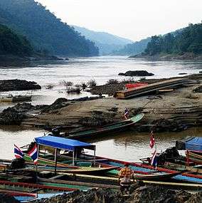
Mae Sam Laep (Thai: แม่สามแลบ) is a village and tambon (sub-district) of Sop Moei District, in Mae Hong Son Province, Thailand.[1] In 2005 it had a population of 9,802. The tambon contains 10 villages. Mae Sam Leap lies near the Burmese border on the Salween River.
References
- ↑ Thaitambon.com, Accessed 21 July 2011 (Thai)
This article is issued from Wikipedia - version of the 12/1/2016. The text is available under the Creative Commons Attribution/Share Alike but additional terms may apply for the media files.