Majdel Selm
| Majdel Selm مجدل سلم | |
|---|---|
| Village | |
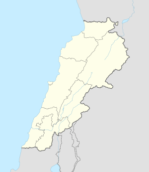  Majdel Selm Location within Lebanon | |
| Coordinates: 33°13′18″N 35°27′52″E / 33.22167°N 35.46444°ECoordinates: 33°13′18″N 35°27′52″E / 33.22167°N 35.46444°E | |
| Grid position | 193/291 PAL |
| Country |
 Lebanon Lebanon |
| Governorate | Nabatieh Governorate |
| District | Marjeyoun District |
| Elevation | 560 m (1,840 ft) |
| Time zone | EET (UTC+2) |
| • Summer (DST) | EEST (UTC+3) |
| Dialing code | +961 |
Majdel Selm, or Mejdel Islim, (Arabic: مجدل سلم) is a village the Marjeyoun District in Southern Lebanon.
Name
According to E. H. Palmer, the name Mejdel Islim means Islim’s watch-tower, p.n.[1]
History
In 1596, it was named as a village, Majdal Salim, in the Ottoman nahiya (subdistrict) of Tibnin under the liwa' (district) of Safad, with a population of 51 households and 8 bachelors, all Muslim. The villagers paid a fixed tax-rate of 25 % on agricultural products, such as wheat, barley, olive trees, fruit trees, vegetable and fruit garden, orchard, goats, beehives, in addition to "occasional revenues" and a press for olive oil or grape syrup; a total of 9,110 akçe.[2][3]
In 1875 Victor Guérin found that the village had about 300 Metawileh inhabitants.[4] He further noted: "A mosque, now abandoned and falling into ruins, has succeeded here a Byzantine church, the materials of which have been used in building it. Over one of the windows is a stone (apparently once the lintel) with an old Greek inscription, the characters of which are too much defaced to be read. A monolithic column lies beside it, half buried in the ground, surmounted by a capital sculptured in form of open basket work."[5]
In 1881, the Palestine Exploration Fund's Survey of Western Palestine (SWP) described it as a "large village, built of stone, of ancient appearance, containing about 500 [..] Metawileh [..]. Situated on table land, surrounded by olives and arable land. Water supply from a large masonry birket and many cisterns."[6] They further noted: "Village containing several good lintels and remains of ruins; an ancient road leads from the village to the Birkeh."[7]
References
- ↑ Palmer, 1881, p. 29
- ↑ Hütteroth and Abdulfattah, 1977, p. 181
- ↑ Note that Rhode, 1979, p. 6 writes that the register that Hütteroth and Abdulfattah studied was not from 1595/6, but from 1548/9
- ↑ Guérin, 1880, p. 267
- ↑ Guérin, 1880, pp. 267-268; as given in Conder and Kitchener, 1881, SWP I, pp. 136
- ↑ Conder and Kitchener, 1881, SWP I, p. 89
- ↑ Conder and Kitchener, 1881, SWP I, p. 136
Bibliography
- Conder, Claude Reignier; Kitchener, H. H. (1881). The Survey of Western Palestine: Memoirs of the Topography, Orography, Hydrography, and Archaeology. 1. London: Committee of the Palestine Exploration Fund.
- Guérin, Victor (1880). Description Géographique Historique et Archéologique de la Palestine (in French). 3: Galilee, pt. 2. Paris: L'Imprimerie Nationale.
- Hütteroth, Wolf-Dieter; Abdulfattah, Kamal (1977). Historical Geography of Palestine, Transjordan and Southern Syria in the Late 16th Century. Erlanger Geographische Arbeiten, Sonderband 5. Erlangen, Germany: Vorstand der Fränkischen Geographischen Gesellschaft. ISBN 3-920405-41-2.
- Palmer, E. H. (1881). The Survey of Western Palestine: Arabic and English Name Lists Collected During the Survey by Lieutenants Conder and Kitchener, R. E. Transliterated and Explained by E.H. Palmer. Committee of the Palestine Exploration Fund.
- Rhode, Harold (1979). Administration and Population of the Sancak of Safed in the Sixteenth Century. Columbia University.
External links
- Majdel Selm, Localiban
- Survey of Western Palestine, Map 2: IAA, Wikimedia commons

| Capital | 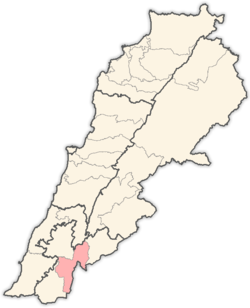 | |
|---|---|---|
| Towns and villages | ||
| Other | ||