Marston Moat
| Marston Moat | |
|---|---|
|
The remains of the moat | |
| Location | Trudoxhill, Somerset, England |
| Coordinates | 51°11′35″N 2°20′03″W / 51.19306°N 2.33417°WCoordinates: 51°11′35″N 2°20′03″W / 51.19306°N 2.33417°W |
| Official name: Marston Moat | |
| Designated | 1 November 1966[1] |
| Reference no. | 29779 |
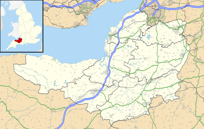  Location of Marston Moat in Somerset | |
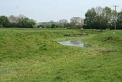
Marston Moat is the site of a fortified manor house in the parish of Trudoxhill, Somerset, England. It has been designated as a Scheduled Ancient Monument.[2] It is now on the Heritage at Risk register due to animal burrowing.[3]
The 23 feet (7.0 m) wide moat which measures 108 feet (33 m) by 188 feet (57 m) has a 10 feet (3.0 m) wide and 1 foot (0.30 m) high bank on its south and east sides.[4] It is situated east of the River Frome.
The site was held by the Bigot family of Marston Bigot before 1195. There is some evidence that they fortified it without a licence to crenellate from Edward II.[5] As a result of this and an insult to the King's messenger Richard Bigot lost his titles to land,[6] which were assigned to William de Meriet and John de Meriet.[7]
It was leased as a farmhouse by the reign of Edward IV however none of the stone remains,[2] and no full excavation has ever been carried out.[8]
References
- ↑ "Marston Moat". English Heritage. Retrieved 25 August 2011.
- 1 2 "Marston Moat". Somerset Historic Environment Record. South West Heritage Trust. Retrieved 25 August 2011.
- ↑ "Marston Moat". Heritage at Risk. English Heritage. Retrieved 25 August 2011.
- ↑ "Marston Moat". Fortified England. Retrieved 25 August 2011.
- ↑ "Marston Moat". Castle Facts. Retrieved 25 August 2011.
- ↑ Dunning, Robert (1995). Somerset Castles. Tiverton: Somerset Books. p. 60. ISBN 0-86183-278-7.
- ↑ "Marston Moat". The Gatehouse. Retrieved 25 August 2011.
- ↑ "Marston Moat". Pastscape National Monument Record. English Heritage. Retrieved 25 August 2011.