Maryborough Airport (Queensland)
| Maryborough Airport | |||||||||||||||
|---|---|---|---|---|---|---|---|---|---|---|---|---|---|---|---|
 | |||||||||||||||
| IATA: MBH – ICAO: YMYB | |||||||||||||||
| Summary | |||||||||||||||
| Airport type | Public | ||||||||||||||
| Operator | Fraser Coast Regional Council | ||||||||||||||
| Serves | Maryborough, Queensland, Australia | ||||||||||||||
| Elevation AMSL | 38 ft / 12 m | ||||||||||||||
| Coordinates | 25°30′48″S 152°42′54″E / 25.51333°S 152.71500°ECoordinates: 25°30′48″S 152°42′54″E / 25.51333°S 152.71500°E | ||||||||||||||
| Map | |||||||||||||||
  YMYB Location in Queensland | |||||||||||||||
| Runways | |||||||||||||||
| |||||||||||||||
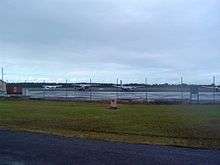
Maryborough Airport (IATA: MBH, ICAO: YMYB) is located approximately 3 km (1.9 mi) north of the town centre. The airport serves as a small regional airport serving Maryborough and Rainbow Bay. However, increasing competition with Hervey Bay Airport has led to a decrease in commercial air traffic.
The airport is primarily used by the Maryborough Aero Club.
The airport was used by the Royal Australian Air Force during World War II; the buildings constructed for the RAAF are now listed on the Queensland Heritage Register.[2]
See also
References
- ↑ YMYB – Maryborough (PDF). AIP En Route Supplement from Airservices Australia, effective 10 November 2016, Aeronautical Chart
- ↑ "Second World War RAAF Buildings, Maryborough Airport (entry 602556)". Queensland Heritage Register. Queensland Heritage Council. Retrieved 1 August 2014.
External links
 Media related to Maryborough Airport (Queensland) at Wikimedia Commons
This article is issued from Wikipedia - version of the 12/4/2016. The text is available under the Creative Commons Attribution/Share Alike but additional terms may apply for the media files.