Mas-ha
| Mas-ha | |
|---|---|
| Other transcription(s) | |
| • Arabic | مسحة |
|
Mas'ha, seen from Elkana | |
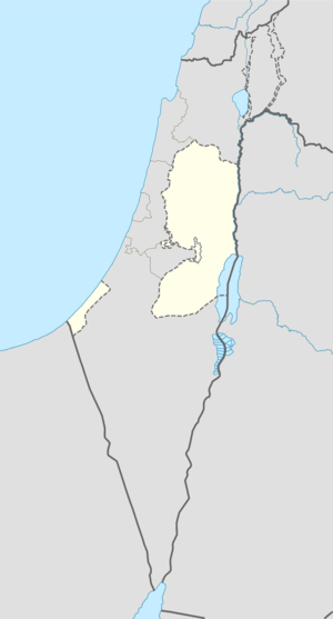  Mas-ha Location of Mas-ha within the Palestinian territories | |
| Coordinates: 32°06′28″N 35°03′06″E / 32.10778°N 35.05167°ECoordinates: 32°06′28″N 35°03′06″E / 32.10778°N 35.05167°E | |
| Palestine grid | 155/168 |
| Governorate | Salfit |
| Government | |
| • Type | Village council |
| Population (2007) | |
| • Jurisdiction | 2,003 |
| Name meaning | "Gravelly soil"[1] |
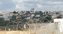
Mas-ha (Arabic: مسحة) is a Palestinian village located in the Salfit Governorate in the northern West Bank, 37 kilometers southwest of Nablus. According to the Palestinian Central Bureau of Statistics, it had a population of 2,003 in 2007.[2]
History
Potsherds from the Byzantine, Byzantine/Umayyad, Crusader/Ayyubid and Mamluk era have been found.[3]
Ottoman era
Potsherds from the early Ottoman era have also been found.[3] Masha appeared in 1596 Ottoman tax registers as being in the Nahiya of Jabal Qubal of the Liwa of Nablus. It had a population of five households, all Muslim, and paid taxes on wheat, barley, summercrops, olive trees, occasional revenues, goats and beehives, and a press for olives or grapes.[4]
French explorer Victor Guérin passed by the village in 1870, and estimated it as having about 300-350 inhabitants, and fig-tree lined borders.[5] In 1882 the Palestine Exploration Fund's Survey of Western Palestine (SWP) described Mes-ha as "a good-sized village, with a high central house, but partly ruinous. It is supplied by cisterns, and the houses are of stone."[6]
British Mandate era
In a census conducted in 1922 by the British Mandate authorities, Mas-ha (called: Masha) had a population of 80, all Muslims,[7] while in the 1931 census it had 20 occupied houses and a population of 87, again all Muslim.[8]
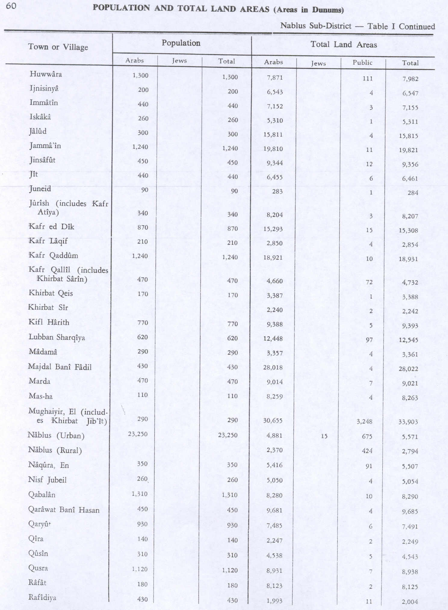
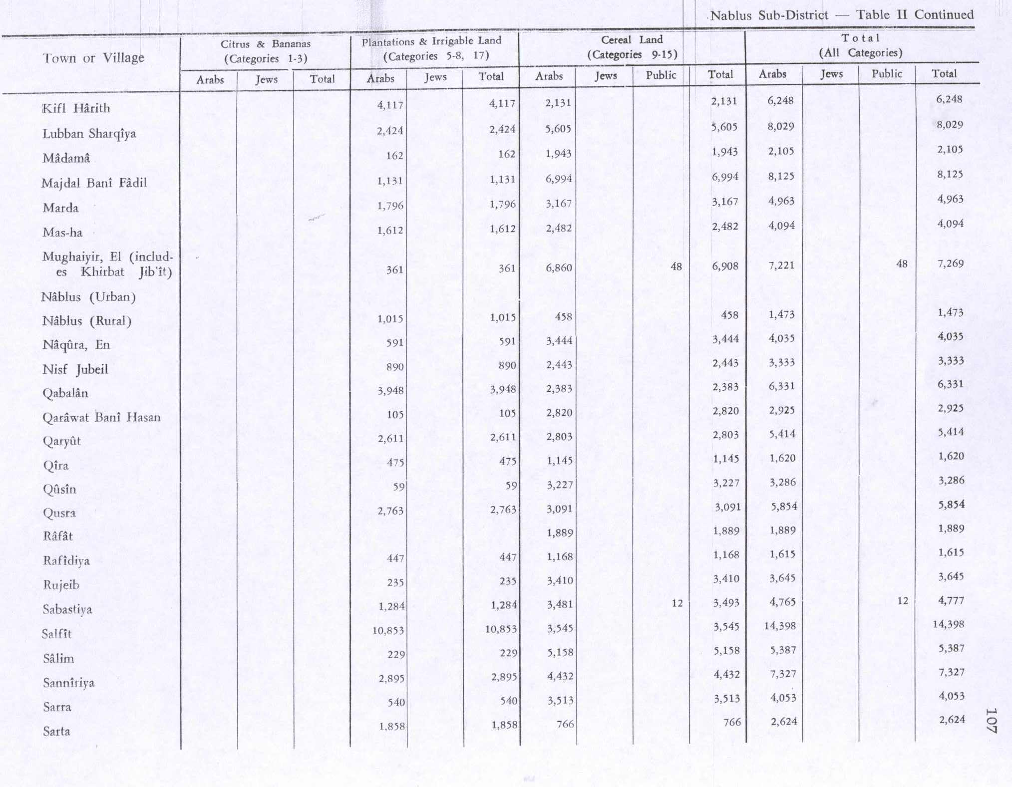
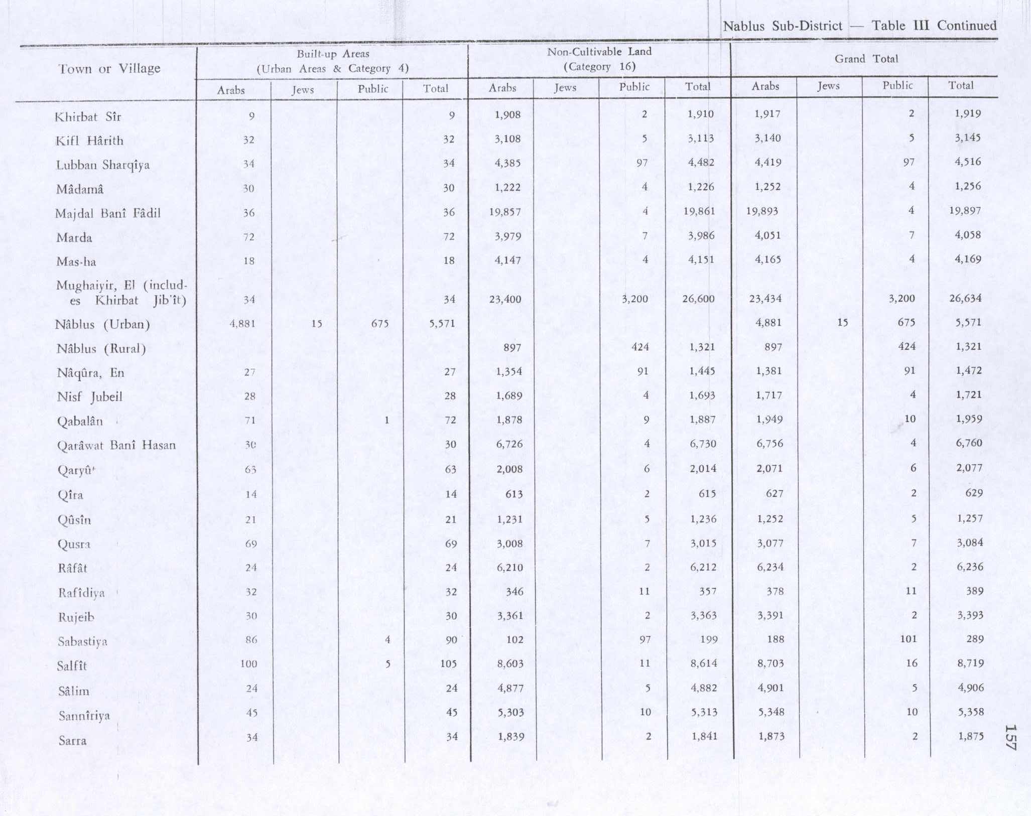
In 1945 the population was 110, all Muslim[9] while the total land area was 8,263 dunams, according to an official land and population survey.[10] Of this, 1,612 were allocated for plantations and irrigable land, 2,482 for cereals,[11] while 18 dunams were classified as built-up areas.[12]
1948-1967
In the wake of the 1948 Arab–Israeli War, and after the 1949 Armistice Agreements, Mas-ha came under Jordanian rule.
Post-1967
After the Six-Day War in 1967, Mas-ha has been under Israeli occupation.
References
- ↑ Palmer, 1881, p. 239
- ↑ 2007 PCBS Census Palestinian Central Bureau of Statistics. p. 112.
- 1 2 Finkelstein, 1997, p. 264
- ↑ Hütteroth and Abdulfattah, 1977, p. 131
- ↑ Guérin, 1875, p. 145 ff
- ↑ Conder and Kitchener, 1882, SWP II, p. 286
- ↑ Barron, 1923, Table IX, Sub-district of Nablus, p. 26
- ↑ Mills, 1932, p. 63
- ↑ Department of Statistics, 1945, p. 19
- ↑ Government of Palestine, Department of Statistics. Village Statistics, April, 1945. Quoted in Hadawi, 1970, p. 60
- ↑ Government of Palestine, Department of Statistics. Village Statistics, April, 1945. Quoted in Hadawi, 1970, p. 107
- ↑ Government of Palestine, Department of Statistics. Village Statistics, April, 1945. Quoted in Hadawi, 1970, p. 157

Bibliography
 |
Wikimedia Commons has media related to Mas-ha. |
- Barron, J. B., ed. (1923). Palestine: Report and General Abstracts of the Census of 1922. Government of Palestine.
- Conder, Claude Reignier; Kitchener, H. H. (1882). The Survey of Western Palestine: Memoirs of the Topography, Orography, Hydrography, and Archaeology. 2. London: Committee of the Palestine Exploration Fund.
- Department of Statistics (1945). Village Statistics, April, 1945. Government of Palestine.
- Finkelstein, Israel; Lederman, Zvi, eds. (1997). Highlands of many cultures. Tel Aviv: Institute of Archaeology of Tel Aviv University Publications Section. ISBN 965-440-007-3.
- Guérin, Victor (1875). Description Géographique Historique et Archéologique de la Palestine (in French). 2: Samarie, pt. 2. Paris: L'Imprimerie Nationale.
- Hadawi, Sami (1970). Village Statistics of 1945: A Classification of Land and Area ownership in Palestine. Palestine Liberation Organization Research Center.
- Hütteroth, Wolf-Dieter; Abdulfattah, Kamal (1977). Historical Geography of Palestine, Transjordan and Southern Syria in the Late 16th Century. Erlanger Geographische Arbeiten, Sonderband 5. Erlangen, Germany: Vorstand der Fränkischen Geographischen Gesellschaft. ISBN 3-920405-41-2.
- Mills, E., ed. (1932). Census of Palestine 1931. Population of Villages, Towns and Administrative Areas (PDF). Jerusalem: Government of Palestine.
- Palmer, E. H. (1881). The Survey of Western Palestine: Arabic and English Name Lists Collected During the Survey by Lieutenants Conder and Kitchener, R. E. Transliterated and Explained by E.H. Palmer. Committee of the Palestine Exploration Fund.
External links
- Welcome To Mas-ha
- Survey of Western Palestine, Map 14: IAA, Wikimedia commons
- The people of Mas'ha protest against the wall 27/07/03, Gush Shalom
- Mas-ha: A village robbed by the Segregation Wall 24 March, 2004, ARIJ
- Difficult olive harvest season in Mas-ha Village 27 November, 2006, ARIJ
- Israeli Occupation Forces prevent Mas-ha villagers from reaching their lands behind the Isolation Wall, 24 January, 2010, ARIJ
- Confiscation until further Notice Az Zawiya and Mas-ha- Salfit Governorate 10 January, 2012, ARIJ
- Mas-ha map
- Mas-ha Village (Fact Sheet), ARIJ
- Mas-ha Village Profile, ARIJ
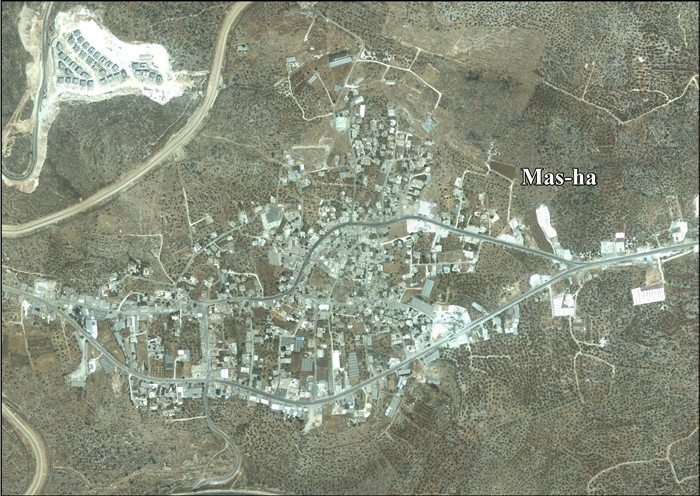
- Mas-ha, aerial photo, ARIJ


| Municipalities |
|   |
|---|---|---|
| Villages | ||