Massachusetts Route 31
| ||||
|---|---|---|---|---|
 | ||||
| Route information | ||||
| Length: | 58.80 mi[1] (94.63 km) | |||
| Major junctions | ||||
| South end: |
 Route 197 (via Dresser Hill Road) in Thompson, CT Route 197 (via Dresser Hill Road) in Thompson, CT | |||
 US 20 in Charlton US 20 in Charlton Route 9 in Spencer Route 9 in Spencer Route 2 in Fitchburg Route 2 in Fitchburg | ||||
| North end: |
 NH Route 31 in Mason, NH NH Route 31 in Mason, NH | |||
| Location | ||||
| Counties: | Worcester, Middlesex | |||
| Highway system | ||||
| ||||


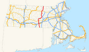
Route 31 is a state highway in the U.S. state of Massachusetts.
Route description
Route 31 begins at the Connecticut border in Dudley, where a short (less than 50-yard-long (46 m)) unnumbered local road changes to Route 31. Through Dudley and Charlton, it is known as Dresser Hill Road. Dresser Hill road winds over Dresser Hill, with several moderately steep grades and some tight corners.
In Charlton, it intersects U.S. Route 20 a few miles east of the I-90 & I-84 interchange. This provides its only connection with an interstate highway. In Charlton, it is known as Masonic Home Road and Brookfield Road. It then passes Lambs Pond.
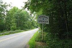
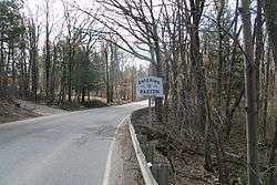
Route 31 then enters Spencer, where it parallels the Podunk Pike (Route 49) for several miles. As Charlton Road, it passes the Spencer State Forest. In the center of Spencer, it crosses Route 9. It then turns north towards Paxton; this stretch is scenic and hilly. Several warning signs are seen here for sharp corners warning of a maximum safe speed of 30 miles per hour (48 km/h).
After a couple long, sweeping corners through a forest of pine trees, Route 31 enters Paxton. Paxton Center School comes after a treed-in section. The intersections of Route 31, Route 122, and Route 56 comprise Paxton Center. Route 31 is variously known as West Street and Holden Street in Paxton; it runs east–west in this section. It passes over a hill past Richards Memorial Library, then uses Grove Street for approximately 1/4 mile.
In Holden, Route 31 passes Asnebumskit Pond and is bridged over Kendall Reservoir. After the intersection with Route 122A it passes Gale Free Public Library and heads north once again. The road heads into an increasingly rural area as the hills get steeper and longer.
Route 31 then enters Princeton and begins climbing very steeply; it gains about three hundred feet in approximately half a mile. Entering the center of Princeton, it joins Rte. 62 and turns east to avoid going over Mount Wachusett. The mountain is instead connected by Mountain Road. After separating from Route 62, Rte. 31 joins Route 140 and becomes Fitchburg Road near Paradise Pond.
It passes through a portion of Leominster State Forest in Westminster before an interchange with a freeway segment of Route 2. After this interchange, Rte. 31 becomes a city street, having shared roadway with Route 2A and a wrong-way concurrency with Route 12. It then passes through downtown Fitchburg. As it leaves Fitchburg it is called Ashby State Road. In Ashby, it connects with Route 119 before reaching the New Hampshire state border, where it becomes NH-31.
The stretch of Route 31 from Paxton Center to Holden Center was named after the late Chief Robert John Mortell of the Paxton Police Department who was murdered in the line of duty in 1994 in the deeply wooded area bordering Route 31.
Junction list
| County | Location | mi | km | Destinations | Notes |
|---|---|---|---|---|---|
| Worcester | Dudley | 0.0 | 0.0 | To Route 197 | Route 31 begins at the Connecticut Border. Connection via Dresser Hill Road. |
| Charlton | 9.3 | 15.0 | US 20 – Sturbridge, Springfield, Worcester, Boston | Westbound US 20 to   I‑90 / I‑84. I‑90 / I‑84.Eastbound US 20 to 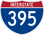  I‑395 / I‑290. I‑395 / I‑290. | |
| 9.9 | 15.9 | I‑90 / Mass Pike | No access between I-90 and Route 31 | ||
| Spencer | 16.8 | 27.0 | Route 9 east – Worcester | Eastern terminus of concurrency with Route 9. | |
| 16.9 | 27.2 | Route 9 west – Brookfield | Western terminus of concurrency with Route 9. | ||
| Paxton | 25.3 | 40.7 |   Route 122 / Route 56 south – Barre, Athol, Worcester, Leicester Route 122 / Route 56 south – Barre, Athol, Worcester, Leicester | Southern terminus of concurrency with Route 56. | |
| 25.4 | 40.9 | Route 56 north – Rutland | Northern terminus of concurrency with Route 56. | ||
| Holden | 30.1 | 48.4 |  Route 122A – Rutland, Barre, Worcester, Milbury Route 122A – Rutland, Barre, Worcester, Milbury | ||
| Princeton | 37.7 | 60.7 |  Route 62 west – Hubbardston, Barre Route 62 west – Hubbardston, Barre | Western terminus of concurrency with Route 62. | |
| 38.0 | 61.2 | Route 62 east – Sterling, Clinton | Eastern terminus concurrency with Route 62. | ||
| 40.5 | 65.2 |   Route 140 south to I‑190 – Sterling, West Boylston Route 140 south to I‑190 – Sterling, West Boylston | Southern terminus of concurrency with Route 140. | ||
| 42.1 | 67.8 | Route 140 north – Gardner, Westminster | Northern terminus concurrency with Route 140. | ||
| Fitchburg | 45.8 | 73.7 | Route 2 – Concord, Boston, Athol, Greenfield | Route 2 Exit 28 | |
| 47.0 | 75.6 |  Route 2A west – Westminster, Gardner Route 2A west – Westminster, Gardner | Western terminus of concurrency with Route 2A. | ||
| 48.1 | 77.4 |  Route 12 north – Ashburnham, Winchendon Route 12 north – Ashburnham, Winchendon | Western terminus of triple concurrency with Routes 31/2A/12. | ||
| 48.9 | 78.7 | Route 12 south – Leominster, Worcester | Eastern terminus of triple concurrency with Routes 31/2A/12. Concurrency with Route 2A continues. | ||
| 47.0 | 75.6 | Route 2A east – Lunenburg, Ayer | Eastern terminus of concurrency with Route 2A. | ||
| Middlesex | Ashby | 55.4 | 89.2 |  Route 119 west – Ashby Route 119 west – Ashby | Western terminus of concurrency with Route 119. |
| 55.5 | 89.3 | Route 119 east – Townsend, Groton | Eastern terminus concurrency with Route 119. | ||
| 58.8 | 94.6 | NH 31 north | Continuation into New Hampshire. | ||
1.000 mi = 1.609 km; 1.000 km = 0.621 mi
| |||||
References
External links
 |
Wikimedia Commons has media related to Massachusetts Route 31. |