Mazama Glacier (Mount Baker)
| Mazama Glacier | |
|---|---|
  Mazama Glacier | |
| Type | Mountain glacier |
| Coordinates | 48°48′13″N 121°48′04″W / 48.80361°N 121.80111°WCoordinates: 48°48′13″N 121°48′04″W / 48.80361°N 121.80111°W[1] |
| Length | 1.5 mi (2.4 km) |
| Terminus | Moraine/talus |
| Status | Retreating |
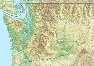
Mazama Glacier is located on Mount Baker in the North Cascades of the U.S. state of Washington.[2] Between 1850 and 1950, Mazama Glacier retreated 7,700 ft (2,300 m). During a cooler and wetter period from 1950 to 1979, the glacier advanced 1,476 ft (450 m) but between 1980 and 2006 retreated back 1,509 ft (460 m).[3] Situated on the north slopes of Mount Baker, Mazama Glacier is bordered by the Park Glacier to the south and Rainbow Glacier to the east.
See also
References
- ↑ "Mazama Glacier". Geographic Names Information System. United States Geological Survey. Retrieved 2012-10-20.
- ↑ Mount Baker, WA (Map). TopoQwest (United States Geological Survey Maps). Retrieved 2012-10-20.
- ↑ Pelto, Mauri. "North Cascade Glacier Retreat". Nichols College. Retrieved 2012-10-20.
This article is issued from Wikipedia - version of the 12/24/2015. The text is available under the Creative Commons Attribution/Share Alike but additional terms may apply for the media files.