Melandaha Upazila
| Melandaha মেলানদহ | |
|---|---|
| Upazila | |
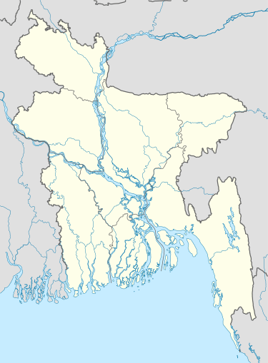  Melandaha Location in Bangladesh | |
| Coordinates: 24°58′N 89°50′E / 24.967°N 89.833°ECoordinates: 24°58′N 89°50′E / 24.967°N 89.833°E | |
| Country |
 Bangladesh Bangladesh |
| Division | Mymensingh Division |
| District | Jamalpur District |
| Area | |
| • Total | 239.65 km2 (92.53 sq mi) |
| Population (1991) | |
| • Total | 262,478 |
| • Density | 1,100/km2 (2,800/sq mi) |
| Time zone | BST (UTC+6) |
Melandaha (Bengali: মেলানদহ) is an Upazila of Jamalpur District[1] in the Division of Mymensingh, Bangladesh.
Geography
Melandaha is located at 24°58′00″N 89°50′00″E / 24.9667°N 89.8333°E . It has 55954 households and total area 239.65 km².
Points of interest
- Gandhi Ashram and Freedom Struggle Museum[2]
- Hazrat Shah Kamal (R) Mazar Sharif,Durmot
Administration
Melandaha has 11 unions/wards, 140 mauzas/mahallas, and 190 villages.
Unions are named as follows:
- Durmot
- Kulia
- Mahmudpur
- Nangla
- Nayanagar
- Adra
- Charbanipakuria
- Fulkucha
- Ghuserpara
- Jhaughara
- Shyampur
See also
References
- ↑ Sayed Md Abdullah Al Mamun Chowdhury (2012), "Melandaha Upazila", in Sirajul Islam and Ahmed A. Jamal, Banglapedia: National Encyclopedia of Bangladesh (Second ed.), Asiatic Society of Bangladesh
- ↑ Akramul Hoque Suman (2015), "Gandhi Ashram, Freedom Struggle Museum attract visitors, researchers", The Daily Observer
| Upazila/Thana: | | |
|---|---|---|
| Upazilas of the Mymensingh Division | ||
|---|---|---|
Headquarters: Mymensingh | ||
| Jamalpur District | ||
| Mymensingh District | ||
| Netrokona District | ||
| Sherpur District | ||
This article is issued from Wikipedia - version of the 11/13/2016. The text is available under the Creative Commons Attribution/Share Alike but additional terms may apply for the media files.