Mexican Federal Highway 54
| ||||
|---|---|---|---|---|
| Carretera Federal 54 | ||||
| Route information | ||||
| Maintained by Secretariat of Communications and Transportation | ||||
| Length: | 984.64 km[1][2][3] (611.83 mi) | |||
| Major junctions | ||||
| East end: |
 Fed. 2 in Ciudad Mier, Tamaulipas Fed. 2 in Ciudad Mier, Tamaulipas | |||
|
 Fed. 54D near El Trapiche, Colima Fed. 54D near El Trapiche, Colima | ||||
| West end: |
 Fed. 110 in Colima City Fed. 110 in Colima City | |||
| Highway system | ||||
|
Mexican Federal Highways
| ||||

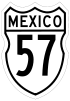

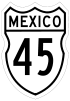


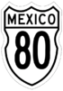


Mexican Federal Highway 54 (Carretera Federal 54) connects Ciudad Mier, Tamaulipas, to Colima City.[6]
The highway joins Mexican Federal Highway 15 and Mexican Federal Highway 80 in the southwest part of Guadalajara.[7] For 148 km (92 mi), the Federal Highway 54 designation is substituted by Mexican Federal Highway 54D from Acatlán de Juárez, Jalisco to Ciudad Guzmán, which is a toll road.[8]
Across the southern Mexican Plateau, FH 54 connects Zacatecas in the southwest to Monterrey in the northeast at FH 57.
References
- ↑ "Datos Viales de Nuevo León" (PDF) (in Spanish). Dirección General de Servicios Técnicos, Secretaría de Comunicaciones y Transportes. 2011. pp. 6, 9. Retrieved 2012-02-05.
- ↑ "Datos Viales de Coahuila" (PDF) (in Spanish). Dirección General de Servicios Técnicos, Secretaría de Comunicaciones y Transportes. 2011. p. 6. Retrieved 2012-02-05.
- ↑ "Datos Viales de Jalisco" (PDF) (in Spanish). Dirección General de Servicios Técnicos, Secretaría de Comunicaciones y Transportes. 2011. pp. 4, 8. Retrieved 2012-02-05.
- ↑ "Google Maps". Retrieved 2012-02-13.
- ↑ "Google Maps". Retrieved 2012-02-29.
- ↑ Mapa Nacional de Comunicaciones y Transportes
- ↑ "Google Maps". Retrieved 2012-02-13.
- ↑ "Datos Viales de Jalisco" (PDF) (in Spanish). Dirección General de Servicios Técnicos, Secretaría de Comunicaciones y Transportes. 2011. pp. 2–3, 26. Retrieved 2012-02-13.
| Highways |
|
|---|---|
| Toll roads | |