Milwrick Flying "M" Airport
| Milwrick Flying "M" Airport | |||||||||||
|---|---|---|---|---|---|---|---|---|---|---|---|
 | |||||||||||
| IATA: none – ICAO: none – FAA LID: 3L7 | |||||||||||
| Summary | |||||||||||
| Airport type | Public use | ||||||||||
| Owner | Nancy Milwrick | ||||||||||
| Serves | Lincoln, Michigan | ||||||||||
| Elevation AMSL | 830 ft / 253 m | ||||||||||
| Coordinates | 44°44′18″N 083°22′47″W / 44.73833°N 83.37972°W | ||||||||||
| Runways | |||||||||||
| |||||||||||
| Statistics (2010) | |||||||||||
| |||||||||||
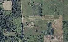
Milwrick Flying "M" Airport (FAA LID: 3L7) is a privately owned, public use airport located three nautical miles (6 km) northeast of the central business district of Lincoln, a village in Alcona County, Michigan, United States.[1] It was formerly known as Flying "M" Ranch Airport.[3][4]
Facilities and aircraft
The airport covers an area of 10 acres (4 ha) at an elevation of 830 feet (253 m) above mean sea level. It has one runway designated 9/27 with a turf surface measuring 2,200 by 90 feet (671 x 27 m). For the 12-month period ending December 31, 2010, the airport had 100 general aviation aircraft operations, an average of 8 per month.[1]
References
- 1 2 3 FAA Airport Master Record for 3L7 (Form 5010 PDF). Federal Aviation Administration. Effective April 5, 2012.
- ↑ "Lincoln, Milwrick Flying "M" Ranch (3L7)" (PDF). Airport Directory. State of Michigan. Retrieved June 18, 2012.
- ↑ "3L7 - Flying M Ranch Airport - Lincoln, Michigan". FAA information effective April 10, 2008. AirNav. Archived from the original on May 9, 2008.
- ↑ "Lincoln, Flying "M" Ranch (3L7)" (PDF). Airport Directory. State of Michigan. Retrieved June 18, 2012.
External links
- Aerial image as of April 1999 from USGS The National Map
- Resources for this airport:
- FAA airport information for 3L7
- AirNav airport information for 3L7
- FlightAware airport information and live flight tracker
- SkyVector aeronautical chart for 3L7
This article is issued from Wikipedia - version of the 9/14/2016. The text is available under the Creative Commons Attribution/Share Alike but additional terms may apply for the media files.