Týn nad Vltavou
| Týn nad Vltavou | |||
| Town | |||
.JPG) Týn nad Vltavou | |||
|
|||
| Country | Czech Republic | ||
|---|---|---|---|
| Region | South Bohemian | ||
| District | České Budějovice | ||
| Commune | Týn nad Vltavou | ||
| Elevation | 362 m (1,188 ft) | ||
| Coordinates | CZ 49°13′24.23″N 14°25′14.04″E / 49.2233972°N 14.4205667°ECoordinates: CZ 49°13′24.23″N 14°25′14.04″E / 49.2233972°N 14.4205667°E | ||
| Area | 43.03 km2 (16.61 sq mi) | ||
| Population | 8,309 (2005) | ||
| Density | 193/km2 (500/sq mi) | ||
| Mayor | Milan Šnorek | ||
| Timezone | CET (UTC+1) | ||
| - summer (DST) | CEST (UTC+2) | ||
| Postal code | 375 01 | ||
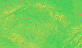 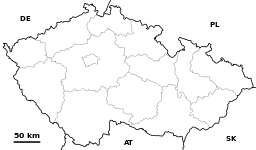  Location in the Czech Republic | |||
| Wikimedia Commons: Týn nad Vltavou | |||
| Statistics: statnisprava.cz | |||
| Website: www.tnv.cz | |||

Týn nad Vltavou (Czech pronunciation: [ˈtiːn ˈnad vl̩tavou̯]; German: Moldautein) is a town in the South Bohemian Region of the Czech Republic. It has approximately 8,200 inhabitants.
History
Until 1918, MOLDAUTHEIN - TYN NAD VLTAVOU was part of the Austrian monarchy (Austria side after the compromise of 1867), in the district with the same name, one of the 94 Bezirkshauptmannschaften in Bohemia.[1]
Main sights
- Main square
- St. Jacob's church
- Town hall
- Town museum, exposition of moldavite stones
- Ruins of Tyn's castle
- Rotating theatre
- Temelín Nuclear Power Station, about 6 km south-west, near the Temelin village
- Confluence of the Vltava and Luznice rivers
- Water reservoir at Hněvkovice, 5 km south on the Vltava river, used as a water reserve for the cooling of Temelin turbine condensers[2]
 Chapel of Virgin Mary
.JPG) Church of Saint James
Church of Saint James.jpg) Náměstí
Náměstí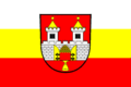 Tyn vltavou prapor.
References
- ↑ Die postalischen Abstempelungen auf den österreichischen Postwertzeichen-Ausgaben 1867, 1883 und 1890, Wilhelm KLEIN, 1967
- ↑ Energy from Southern Bohemia, Temelin Information Centre publication, 2001
External links
- (Czech) Municipal website
 |
Wikimedia Commons has media related to Týn nad Vltavou. |
This article is issued from Wikipedia - version of the 7/28/2016. The text is available under the Creative Commons Attribution/Share Alike but additional terms may apply for the media files.