Montanha
For the municipality in Brazil, see Montanha, Espírito Santo.
Not to be confused with Montanhas.
| Montanha | |
|---|---|
  | |
| Coordinates: 15°05′02″N 23°35′02″W / 15.084°N 23.584°WCoordinates: 15°05′02″N 23°35′02″W / 15.084°N 23.584°W | |
| Country | Cape Verde |
| Island | Santiago |
| Municipality | São Lourenço dos Órgãos |
| Civil parish | São Lourenço dos Órgãos |
| Population (2010)[1] | |
| • Total | 462 |
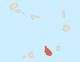
Montanha is a settlement in the central part of the island of Santiago, Cape Verde. It is situated 8 km southwest of Pedra Badejo. The area is intensively farmed; mainly maize, beans and sugar-cane.
Mahogany trees
There are two African mahogany trees near the village of Banana (part of the settlement Montanha), standing at the bottom of the Ribeira Montanha valley, 400 m above sea level. The trees were identified as an Important Bird Area (IBA) by BirdLife International because they support a colony of purple herons[2] or Bourne's herons.[3][4]
References
- ↑ "2010 Census results". Instituto Nacional de Estatística Cabo Verde (in Portuguese). 17 March 2014.
- ↑ "Mahoganies at Banana, Ribeira Montanha, Ilha de Santiago". Important Bird Areas factsheet. BirdLife International. 2013. Retrieved 2014-04-01.
- ↑ Birds in Cape Verde
- ↑ Batty, Chris (2005). "Cape Verde Islands 24th February-7th March 2005". Bird Trip Reports. birdtours.co.uk. Retrieved 2013-08-13.
Subdivisions of the island of Santiago | |||||||
|---|---|---|---|---|---|---|---|
| Praia |
|  | |||||
| Ribeira Grande de Santiago |
| ||||||
| Santa Catarina |
| ||||||
| Santa Cruz |
| ||||||
| São Domingos | |||||||
| São Lourenço dos Órgãos |
| ||||||
| São Miguel |
| ||||||
| São Salvador do Mundo |
| ||||||
| Tarrafal |
| ||||||
| Communities and settlements |  | |
|---|---|---|
| Reservoir | ||
| Landmarks and points of Interests | ||
| Culture | ||
This article is issued from Wikipedia - version of the 11/19/2016. The text is available under the Creative Commons Attribution/Share Alike but additional terms may apply for the media files.