Montgomery County Airpark
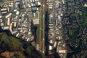
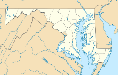
Montgomery County Airpark (IATA: GAI, ICAO: KGAI, FAA LID: GAI) is a public airport located three miles (5 km) northeast of the city of Gaithersburg, in Montgomery County, Maryland.
History
The airport was built by developer William E. Richardson in 1960.[1] Richardson deeded title to the land to Montgomery County, which leased the land back to Richardson to operate the airport.[1] Richardson planned to operate charter flights and an air taxi to National Airport, Baltimore's Friendship Airport, and the soon-to-be-opened Dulles Airport.[1] The airport was dedicated on October 22, 1960.[2] After having a simple hangar during its first four years of operation, a terminal building was built in 1964.[3]
Facilities
Runways
Montgomery County Airpark covers 125 acres (51 ha) and has one runway.
- Runway 14/32: 4,202 x 75 ft. (1,281 x 23 m), Surface: Asphalt. (32 - right traffic)
Navigational aids
- WAAS/GPS/RNAV MDA 262 agl
- VOR 155 degree from FDK 109.0 MDA 600 agl
On-field services
- DC Metro Aviation Services
- Full-service FBO - 100LL JetA
- Hangar-tiedown rental
- Charter Operators
- Open Air Charters - Part 135
- Flight Schools
- Fleming Aviation
- Washington International Flight Academy (WIFA)
- Aircraft Sales
- Fleming Aviation
- Trebor Aviation
- Designated Pilot Examiner
- Food & Beverage
Flying clubs
References
External links
- Resources for this airport:
|
|---|
|
|
|
| Administration | | |
|---|
|
| Landmarks | |
|---|
|
| Culture | |
|---|
|
| Sports | |
|---|
|
| Education | Colleges | |
|---|
| High schools | |
|---|
| Private | |
|---|
|
|---|
|
| Transportation | Air | |
|---|
| Public transportation | |
|---|
| Highways | |
|---|
| Roads | |
|---|
|
|---|