Moranbong-guyok
| Moranbong-guyŏk | |
|---|---|
| Korean transcription(s) | |
| • Hangul | 모란봉구역 |
| • Hanja | 牡丹峰區域 |
| • Revised Romanization | Moranbong-guyeok |
| • McCune–Reischauer | Moranbong-guyŏk |
|
| |
| Country | North Korea |
| Administrative divisions | 15 administrative dong |
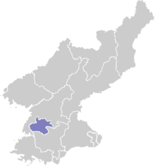
Moranbong-guyŏk, or the Moranbong District, is one of the 19 guyŏk which constitute the city of Pyongyang, North Korea. It is located north of Chung-guyok, the city's central district, and is bordered to the north by Sosong and Taesong-guyoks, to the east by the Taedong River, and the west by the Potong River and Potonggang-guyok. It is named after Moran Hill located in the district's west area ("Moran" is Korean for peony). It was designated a guyŏk in October 1960 by the Pyongyang City People's Committee.
Overview
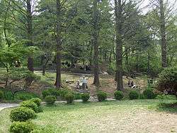
A large part of the district is taken up by the Moranbong Park, Pyongyang's largest recreation area. The park contains many significant historic relics, including vestiges of the old Pyongyang Castle walls and various ornamental pavilions.[1] The district is also home to the Kim Il-sung Stadium and the site of Kim's first speech after the liberation of Pyongyang. The Pyongyang Arch of Triumph, the world's largest such arch, is also located in the district.
Transport
The Pyongyang Metro runs through this district, with stops at Tongil, Kaeson, Chonu, and Chonsung stations.[2]
It is connected to Rungra Island and Taedonggang-guyŏk (on the Taedong's left bank) by the Rungra Bridge.[3]
Administrative divisions
Moranbong-guyok is divided into fifteen administrative districts known as dong. The largest neighborhoods (Inhung, Pipa, and Kinmaul) are further divided in two parts for administrative purposes.[4]
| Chosŏn'gŭl | Hancha | |
|---|---|---|
| Changhyŏn-dong | 장현동 | 長峴洞 |
| Ch'ilsongmun-dong | 칠성문동 | 七星門洞 |
| Chinhŭng-dong | 진흥동 | 進興洞 |
| Chŏnsŭng-dong | 전승동 | 戰勝洞 |
| Chŏnu-dong | 전우동 | 戰友洞 |
| Hŭngbu-dong | 흥부동 | 興富洞 |
| Inhŭng-dong | 인흥동 | 仁興洞 |
| Kaesŏn-dong | 개선동 | 凱旋洞 |
| Kinmaŭl-dong | 긴마을동 | 긴마을洞 |
| Minhŭng-dong | 민흥동 | 民興洞 |
| Pip'a-dong | 비파동 | 琵琶洞 |
| Puksae-dong | 북새동 | 北塞洞 |
| Sŏhŭng-dong | 서흥동 | 西興洞 |
| Sŏngbuk-dong | 성북동 | 城北洞 |
| Wŏlhyang-dong | 월향동 | 月香洞 |
Sources
- ↑
- ↑
- ↑ "능라교", Doosan Encyclopedia, retrieved 2010-07-02
- ↑ http://nk.joins.com/map/i005.htm
Coordinates: 39°02′57″N 125°45′41″E / 39.049186°N 125.761356°E