Mount Black (Tasmania)
| Mount Black | |
|---|---|
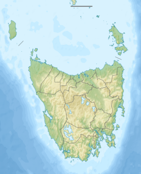  Mount Black Location in Tasmania | |
| Highest point | |
| Elevation | 950 m (3,120 ft) |
| Coordinates | 41°45′36″S 145°33′36″E / 41.76000°S 145.56000°ECoordinates: 41°45′36″S 145°33′36″E / 41.76000°S 145.56000°E [1] |
| Geography | |
| Location | Western Tasmania, Australia |
| Parent range | West Coast Range |
| Topo map | 8014 |
| Geology | |
| Age of rock | Jurassic |
| Climbing | |
| Easiest route | Murchison Highway |
Mount Black is a mountain on the West Coast Range located in the West Coast region of Tasmania, Australia.[2] With an elevation of 950 metres (3,117 ft) above sea level, the mountain is located adjacent to the town of Rosebery.
The Murchison Highway passes around its lower slopes.[3]
It is the location of some former exploration and mine sites.[4][5]
See also
References
- ↑ "Mount Black (TAS)". Gazetteer of Australia online. Geoscience Australia, Australian Government.
- ↑ Baillie, Peter (2010). "The West Coast Range, Tasmania: Mountains and Geological Giants" (PDF). Papers and Proceedings of the Royal Society of Tasmania (reprint ed.). Hobart, Tasmania: University of Tasmania. 144: 1–13. ISSN 0080-4703. Retrieved 18 June 2015.
- ↑ Maclean, Charles; Aplin, Neil; Transport Tasmania. Transport Policy Unit (1981), An evaluation of a proposal for climbing lanes on the Mount Black section of the Murchison Highway, Transport Policy Unit, retrieved 25 February 2015
- ↑ "MOUNT BLACK PROPRIETARY.". The Sydney Morning Herald. National Library of Australia. 15 August 1896. p. 11. Retrieved 25 February 2015.
- ↑ "SOUTH MOUNT BLACK.". Daily Telegraph. Launceston, Tas.: National Library of Australia. 20 January 1897. p. 3. Retrieved 25 February 2015.
This article is issued from Wikipedia - version of the 9/15/2015. The text is available under the Creative Commons Attribution/Share Alike but additional terms may apply for the media files.