Mount Lesueur
| Mount Lesueur | |
|---|---|
 | |
| Highest point | |
| Elevation | 313 m (1,027 ft) [1] |
| Coordinates | 30°10′31.8″S 115°11′56.7″E / 30.175500°S 115.199083°E |
| Geography | |
| Location | Western Australia |
| Parent range | Gairdner Range |
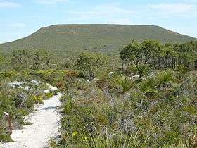
Mount Lesueur is a near-circular, flat-topped mesa located 21 kilometres from Jurien Bay in Western Australia.[2] It rises above the surrounding lateritic plain of Lesueur National Park which has eroded away around it.[2]
Mount Lesueur was first sighted and named by Europeans as the French ship the Naturaliste sailed past Jurien Bay on its voyage up the Western Australian coast.[2] It was named in honour of Charles Alexander Lesueur, a natural history artist on board the ship. The next recorded sighting was by Captain George Grey, who led a small party through the area in 1839 after they were shipwrecked near Kalbarri.[2] In 1849 a party led by A.C. Gregory ascended Mount Lesueur.[3] They were followed the next year by botanical collector James Drummond on the first of his many visits to the area.[2][3]
A reserve (No.24275) was created around Mount Lesueur for "educational purposes" in the 1950s.[3] A more extensive area was gazetted as a national park in 1992.[3]
Mount Lesueur has an extremely high level of plant biodiversity, making it of immense research and conservation importance to botanists.
References
- ↑ "Mount Lesueur". Gazeteer of Australia. Geoscience Australia. Retrieved 2009-07-17.
- 1 2 3 4 5 "Lesueur National Park". Park Finder. Department of Conservation and Environment. Retrieved 2009-07-17.
- 1 2 3 4 "Management Plan:Lesueur National Park and Coomallo Nature Reserve 1995 - 2005" (PDF). Department of Conservation and Land Management. 1995. Retrieved 2009-07-17.