Mường Lát District
| Mường Lát District | |
|---|---|
| District | |
| Country |
 Vietnam Vietnam |
| Region | North Central Coast |
| Province | Thanh Hóa |
| Capital | Mường Lát |
| Area | |
| • Total | 312.22 sq mi (808.65 km2) |
| Population (2003) | |
| • Total | 30,318 |
| • Density | 97/sq mi (37.5/km2) |
| Time zone | UTC + 7 (UTC+7) |
Mường Lát is a district (huyện) of Thanh Hóa Province in the North Central Coast region of Vietnam.
As of 2003 the district had a population of 30,318.[1] The district covers an area of 817 km². The district capital lies at Mường Lát.[1]
References
- 1 2 "Districts of Vietnam". Statoids. Retrieved March 19, 2009.
Coordinates: 20°30′00″N 104°34′59″E / 20.500°N 104.583°E
| Districts of North Central Coast (Bắc Trung Bộ) | ||
|---|---|---|
| Thanh Hóa Province | 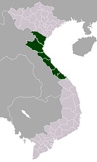 | |
| Nghệ An Province | ||
| Hà Tĩnh Province | ||
| Quảng Bình Province | ||
| Quảng Trị Province | ||
| Thừa Thiên-Huế Province | ||
This article is issued from Wikipedia - version of the 8/10/2016. The text is available under the Creative Commons Attribution/Share Alike but additional terms may apply for the media files.