North Dakota Highway 200
| ||||
|---|---|---|---|---|
| Route information | ||||
| Maintained by NDDOT | ||||
| Length: | 415.778 mi[1] (669.130 km) | |||
| Major junctions | ||||
| West end: |
 MT 200 near Fairview, Montana MT 200 near Fairview, Montana | |||
| ||||
| East end: |
 MN 200 near Halstad, Minnesota MN 200 near Halstad, Minnesota | |||
| Location | ||||
| Counties: | Foster, Mercer, Wells, Griggs, Sherdian, McLean, Dunn, McKenzie, Steele, Traill | |||
| Highway system | ||||
| ||||
.svg.png)
.svg.png)
North Dakota Highway 200 is a major east–west highway in North Dakota. It runs from Minnesota State Highway 200 at the Minnesota border near Halstad, Minnesota to Montana Highway 200 near Fairview, Montana. At nearly 416 miles (669 km), it is the longest state highway in North Dakota.
This state highway is part of a nationwide chain of similarly numbered state highways that stretch from Minnesota to Idaho.
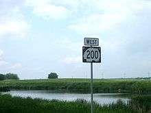
Highway 200 reassurance shield in Sheridan County
Major intersections
| County | Location | mi[1] | km | Destinations | Notes |
|---|---|---|---|---|---|
| McKenzie | | 0.000 | 0.000 | MT 200 west – Fairview, Sidney | Continuation into Montana |
| | 0.378 | 0.608 | .svg.png) ND 58 north ND 58 north | ||
| | 18.684 | 30.069 |  US 85 north – Williston US 85 north – Williston | Western end of US 85 overlap | |
| Alexander | 19.602 | 31.546 |  US 85 Bus. south – Alexander US 85 Bus. south – Alexander | ||
| 22.603 | 36.376 | US 85 Bus. north – Alexander | |||
| | 23.764 | 38.244 | .svg.png) ND 68 west ND 68 west | ||
| Watford City | 37.449 | 60.268 | US 85 Bus. south – Watford City | ||
| 42.277 | 68.038 |  .svg.png) US 85 Bus. north / ND 23 east – Watford City, New Town US 85 Bus. north / ND 23 east – Watford City, New Town | |||
| | 75.083 | 120.834 | US 85 south – Belfield | Eastern end of US 85 overlap | |
| Dunn | | 95.254 | 153.296 | .svg.png) ND 22 ND 22 | Roundabout |
| | 115.351 | 185.639 | .svg.png) ND 8 north – Halliday ND 8 north – Halliday | Western end of ND 8 overlap | |
| | 117.262 | 188.715 | ND 8 south – Richardton | Eastern end of ND 8 overlap | |
| Mercer | | 143.511 | 230.959 | .svg.png) ND 49 south – Beulah ND 49 south – Beulah | |
| | 157.781 | 253.924 |   .svg.png) ND 200A east – Stanton, Washburn ND 200A east – Stanton, Washburn | ||
| | 169.952 | 273.511 | .svg.png) ND 1806 west ND 1806 west | ||
| McLean | | 186.397 | 299.977 | .svg.png) ND 48 north ND 48 north | |
| | 188.892 | 303.992 |  US 83 north – Coleharbor, Minot US 83 north – Coleharbor, Minot | Western end of US 83 overlap | |
| | 192.873 | 310.399 | US 83 south – Underwood, Washburn | Eastern end of US 83 overlap | |
| | 197.047 | 317.116 | ND 200A east | ||
| | 205.797 | 331.198 | .svg.png) ND 41 north – Turtle Lake ND 41 north – Turtle Lake | Western end of ND 41 overlap | |
| Mercer | 213.797 | 344.073 | ND 41 south – Wilton | Eastern end of ND 41 overlap | |
| Sheridan | McClusky | 236.225 | 380.167 | .svg.png) ND 14 – Wing, Anamoose ND 14 – Wing, Anamoose | |
| Wells | | 252.062 | 405.654 | .svg.png) ND 3 south – Tuttle, Steele ND 3 south – Tuttle, Steele | Western end of ND 3 overlap |
| Hurdsfield | 254.202 | 409.098 | ND 3 north – Harvey | Eastern end of ND 3 overlap | |
| | 268.577 | 432.233 |  US 52 west – Fessenden, Harvey, Minot US 52 west – Fessenden, Harvey, Minot | Western end of US 52 overlap | |
| | 278.580 | 448.331 | .svg.png) ND 30 north – Cathay ND 30 north – Cathay | ||
| Foster | Carrington | 293.491 | 472.328 |  US 52 east / US 281 – Jamestown, Devils Lake US 52 east / US 281 – Jamestown, Devils Lake | Eastern end of US 52 overlap |
| Glenfield | 319.423 | 514.061 | .svg.png) ND 20 – Jamestown, Devils Lake ND 20 – Jamestown, Devils Lake | ||
| Griggs | | 330.806 | 532.381 | .svg.png) ND 1 north – Binford ND 1 north – Binford | |
| | 337.913 | 543.818 | ND 1 south – Hannaford | ||
| Cooperstown | 340.504 | 547.988 | .svg.png) ND 45 north – Cooperstown ND 45 north – Cooperstown | ||
| Steele | | 354.115 | 569.893 | .svg.png) ND 32 south – Oriska ND 32 south – Oriska | South end of ND 32 overlap |
| Finley | 359.041 | 577.820 | ND 32 north – Sharon, Aneta | North end of ND 32 overlap | |
| Traill | | 377.411 | 607.384 | .svg.png) ND 18 north – Hatton ND 18 north – Hatton | Western end of ND 18 overlap |
| Mayville | 384.404 | 618.638 | ND 18 south – Casselton | Eastern end of ND 18 overlap | |
| | 395.560 | 636.592 |  I-29 – Grand Forks, Fargo I-29 – Grand Forks, Fargo | I-29 exit 111 | |
| | 406.526 | 654.240 | ND 200A west | ||
| Red River of the North | 415.778 | 669.130 | North Dakota–Minnesota state line | ||
| Norman | Halstad | MN 200 east – Ada | Continuation into Minnesota | ||
1.000 mi = 1.609 km; 1.000 km = 0.621 mi
| |||||
References
- 1 2 North Dakota Department of Transportation (2015). Route and Mileage Map (PDF) (Map). Bismarck: North Dakota Department of Transportation. Retrieved July 21, 2016.
External links
- The North Dakota Highways Page by Chris Geelhart
| Bridges of the Missouri River | ||||
|---|---|---|---|---|
| ||||


| Bridges of the James River | ||||
|---|---|---|---|---|
| ||||

This article is issued from Wikipedia - version of the 10/19/2016. The text is available under the Creative Commons Attribution/Share Alike but additional terms may apply for the media files.