Narkatiaganj
| Narkatiaganj नरकटियागंज | |
|---|---|
| Town | |
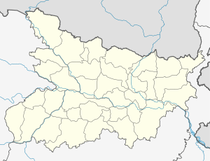  Narkatiaganj Location in Bihar, India | |
| Coordinates: 27°06′29″N 84°27′50″E / 27.108°N 84.464°ECoordinates: 27°06′29″N 84°27′50″E / 27.108°N 84.464°E | |
| Country |
 India India |
| State | Bihar |
| District | West Champaran |
| Elevation | 89 m (292 ft) |
| Population (2011)[1] | |
| • Total | 49,507 |
| Time zone | IST (UTC+5:30) |
| PIN | 845455 |
| Telephone code | 06253 |
| Lok Sabha constituency | Valmiki Nagar |
| Vidhan Sabha constituency | Narkatiaganj |
| Website |
westchamparan |
Narkatiaganj is a city and a notified area in West Champaran district in the Indian state of Bihar. It is a part of Tirhut Division, and situated 280 kilometres (170 mi) northwest of capital of the state, Patna.
Overview
Narkatiaganj is a subdivision region in West Champaran district in the Indian state of Bihar. It is situated 280 kilometres (170 mi) northwest of capital Patna.[2] Narkatiaganj block has twenty seven Panchayats.[3][4] The city is well connected by roads and railways to all major places of Bihar and neighbor states. It is situated on the Barauni–Gorakhpur, Raxaul and Jainagar railway lines.[5]
Demographics
As of 2011 India census, Narkatiaganj had a population of 49,507 in 9083 households. Males constitute 53% of the population and females 43%. Narkatiaganj has an average literacy rate of 65%, lower than the national average of 74%, male literacy is 57.65% and female literacy is 42.34%. In Narkatiaganj, 15.7% of the population is under 6 years of age.[6]
Climate
| Climate data for Narkatiaganj | |||||||||||||
|---|---|---|---|---|---|---|---|---|---|---|---|---|---|
| Month | Jan | Feb | Mar | Apr | May | Jun | Jul | Aug | Sep | Oct | Nov | Dec | Year |
| Record high °C (°F) | 22 (72) |
27.2 (81) |
31 (88) |
37 (99) |
34 (93) |
36 (97) |
33 (91) |
34 (93) |
33 (91) |
33 (91) |
30 (86) |
25 (77) |
37 (99) |
| Record low °C (°F) | 7 (45) |
9 (48) |
12 (54) |
23 (73) |
23 (73) |
26 (79) |
25 (77) |
24 (75) |
24 (75) |
21 (70) |
16 (61) |
9 (48) |
9 (48) |
| Source: [7] | |||||||||||||
Notable people
Places of interest
Nearby Narkatiaganj is the historical Chanaki Garh, which is said to be a palace of Chanakya in the region of Chandragupta Maurya of the Mauryan period.[8] An Iron Pillar (also known as Ashoka Stambha) representing the history of India and established by Ashoka, is another center of attraction.[9][10]
See also
References
- ↑ "Census of India Search details". censusindia.gov.in. Retrieved 10 May 2015.
- ↑ Roshan Kumar (18 August 2014). "All roads lead to Narkatiaganj". The Telegraph. Retrieved 13 December 2014.
- ↑ "WEST CHAMPARAN DISTRICT AT A GLANCE". Retrieved 13 May 2014.
- ↑ "Panchayats of Narkatiaganj Block, West Champaran". Retrieved 7 May 2014.
- ↑ "अभी खाली नहीं गोरखपुर-नरकटियागंज रूट". 27 August 2014. Retrieved 13 December 2014.
- ↑ "Population Enumeration Data (Final Population)". Retrieved 13 December 2014.
- ↑ "Narkatiaganj, Bihar Weather". Retrieved 7 May 2014.
- ↑ "PLACES OF TOURIST & HISTORIC INTEREST". Retrieved 13 May 2014.
- ↑ Upinder Singh (ed.). Delhi: Ancient History (illustrated ed.). Berghahn Books, 2007. p. 174. ISBN 9788187358299. Retrieved 13 May 2014.
- ↑ "Samastipur Division" (PDF). Retrieved 11 January 2014.