Naukati Bay Seaplane Base
| Naukati Bay Seaplane Base (Nichin Cove Seaplane Base) | |||||||||||||||
|---|---|---|---|---|---|---|---|---|---|---|---|---|---|---|---|
| IATA: NKI[1] – ICAO: none – FAA LID: AK62 | |||||||||||||||
| Summary | |||||||||||||||
| Airport type | Public use | ||||||||||||||
| Owner | Naukati Bay Community | ||||||||||||||
| Serves | Naukati Bay, Alaska | ||||||||||||||
| Location | Tuxekan Island | ||||||||||||||
| Elevation AMSL | 0 ft / 0 m | ||||||||||||||
| Coordinates | 55°50′59″N 133°13′40″W / 55.84972°N 133.22778°WCoordinates: 55°50′59″N 133°13′40″W / 55.84972°N 133.22778°W | ||||||||||||||
| Map | |||||||||||||||
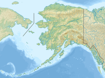  AK62 Location in Alaska | |||||||||||||||
| Runways | |||||||||||||||
| |||||||||||||||
| Statistics (2006) | |||||||||||||||
| |||||||||||||||
Naukati Bay Seaplane Base,[2] formerly known as Nichin Cove Seaplane Base[3] (IATA: NKI, FAA LID: AK62), is a public use seaplane base[2] located at Nichin Cove on the east side of Tuxekan Island,[4] in the Prince of Wales-Hyder Census Area (formerly Prince of Wales-Outer Ketchikan Census Area) of the U.S. state of Alaska. It is owned by the Naukati Bay Community[2] and located 2 nautical miles (4 km) southwest of Naukati Bay which is on Prince of Wales Island.[5]
Facilities and aircraft
Naukati Bay Seaplane Base resides at elevation of 0 feet (0 m) above mean sea level. It has two seaplane landing areas: one designated N/S with a water surface measuring 10,000 by 1,000 feet (3,048 x 305 m) and another designated NE/SW which is 10,000 by 300 feet (3,048 x 91 m). For the 12-month period ending December 31, 2006, the facility had 300 aircraft operations, an average of 25 per month: 83% air taxi and 17% general aviation.[2]
References
- ↑ "Airline and Airport Code Search". International Air Transport Association. Retrieved April 4, 2016.
- 1 2 3 4 5 FAA Airport Master Record for AK62 (Form 5010 PDF). Federal Aviation Administration. Effective May 31, 2012.
- ↑ "AK62 – Nichin Cove Seaplane Base – Tuxekan Island, Alaska, USA". FAA Information Effective April 10, 2008. AirNav. Archived from the original on May 30, 2008.
- ↑ "Topographic map". The National Map. U.S. Geological Survey.
- ↑ "Distance and heading from Naukati Bay, Alaska (55°52'25"N 133°11'05"W) to AK62 (55°50'59"N 133°13'40"W)". Great Circle Mapper. Retrieved September 27, 2012.
External links
- Resources for this airport:
- FAA airport information for AK62
- AirNav airport information for AK62
- ASN accident history for WNC
- FlightAware airport information and live flight tracker
- SkyVector aeronautical chart for AK62