Nazla
| Nazla نزلة Nazle | |
|---|---|
| Town | |
| Al-Nazlah | |
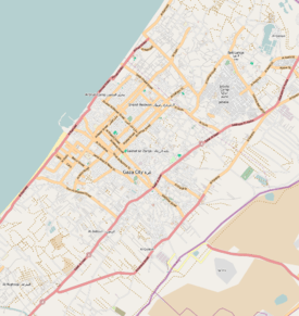  Nazla نزلة Location in Gaza Strip | |
| Coordinates: 31°31′58″N 34°28′56″E / 31.53278°N 34.48222°E | |
| Country |
 Palestine Palestine |
| Governorate | North Governorate |
| City | Jabalia |
| Time zone | EET (UTC+2) |
| • Summer (DST) | +3 (UTC) |
Nazla (Arabic: نزلة; also spelled al-Nazlah, Nazle, Annazla or en-Nuzleh[1]) is a Palestinian town in the North Governorate of the Gaza Strip. It was formerly a municipality but was merged with the nearby city of Jabalia.[2] Nazla is located a few kilometers north of Gaza City.
History
Nazla has been identified as the site of the Byzantine-era town of Asalea (Ασαλέα in Greek).[3][4] Asalea belonged to the city of Gaza during that period.[3] A celebrated Christian figure in Byzantine Gaza was Alaphion of Asalea who was known to be pious and was one of the early missionaries who helped spread Christianity in the area.[5] In the 6th century Madaba Map, Asalea is marked by three towers, a gate and a segment of a wall.[6]
Ottoman era
In 1863, the French explorer Victor Guérin found the village to have about 150 inhabitants.[7]
An Ottoman village list of about 1870 showed that Nazle had 114 houses and a population of 414, though the population count included only men.[8]
In 1883, the Palestine Exploration Fund's Survey of Western Palestine described Nazla as a "small hamlet" and a suburb of Jabalia. To the east of Nazla was a well.[9]
British mandate era
In the 1922 census of Palestine conducted by the British Mandate authorities, Nazla had a population of 694, all Muslim,[10] increasing in the 1931 census to 944, still all Muslims, in 226 houses.[11]
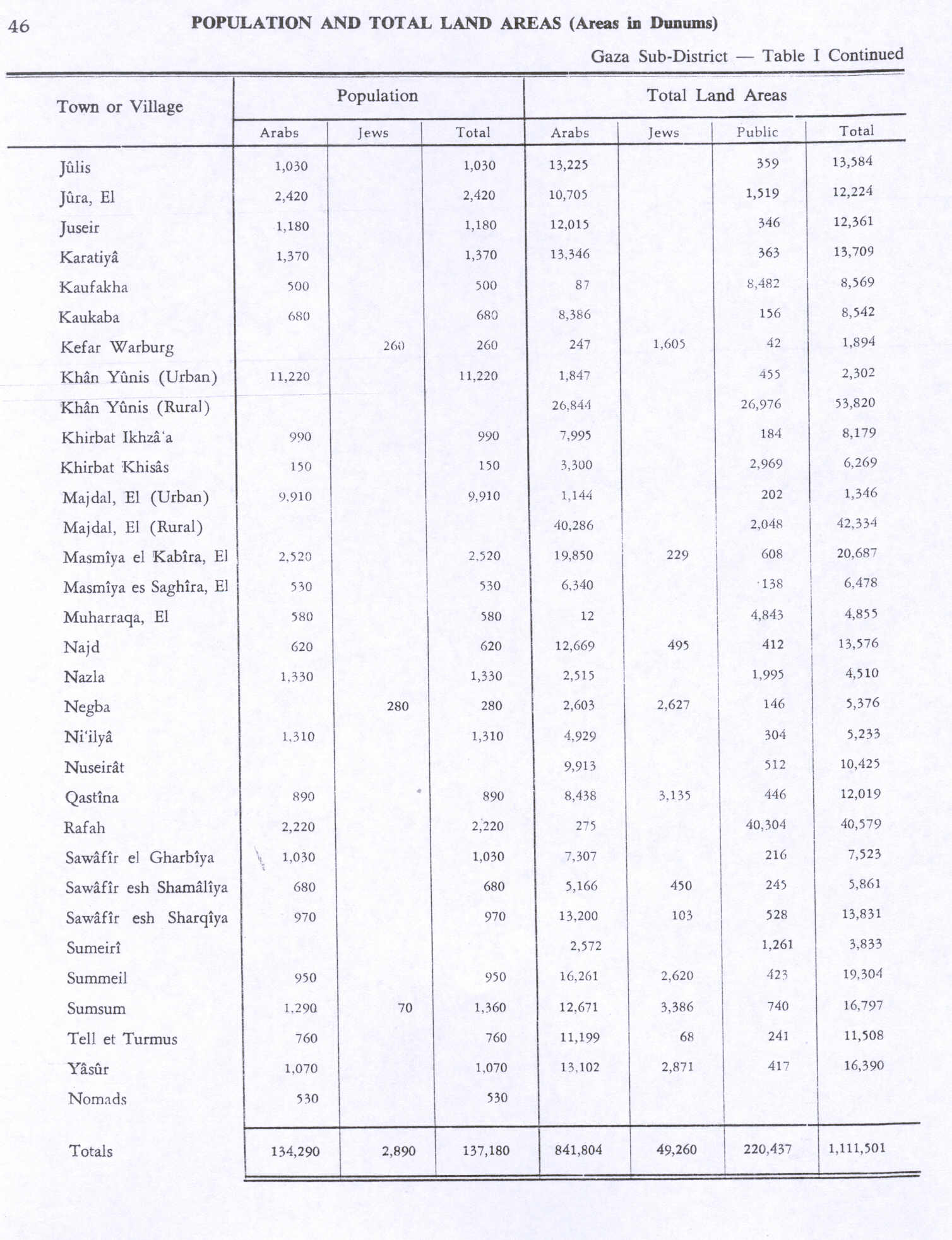
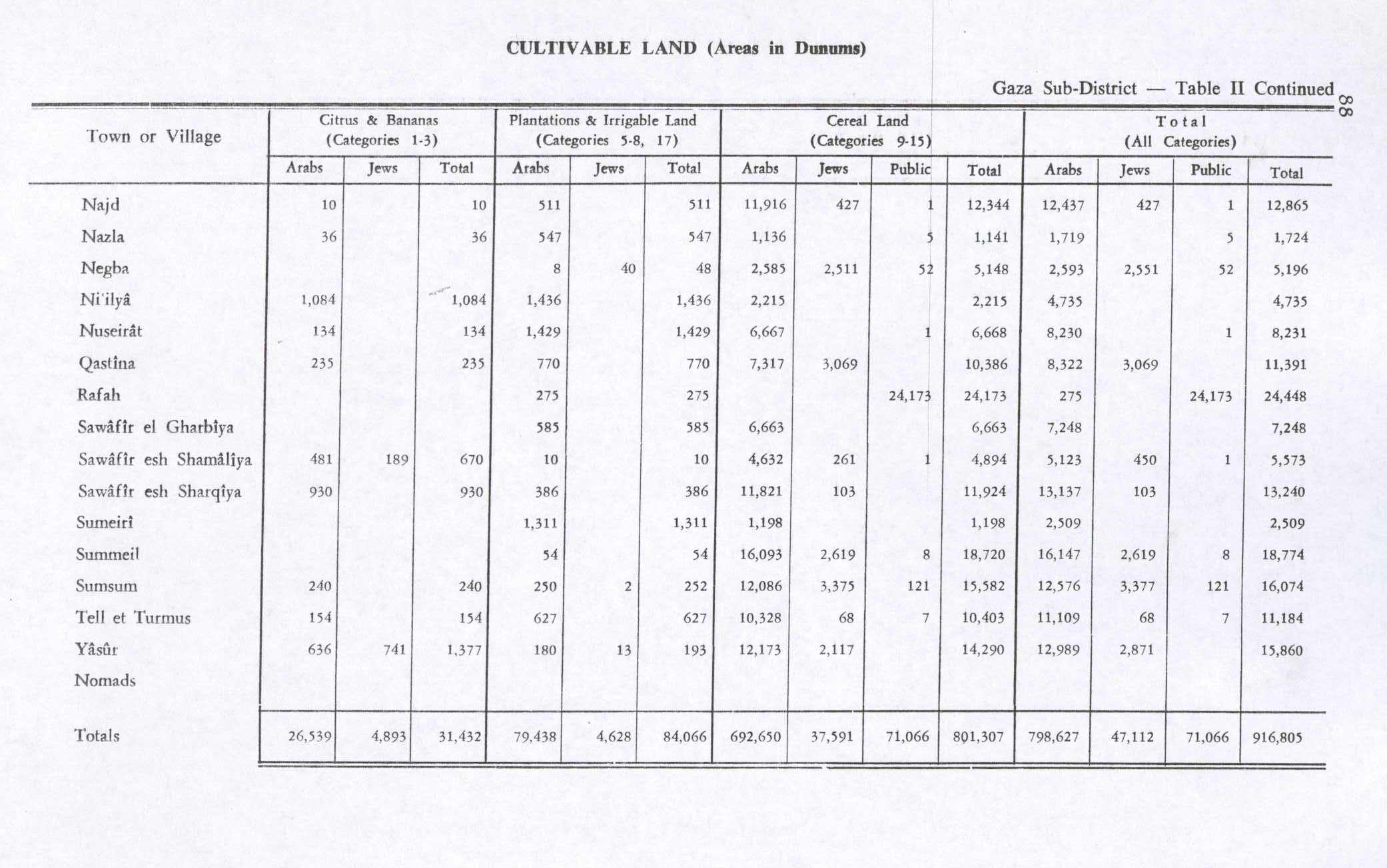
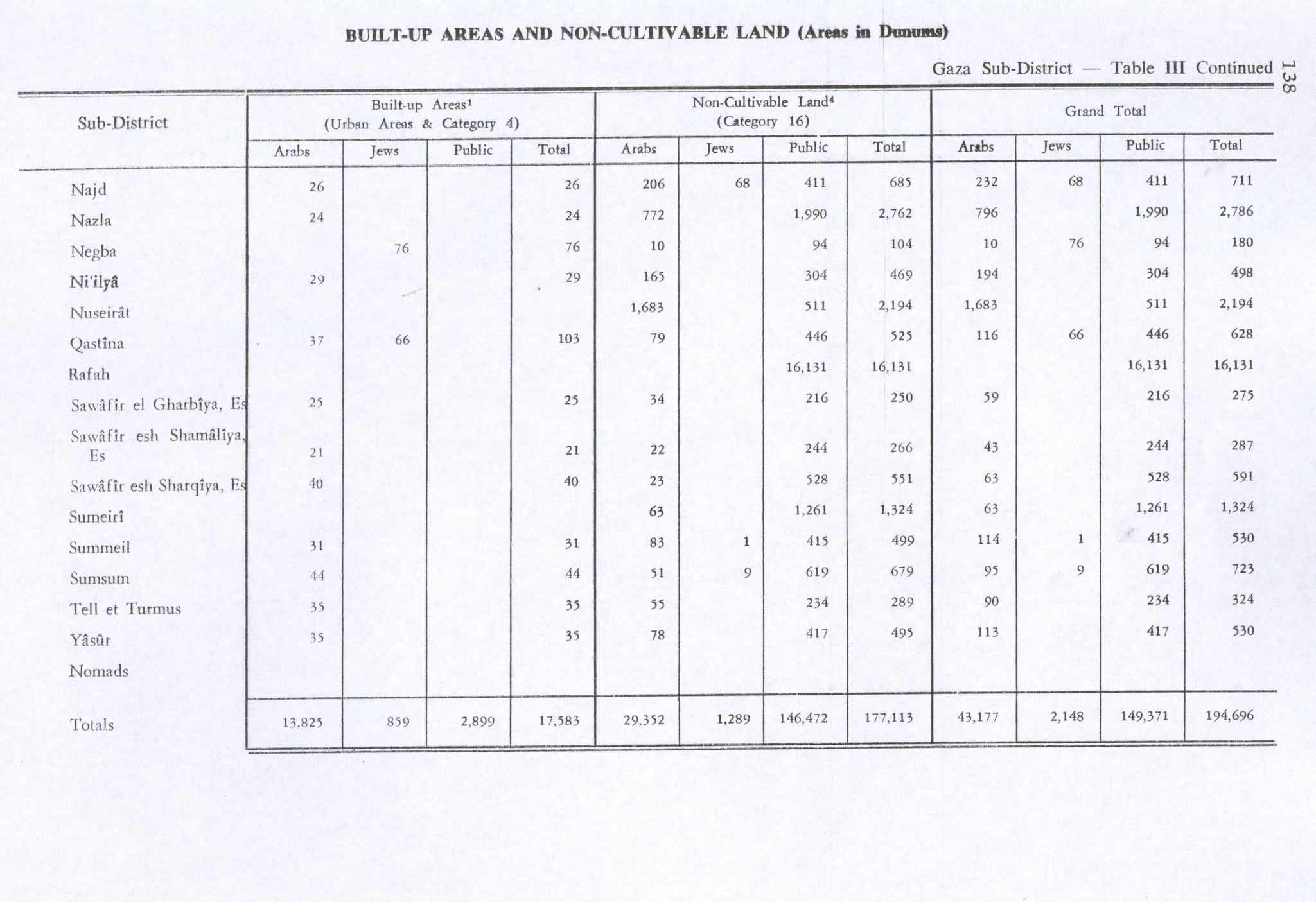
In 1945 Nazla had a population of 1,330, all Muslims,[12] with 4,510 dunams of land, according to an official land and population survey.[13][14] Of this, 36 dunams were for citrus and bananas, 547 for plantations and irrigable land, 1,141 used for cereals,[15] while 24 dunams were built-up land.[16]
1948, and after
During Egyptian rule following the 1948 Arab–Israeli War, Nazla was one of six localities to establish a village council to administer its affairs. Israel occupied the Gaza Strip during the 1967 Six Day War.[17][18] In the 1970s and 1980s, Israel developed building projects in Nazla, offering Palestinian refugee families subsidized rates to resettle there.[19]
References
- ↑ meaning Settlement, or hamlet, according to Palmer, 1881, p. 361
- ↑ Roy, 1995, p. 16
- 1 2 Bitton-Ashkelony and Kofsky, 2004, p. 45
- ↑ Kaswalder, 2002, p. 287.
- ↑ Bingham, 1834, p. 137
- ↑ 114. Asalea - (al-Nazlah). Franciscan Cyberspot quoting Michael Avi-Yonah, The Madaba Mosaic Map (1954).
- ↑ Guérin, 1869, p. 177
- ↑ Socin, 1879, p. 158
- ↑ Conder and Kitchener, 1883, SWP III, p. 236
- ↑ Barron, 1923, Table V, Sub-district of Gaza, p. 8
- ↑ Mills, 1932, p. 5
- ↑ Department of Statistics, 1945, p. 32
- ↑ Government of Palestine, Department of Statistics. Village Statistics, April, 1945. Quoted in Hadawi, 1970, p. 46
- ↑ Nazla Profile. Jerusalem Media and Communications Center. 2007-02-09.
- ↑ Government of Palestine, Department of Statistics. Village Statistics, April, 1945. Quoted in Hadawi, 1970, p. 88
- ↑ Government of Palestine, Department of Statistics. Village Statistics, April, 1945. Quoted in Hadawi, 1970, p. 138
- ↑ Shahwan, 2003, p. 41
- ↑ Dishon, 1973, p. 457
- ↑ United Nations. Yearbook of the United Nations 1987. (1992). p. 340.

Bibliography
- Barron, J. B., ed. (1923). Palestine: Report and General Abstracts of the Census of 1922. Government of Palestine.
- Bingham, Joseph (1834). Origines Ecclesiasticæ: Or, The Antiquities of the Christian Church, and Other Works, of the Rev. Joseph Bingham ; with a Set of Maps of Ecclesiastical Geography, to which are Now Added, Several Sermons, and Other Matter, Never Before Published. 7. William Straker.
- Bitton-Askeloni, Bruria; Kofsky, Arieh (2004). Christian Gaza In Late Antiquity. BRILL. ISBN 978-90-04-13868-1.
- Conder, Claude Reignier; Kitchener, H. H. (1883). The Survey of Western Palestine: Memoirs of the Topography, Orography, Hydrography, and Archaeology. 3. London: Committee of the Palestine Exploration Fund.
- Department of Statistics (1945). Village Statistics, April, 1945. Government of Palestine.
- Dishon (1973). Middle East Record 1968. 4. John Wiley & Sons. ISBN 0470216115.
- Guérin, Victor (1869). Description Géographique Historique et Archéologique de la Palestine (in French). 1: Judee, pt. 2. Paris: L'Imprimerie Nationale.
- Hadawi, Sami (1970). Village Statistics of 1945: A Classification of Land and Area ownership in Palestine. Palestine Liberation Organization Research Center.
- Mills, E., ed. (1932). Census of Palestine 1931. Population of Villages, Towns and Administrative Areas (PDF). Jerusalem: Government of Palestine.
- Palmer, E. H. (1881). The Survey of Western Palestine: Arabic and English Name Lists Collected During the Survey by Lieutenants Conder and Kitchener, R. E. Transliterated and Explained by E.H. Palmer. Committee of the Palestine Exploration Fund.
- Roy, Sara M. (1995). The Gaza Strip: The Political Economy of De-Development. Institute for Palestine Studies. ISBN 0887282601.
- Shahwan, Usama Salim (2003). Public Administration in Palestine: Past and Present. University Press of America. ISBN 0761826882.
- Socin, A. (1879). "Alphabetisches Verzeichniss von Ortschaften des Paschalik Jerusalem". Zeitschrift des Deutschen Palästina-Vereins. 2: 135–163.
External links
- Welcome To Nazla
- Survey of Western Palestine, Map 19: IAA, Wikimedia commons

| Cities | | |
|---|---|---|
| Municipalities | ||
| Villages |
| |
| Refugee camps | ||