Newtowne Neck State Park
| Newtowne Neck State Park | |
| Maryland State Park | |
| Country | United States |
|---|---|
| State | Maryland |
| County | St. Mary's |
| Elevation | 13 ft (4 m) [1] |
| Coordinates | 38°14′43″N 76°42′29″W / 38.24528°N 76.70806°WCoordinates: 38°14′43″N 76°42′29″W / 38.24528°N 76.70806°W [1] |
| Area | 791 acres (320 ha) [2] |
| Established | 2009 |
| Management | Maryland Department of Natural Resources |
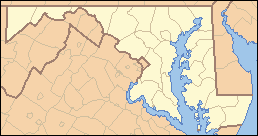  Location in Maryland | |
| Website: Newtowne Neck State Park | |
Newtowne Neck State Park is a Maryland state park occupying a peninsula that is surrounded by Breton Bay, St. Clements Bay, and the Potomac River in St. Mary's County. The park offers 7 miles (11 km) of undeveloped shoreline, fishing, hunting, unimproved hiking and biking trails, and kayaking.[3]
In 2014, the park was reopened to the public;[3] it had been closed following the discovery of military ordnance on the site in 2012.[4] The park was part of the state's purchase of former Jesuit holdings in Southern Maryland in 2009.[5]
References
- 1 2 "Newtown Neck". Geographic Names Information System. United States Geological Survey.
- ↑ "FY2013 DNR Owned Lands Acreage Report" (PDF). Maryland DNR. Retrieved December 21, 2013.
- 1 2 "Newtowne Neck State Park". Maryland DNR. Retrieved December 21, 2013.
- ↑ "Military Ordnance Safety Sweep Conducted at Newtowne Neck State Park" (PDF) (Press release). Maryland State Fire Marshall. July 2, 2013. Retrieved December 21, 2013.
- ↑ "Province Properties Vision Plan" (PDF). Maryland DNR. April 2010. Retrieved December 21, 2013.
External links
- Newtowne Neck State Park Maryland Department of Natural Resources
This article is issued from Wikipedia - version of the 6/3/2014. The text is available under the Creative Commons Attribution/Share Alike but additional terms may apply for the media files.