Ngaliema
| Ngaliema Commune de Ngaliema | |
|---|---|
| Commune | |
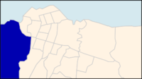 Ngaliema on a map of Kinshasa communes | |
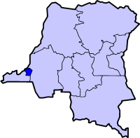 Kinshasa city-province on a map of the DRC | |
| Coordinates: 04°20′56″S 15°15′10″E / 4.34889°S 15.25278°ECoordinates: 04°20′56″S 15°15′10″E / 4.34889°S 15.25278°E[1] | |
| Country | Democratic Republic of the Congo |
| Province | Kinshasa |
| District | Lukunga |
| Area | |
| • Total | 224.3 km2 (86.6 sq mi) |
| Population (2004 est.) | |
| • Total | 683,135 |
| • Density | 3,000/km2 (7,900/sq mi) |
Ngaliema is a municipality (commune) in the Lukunga District of Kinshasa, the capital city of the Democratic Republic of the Congo.[2]
Location
Ngaliema is situated in the west of Kinshasa. It stretches south towards Mont Ngaliema and along the main road linking Kinshasa and the city of Matadi in Bas-Congo. The boundary between Ngaliema and the Mont Ngafula commune is defined by the Lukunga River.[3]
Buildings
In addition to the communities of Binza Ozone, Binza Météo, Binza Delvaux and Binza I.P.N., the area also accommodates:
- The Palais de Marbre (Marble Palace): built as a Presidential guests' residence under Mobutu Sese Seko, it was the official residence of President Laurent-Désiré Kabila. It is in his private office at the Marble palace that Kabila was assassinated, allegedly by one of his bodyguards.
- The Cité de l'OUA (OAU village) compound: built when Kinshasa was the host of a summit of heads of states of the Organisation of African Unity, the sprawling compound has paid host to many official functions. Most recently, it has become the official location of the weekly meeting of the Council of Ministers, the deliberative body of the Congolese executive branch.
- The Camp Militaire Colonel Tshatshi (Colonel Tshatshi Military Compound): One of the two major military bases in Kinshasa, the base pays host to the defense department, and the Joint Chiefs of staff central command headquarters for the Military of the Democratic Republic of the Congo (FARDC). It also surrounds two previous Presidential palaces.
- The Mont Fleury neighbourhood, also known as Kinshasa's "Beverly Hills".
Demographics
| Year | 1967 | 1970 | 1984 | 2003 | 2004 |
|---|---|---|---|---|---|
| Population | 30,640 | 63,844 | 252,151 | 660,646 | 683,135 |
See also
 |
Wikimedia Commons has media related to Ngaliema. |
References
- ↑ "Ngaliema, Kinshasa, Democratic Republic of the Congo". Google Maps. Retrieved 20 August 2011.
- ↑ "Géographie de Kinshasa (Geography of Kinshasa)" (in French). Ville de Kinshasa (City of Kinshasa). Retrieved 20 August 2011.
- ↑ Nzuzi, Francis Lelo (2008). Kinshasa: ville et environnement. Editions L'Harmattan. p. 132. ISBN 2-296-06080-3.
External links
- Binza Rotary Club
- Pictures of the gardens of the Mont Nagliema palace
- Map of Kinshasa (2001)
- Map of Léopoldville (1960)
- Map of Léopoldville (1954)



This article is issued from Wikipedia - version of the 11/9/2016. The text is available under the Creative Commons Attribution/Share Alike but additional terms may apply for the media files.