Nieuwe Niedorp
| Nieuwe Niedorp | ||
|---|---|---|
| Town | ||
 | ||
| ||
 | ||
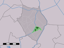 The village centre (dark green) and the statistical district (light green) of Nieuwe Niedorp in the former municipality of Niedorp. | ||
| Coordinates: 52°44′29″N 4°54′2″E / 52.74139°N 4.90056°ECoordinates: 52°44′29″N 4°54′2″E / 52.74139°N 4.90056°E | ||
| Country | Netherlands | |
| Province | North Holland | |
| Municipality | Hollands Kroon | |
| Population | ||
| • Total | 3,160 | |
| Time zone | CET (UTC+1) | |
| • Summer (DST) | CEST (UTC+2) | |
| Postal code | 1733 | |
| Dialing code | 0226 | |

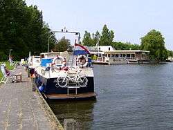
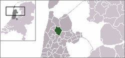
Nieuwe Niedorp (West Frisian: Naaie Nierup) is a village in the Dutch province of North Holland. It is a part of the municipality of Hollands Kroon, and lies about 9 kilometres (5.6 mi) northeast of Heerhugowaard.
Nieuwe Niedorp was a separate municipality until 1970, when it merged with Oude Niedorp and Winkel.[1]
In 2007, the village of Nieuwe Niedorp had 3160 inhabitants. The built-up area of the village was 0.53 km², and contained 760 residences.[2] The statistical area "Nieuwe-Niedorp", which also can include the peripheral parts of the village, as well as the surrounding countryside, has a population of around 3200.[3]
It has a remarkably leaning church tower.
Famous Inhabitants
- Dirck Pietersz van Nierop 1540-1610
- Dirck Rembrantsz van Nierop 1610-1682
- Pieter Rembrantsz van Nierop 1640-1708
- Elisabeth van der Woude 1657-1698
References
- ↑ Ad van der Meer and Onno Boonstra, "Repertorium van Nederlandse gemeenten", KNAW, 2006.
- ↑ Statistics Netherlands (CBS), Bevolkingskernen in Nederland 2001. (Statistics are for the continuous built-up area).
- ↑ Statistics Netherlands (CBS), Statline: Kerncijfers wijken en buurten 2003-2005. As of 1 January 2005.
See also
External links
- J. Kuyper, Gemeente Atlas van Nederland, 1865-1870, "Nieuwe-Niedorp". Map of the former municipality in 1868.
This article is issued from Wikipedia - version of the 10/29/2015. The text is available under the Creative Commons Attribution/Share Alike but additional terms may apply for the media files.