North Fork Crooked River
| North Fork Crooked River | |
| Country | United States |
|---|---|
| State | Oregon |
| County | Crook |
| Source | Ochoco National Forest |
| - location | Ochoco Mountains |
| - coordinates | 44°14′05″N 120°12′51″W / 44.23472°N 120.21417°W [1] |
| Mouth | Crooked River |
| - location | between Post and Paulina |
| - coordinates | 44°07′01″N 120°14′43″W / 44.11694°N 120.24528°WCoordinates: 44°07′01″N 120°14′43″W / 44.11694°N 120.24528°W [1] |
| Length | 46 mi (74 km) [2] |
| Basin | 323 sq mi (837 km2) [2] |
| Discharge | |
| - average | 368 cu ft/s (10 m3/s) [2] |
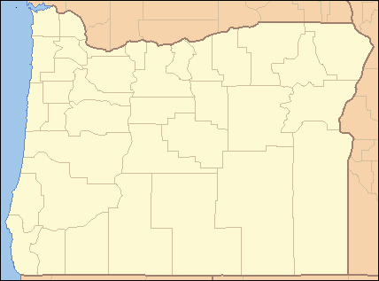  Location of the mouth of North Fork Crooked River in Oregon | |
The North Fork Crooked River is a tributary, 46 miles (74 km) long, of the Crooked River in the U.S. state of Oregon.[2] Beginning in the Ochoco National Forest and the Ochoco Mountains east of Prineville, it flows north, then east, then south-southwest to meet the larger stream between Post and Paulina. The confluence is 111 miles (179 km) upstream of where the Crooked River flows into the Deschutes River.[3]
In 1988, Congress added a large fraction of the river to the National Wild and Scenic Rivers System. About 12 miles (19 km) were designated "wild", about 8 miles (13 km) "scenic", and about 13 miles (21 km) "recreational".[4] About 8 miles (13 km) of the upper river flowing through Big Summit Prairie was excluded from the Wild Rivers designation. It is private land used as livestock pasture.[5]
See also
References
- 1 2 "North Fork Crooked River". Geographic Names Information System. United States Geological Survey (USGS). November 28, 1980. Retrieved December 11, 2014.
- 1 2 3 4 Palmer, Tim (2014). Field Guide to Oregon Rivers. Corvallis: Oregon State University Press. p. 224. ISBN 978-0-87071-627-0.
- ↑ United States Geological Survey. "United States Topographic Map". Retrieved December 12, 2014.
- ↑ "Crooked River (North Fork), Oregon". National Wild and Scenic Rivers System. Retrieved December 12, 2014.
- ↑ "North Fork Crooked River Environmental Assessment and Draft Management Plan" (PDF). Bureau of Land Management. 1992. p. 14. Retrieved December 12, 2014.