Norvalspont
| Norvalspont | |
|---|---|
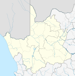  Norvalspont  Norvalspont  Norvalspont
| |
| Coordinates: 30°38′S 25°27′E / 30.63°S 25.45°ECoordinates: 30°38′S 25°27′E / 30.63°S 25.45°E | |
| Country | South Africa |
| Province | Northern Cape |
| District | Pixley ka Seme |
| Municipality | Umsobomvu |
| Established | 1848 |
| Area[1] | |
| • Total | 0.9 km2 (0.3 sq mi) |
| Population (2011)[1] | |
| • Total | 1,198 |
| • Density | 1,300/km2 (3,400/sq mi) |
| Racial makeup (2011)[1] | |
| • Black African | 91.7% |
| • Coloured | 7.8% |
| • Indian/Asian | 0.3% |
| • White | 0.0% |
| • Other | 0.1% |
| First languages (2011)[1] | |
| • Xhosa | 86.3% |
| • Afrikaans | 8.7% |
| • Sotho | 3.2% |
| • Other | 1.8% |
| PO box | 9797 |
| Area code | 051 |
Norvalspont is a small town in Pixley ka Seme District Municipality in the Northern Cape province of South Africa.
The settlement lies some 40 km east-north-east of Colesberg and 43 km west-north-west of Venterstad, on the southern bank of the Orange River, just below the Gariep Dam. Afrikaans for Norval’s ferry, it is named after an enterprising Scot who constructed a ferry here in 1848.[2]
The first bridge across the Orange River was built in 1889. The bridge was blown up during the Second Boer War. There was also a large concentration camp for Afrikaner women and children at Norvalspont during the Second Boer War.
References
- 1 2 3 4 Sum of the Main Places Norvalspont and Masizakhe from Census 2011.
- ↑ "Dictionary of Southern African Place Names (Public Domain)". Human Science Research Council. p. 341.
 |
Philippolis 53 km | Springfontein 56 km Gariep Dam 9 km Orange River |
Bethulie 62 km Lake !Gariep |
|
| Colesberg 41 km |  |
Venterstad 43 km Burgersdorp 109 km | ||
| ||||
 | ||||
| Noupoort 96 km | Farms | Steynsburg 97 km |


 |
Wikimedia Commons has media related to Norvalspont. |
Municipalities and communities of Pixley ka Seme District Municipality, Northern Cape | ||
|---|---|---|
District seat: De Aar | ||
| Emthanjeni | .svg.png) | |
| Kareeberg | ||
| Renosterberg | ||
| Siyancuma | ||
| Siyathemba | ||
| Thembelihle | ||
| Ubuntu | ||
| Umsobomvu | ||
This article is issued from Wikipedia - version of the 8/18/2016. The text is available under the Creative Commons Attribution/Share Alike but additional terms may apply for the media files.