Novoaidar Raion
| Novoaidarskyi Raion Новоайдарський район | |||
|---|---|---|---|
| Raion | |||
| |||
 | |||
| Coordinates: 48°57′34″N 38°58′32″E / 48.95944°N 38.97556°ECoordinates: 48°57′34″N 38°58′32″E / 48.95944°N 38.97556°E | |||
| Country |
 Ukraine Ukraine | ||
| Region | Luhansk Oblast | ||
| Established | 1923 | ||
| Admin. center | Novoaidar | ||
| Subdivisions |
List
| ||
| Government | |||
| • Governor | Mykola Zahodyachenko | ||
| Area | |||
| • Total | 1,536 km2 (593 sq mi) | ||
| Population (2013) | |||
| • Total |
 25,294 25,294 | ||
| Time zone | EET (UTC+2) | ||
| • Summer (DST) | EEST (UTC+3) | ||
| Postal index | 93500—93543 | ||
| Area code | +380 6445 | ||
| Website | http://ndar.loga.gov.ua | ||
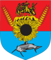
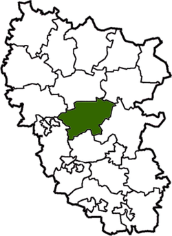
Novoaidar Raion (Ukrainian: Новоайдарський район) is a raion (district) in Luhansk Oblast in eastern Ukraine. The administrative center of the raion is the urban-type settlement of Novoaidar. Population: 25,294 (2013 est.)[1].
Starting Mid-April 2014 pro-Russian separatists captured several towns and raions in Luhansk Oblast;[2][3] Ukrainian forces reportedly removed the separatists from the last village in the Novoaidar Raion under separatist control, Krymsky, on 20 October 2014.[4]
To facilitate the governance of Luhansk Oblast during the War in Donbass, the Verkhovna Rada on 7 October 2014 made some changes in the administrative divisions, so that the localities in the government-controlled areas were grouped into districts. In particular, the town of Shchastya was transferred from Luhansk Municipality to Novoaidar Raion. Some areas were transferred to the raion from Slovianoserbsk Raion.[5]
References
- ↑ "Чисельність наявного населення України (Actual population of Ukraine)" (in Ukrainian). State Statistics Service of Ukraine. Retrieved 21 January 2015.
- ↑ http://www.newrepublic.com/article/117387/putin-accidentally-helping-unite-eastern-and-western-ukraine
- ↑ http://en.itar-tass.com/world/735082
- ↑ "Українські військові звільнили Кримське від терористів". IPress. 19 October 2014.
Krymske in Luhansk region liberated ‘without a shot fired’, UNIAN (20 Oct. 2014) - ↑ "Рада изменила границы районов Луганской области" (in Russian). Lenta.ru. 7 October 2014. Retrieved 28 November 2015.
| Raions |  | ||||||
|---|---|---|---|---|---|---|---|
| Cities |
| ||||||
| |||||||