Nyakahita
| Nyakahita | |
|---|---|
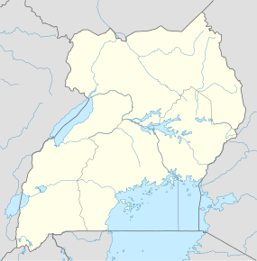  Nyakahita Map of Uganda showing the location of Nyakahita. | |
| Coordinates: 00°24′50″S 31°05′44″E / 0.41389°S 31.09556°E | |
| Region | Western Region of Uganda |
| Sub-region | Ankole sub-region |
| District | Kiruhura District |
| County | Nyabushozi County |
| Constituency | Nyabushozi County |
| Government | |
| • MP | Fred Mwesigye[1] |
| Elevation | 1,400 m (4,600 ft) |
| Time zone | EAT (UTC+3) |
Nyakahita is a sparsely populated settlement in the Western Region of Uganda.
Location
The settlement is approximately 60 kilometres (37 mi), by road, east of Mbarara, the largest city in the Ankole sub-region along the Mbarara–Masaka highway.[2] It is about 205 kilometres (127 mi), by road, southwest of Kampala, the capital and largest city of Uganda.[3] The coordinates of Nyakahita are 0°24'50.0"S, 31°05'44.0"E (Latitude:-0.413889; Longitude:31.095556).[4]
Points of interest
The Nyakahita–Kazo–Kamwenge–Fort Portal Road makes a T-junction with the
Mbarara-Masaka highway at Nyakahita. The town of Lyantonde (est. 2011 pop: 8,900),[5] in Lyantonde District, lies to the immediate east of Nyakahita on this highway.
See also
References
- ↑ POU, . (25 July 2015). "Profile of Fred Mwesigye, Member of Parliament for Nyabushozi County, Kiruhura District". Parliament of Uganda (POU). Retrieved 25 July 2015.
- ↑ GFC (25 July 2015). "Map Showing Mbarara And Nyakahita With Route Marker". Globefeed.com (GFC). Retrieved 25 July 2015.
- ↑ GFC (25 July 2015). "Map Showing Kampala And Nyakahita With Route Marker". Globefeed.com (GFC). Retrieved 25 July 2015.
- ↑ Google (25 July 2015). "Location of Nyakahita at Google Maps" (Map). Google Maps. Google. Retrieved 25 July 2015.
- ↑ UBOS (2012). "Estimated Population of Lyantonde In 2002, 2010 & 2011" (PDF). Kampala: Uganda Bureau of Statistics (UBOS). Retrieved 27 May 2014.
This article is issued from Wikipedia - version of the 7/27/2015. The text is available under the Creative Commons Attribution/Share Alike but additional terms may apply for the media files.