Parawada
| Parawada పరవాడ | |
|---|---|
| Suburb | |
|
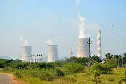
NTPC simhadri beside Ravada | |
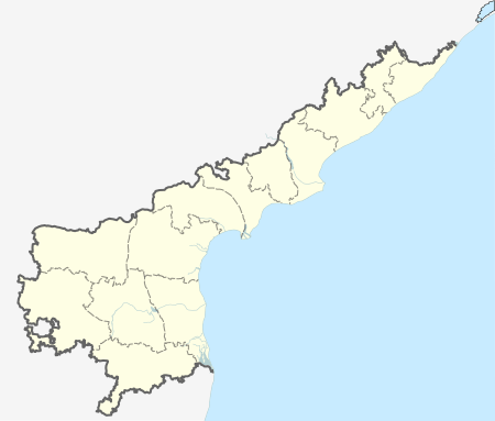  Parawada  Parawada Location in Andhra Pradesh, India | |
| Coordinates: 17°38′00″N 83°06′00″E / 17.6333°N 83.1000°ECoordinates: 17°38′00″N 83°06′00″E / 17.6333°N 83.1000°E | |
| Country |
 India India |
| State | Andhra Pradesh |
| District | Visakhapatnam |
| Elevation | 19 m (62 ft) |
| Population (2011) | |
| • Total | 8,203 |
| Languages | |
| • Official | Telugu |
| Time zone | IST (UTC+5:30) |
| PIN | 531021 |
| Vehicle registration | AP 31-33 |
Parawada is a suburb and a Mandal in Visakhapatnam district in the state of Andhra Pradesh in India.[1]
Geography
Paravada is located at 17°38′00″N 83°06′00″E / 17.6333°N 83.1°E.[2] It has an average elevation of 19 meters (65 feet).
List of Elected Members:
- 1951 - Mullapadi Veerabhadram
- 1955 - Eti Nagayya
- 1962 - Salapu China Appala Naidu
- 1967 - S.R.S.Appala Naidu
- 1972 and 1978 - Bhattam Srirama Murthy
- 1983 and 1985 - Paila Appala Naidu
- 1989, 1994 and 1999 - Bandaru Satyanarayana Murthy
- 2004 - Gandi Babji
- 2009-Panchakarla Ramesh Babu
- 2014-Bandaru Satyanarayana Murthy
Transport
APSRTC run the buses from all areas in Visakhapatnam city. Duvvada railway station is very close to this area.
References
- ↑ "Mandal wise list of villages in Visakhapatnam district" (PDF). Chief Commissioner of Land Administration. National Informatics Centre. Archived from the original (PDF) on 19 March 2015. Retrieved 6 March 2016.
- ↑ Falling Rain Genomics.Paravada
External links
 |
Wikimedia Commons has media related to Parawada. |
This article is issued from Wikipedia - version of the 9/16/2016. The text is available under the Creative Commons Attribution/Share Alike but additional terms may apply for the media files.