Penny River
| Penny River | |
| Country | United States |
|---|---|
| State | Alaska |
| District | Nome Census Area |
| Source | Seward Peninsula |
| - elevation | 876 ft (267 m) [1] |
| - coordinates | 64°42′16″N 165°33′21″W / 64.70444°N 165.55583°W [2] |
| Mouth | Norton Sound, Bering Sea |
| - location | 10 miles (16 km) west of Nome |
| - elevation | 0 ft (0 m) [2] |
| - coordinates | 64°32′10″N 165°44′20″W / 64.53611°N 165.73889°WCoordinates: 64°32′10″N 165°44′20″W / 64.53611°N 165.73889°W [2] |
| Length | 13 mi (21 km) [3] |
| Basin | 36 sq mi (93 km2) [4] |
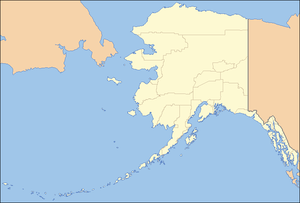  Location of the mouth of the Penny River in Alaska
| |
Penny River (also known as Schrader No Name River) is a waterway on the Seward Peninsula in the U.S. state of Alaska. There are several creek tributaries including Willow, Snowshoe and Homestake, from the west; and Quartz and Negsue from the east.[5] Penny River enters Bering Sea a little east of the mouth of Cripple River, and has a drainage area of 36 square miles (93 km2) [4]
See also
References
- ↑ Derived by entering source coordinates in Google Earth.
- 1 2 3 "Penny River". Geographic Names Information System. United States Geological Survey. March 31, 1981. Retrieved September 22, 2013.
- ↑ Orth, Donald J.; United States Geological Survey (1971) [1967]. Dictionary of Alaska Place Names: Geological Survey Professional Paper 567 (PDF). University of Alaska Fairbanks. United States Government Printing Office. p. 748. Retrieved September 22, 2013.
- 1 2 Geological Survey (U.S.) (1896). Water-supply Paper (Public domain ed.). U.S. Government Printing Office. pp. 43–. Retrieved 31 March 2013.
- ↑ Baker, Marcus (1902). Geographic Dictionary of Alaska. U.S. Government Printing Office. pp. 206, 297, 319, 333, 379, 436–. Retrieved 31 March 2013.
This article is issued from Wikipedia - version of the 10/19/2016. The text is available under the Creative Commons Attribution/Share Alike but additional terms may apply for the media files.