Pic de Vallibierna
| Pic de Vallibierna | |
|---|---|
 | |
| Highest point | |
| Elevation | 3,067 m (10,062 ft) [1] |
| Listing | List of Pyrenean three-thousanders |
| Coordinates | 42°35′42″N 0°39′18″E / 42.59500°N 0.65500°ECoordinates: 42°35′42″N 0°39′18″E / 42.59500°N 0.65500°E [2] |
| Geography | |
| Parent range |
Massif de la Maladeta Pyrenees |
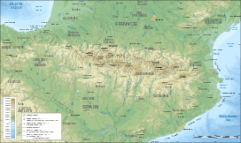

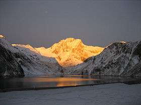
The Pic de Vallibierna, culminating at 3,067 m (10,062 ft), together with the tuc Culebras 3,062 m (10,046 ft) forms a massif located south of the massif de la Maladeta, in the Spanish Pyrenees (Aragon province). The crest separating both summits is nicknamed the horse step.
References
- ↑ "Liste des 3000 pyrénéens par massif". Retrieved 2014-06-13.
- ↑ "Fiche Mendikat". Retrieved 2014-06-13.
This article is issued from Wikipedia - version of the 3/21/2015. The text is available under the Creative Commons Attribution/Share Alike but additional terms may apply for the media files.