Al Qaisumah/Hafr Al Batin Airport
| Al Qaisumah/Hafr Al Batin Airport مطار القيصومة/حفر الباطن | |||||||||||
|---|---|---|---|---|---|---|---|---|---|---|---|
| IATA: AQI – ICAO: OEPA | |||||||||||
| Summary | |||||||||||
| Airport type | Public | ||||||||||
| Operator | Government | ||||||||||
| Serves | Qaisumah, Hafar Al-Batin | ||||||||||
| Location | Eastern Province, Saudi Arabia | ||||||||||
| Elevation AMSL | 1,174 ft / 358 m | ||||||||||
| Coordinates | 28°20′06.8″N 046°07′29.8″E / 28.335222°N 46.124944°ECoordinates: 28°20′06.8″N 046°07′29.8″E / 28.335222°N 46.124944°E | ||||||||||
| Map | |||||||||||
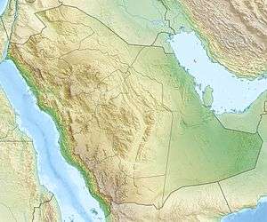  OEPA Location of airport in Saudi Arabia | |||||||||||
| Runways | |||||||||||
| |||||||||||
Al Qaisumah/Hafr al Batin Airport (Arabic: مطار القيصومة/حفر الباطن, IATA: AQI, ICAO: OEPA) is an airport serving Al Qaisumah (also spelled Al Qaysumah), a village near the city of Hafar Al-Batin in Eastern Province, Saudi Arabia. The airport itself is about 20 kilometres (12.4 mi) southeast of Hafar Al-Batin.
The airport began in 1962 as a dusty runway for a Dakota aircraft which was used at that time for transporting Saudi Aramco employees between stations in the northern region. Today, the airport has a 3000 metres runway capable of handling Boeing 737, a total of 11 million square metre area, a passenger terminal, a sewage system and a water treatment and stand-by power plant.[1]
Facilities
The airport resides at an elevation of 1,174 feet (358 m) above mean sea level. It has one runway designated 16/34 with an asphalt surface measuring 3,000 by 45 metres (9,843 ft × 148 ft).
Airlines and destinations
Airlines offering scheduled passenger service:
| Airlines | Destinations |
|---|---|
| Nesma Airlines | Ha'il |
| Saudi Arabian Airlines | Jeddah, Riyadh |
See also
- Hafar Al-Batin Domestic Airport (King Khaled Military City Airport), located at 27°54′03″N 045°31′41″E / 27.90083°N 45.52806°E.
References
- ↑ "Qaisumah Domestic Airport". General Authority of Civil Aviation. Archived from the original on 19 July 2011. (English)
External links
- General Authority of Civil Aviation (GACA) (English)
- Aeronautical chart for OEPA at SkyVector
- Current weather for OEPA at NOAA/NWS
- Accident history for AQI / OEPA at Aviation Safety Network