Qala Wust
| Qala Wust | |
|---|---|
| village | |
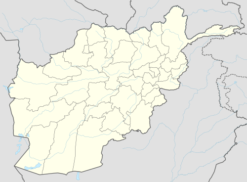  Qala Wust Location in Afghanistan | |
| Coordinates: 36°58′19″N 72°50′48″E / 36.97194°N 72.84667°ECoordinates: 36°58′19″N 72°50′48″E / 36.97194°N 72.84667°E | |
| Country |
 Afghanistan Afghanistan |
| Province | Badakhshan Province |
| Time zone | + 4.30 |
Qala Wust[1] (name variants: Kala Wust, Ūst, Qal‘ah-ye Ūst (BGN standard), Qal‘a-i-Ūst, Qala Ust, Qala Yost, Qal‘eh-ye Vost[2]) is a mountain village in the Wakhan region of the Badakhshan Province, north-eastern Afghanistan.
Qala Wust is a settlement of Tajik highlanders.[3]
The village gave names to the Qala Wust Valley,[4][5] Qala Wust Gneiss formation,[6] and made a former name (Koh-i Qala-i Ust; koh-i means "mountain of") of the Kohanha massif.[3]
References
- ↑ "qala/kala/etc. means "fort", stronghold" in Iranian languages
- ↑ "NGA GeoName Database". National Geospatial Intelligence Agency. Archived from the original on June 8, 2008. (one has to enter the search term)
- 1 2 "Himalaje-Karakorum", by Kazimierz Saysse-Tobiczyk, 138, 148
- ↑ The American Alpine Journal, Volume 15, p. 220
- ↑ The Himalayan journal, Volume 32, p. 48
- ↑ Geology of Central Badakhshan and Surrounding Countries, 1975, Istituto di Geologia, Universita de Milano (Italy), p. 300
This article is issued from Wikipedia - version of the 10/19/2016. The text is available under the Creative Commons Attribution/Share Alike but additional terms may apply for the media files.