Quebec Route 197
| ||||
|---|---|---|---|---|
 | ||||
| Route information | ||||
| Maintained by Transports Québec | ||||
| Length: | 18.5 km[1] (11.5 mi) | |||
| Major junctions | ||||
| South end: |
 Route 132 in Gaspé Route 132 in Gaspé (Saint-Majorique) | |||
| North end: |
Route 132 in Gaspé (Rivière-au-Renard) | |||
| Location | ||||
| Major cities: | Gaspé | |||
| Highway system | ||||
| ||||


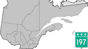
Route 197 is a short 19 km two-lane highway which cuts through the Appalachian Mountains in the municipality of Gaspé, Quebec, Canada. Its only function is to act as a shortcut to Route 132 which goes around the Forillon peninsula which makes up Forillon National Park. It starts at the junction of Route 132 in Rivière-au-Renard (part of the municipality of Gaspé) and ends again at the junction of Route 132 in Saint-Majorique, part of Gaspé as well.
Municipalities along Route 197
- Gaspé - (Rivière-au-Renard / Rivière-Morris / Saint-Majorique )
See also
References
- ↑ Ministère des transports, "Distances routières", page 77, Les Publications du Québec, 2005
External links
- Interactive Provincial Route Map (Quebec Ministry of Transportation) (French)
- Route 197 on Google Maps
This article is issued from Wikipedia - version of the 11/9/2016. The text is available under the Creative Commons Attribution/Share Alike but additional terms may apply for the media files.