Rambrouch
| Rambrouch Rammerech | ||
|---|---|---|
| Commune | ||
 | ||
| ||
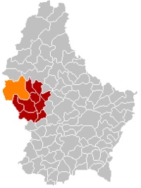 Map of Luxembourg with Rambrouch highlighted in orange, and the canton in dark red | ||
| Coordinates: 49°49′48″N 5°50′59″E / 49.829875°N 5.849781°ECoordinates: 49°49′48″N 5°50′59″E / 49.829875°N 5.849781°E | ||
| Country |
 Luxembourg Luxembourg | |
| Canton | Redange | |
| Government | ||
| • Mayor | Antoine Rodesch | |
| Area | ||
| • Total | 79.09 km2 (30.54 sq mi) | |
| Area rank | 3rd of 105 | |
| Highest elevation | 554 m (1,818 ft) | |
| • Rank | 2nd of 105 | |
| Lowest elevation | 311 m (1,020 ft) | |
| • Rank | 100th of 105 | |
| Population (2014) | ||
| • Total | 4,071 | |
| • Rank | 34th of 105 | |
| • Density | 51/km2 (130/sq mi) | |
| • Density rank | 88th of 105 | |
| Time zone | CET (UTC+1) | |
| • Summer (DST) | CEST (UTC+2) | |
| LAU 2 | LU00003005 | |
| Website | rambrouch.lu | |

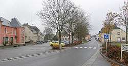
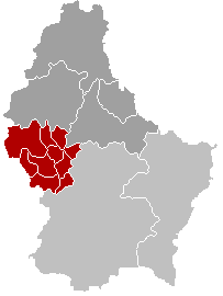
Rambrouch (Luxembourgish: Rammerech) is a commune and small town in western Luxembourg, in the canton of Redange. It lies close to the border with Belgium.
Rambrouch was formed on 1 January 1979 from the former communes of Arsdorf, Bigonville, Folschette, and Perlé, all in Redange canton. The law creating Rambrouch was passed on 27 July 1978.[1]
As of 2005, the town of Rambrouch, which lies in the centre of the commune, has a population of 379. Other towns within the commune include Arsdorf, Bigonville, Bilsdorf, Folschette, Holtz, Hostert, Koetschette, Perlé, Rombach, Schwiedelbrouch, and Wolwelange.
See also
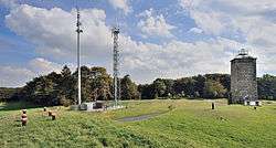
- Napoléonsgaard hill
References
- ↑ "Mémorial A, 1978, No. 46" (PDF) (in French). Service central de législation. Retrieved 2006-08-11.
External links
-
 Media related to Rambrouch at Wikimedia Commons
 - Commune of Rambrouch official website
 |
Fauvillers (BE-WLX) | Boulaide | Esch-sur-Sûre | |
| Martelange (BE-WLX) |  |
Wahl | ||
| ||||
 | ||||
| Attert (BE-WLX) | Ell, Redange | Préizerdaul |


 | ||
This article is issued from Wikipedia - version of the 12/1/2016. The text is available under the Creative Commons Attribution/Share Alike but additional terms may apply for the media files.