Rancho Ex-Mission la Purisima
Rancho Ex-Mission la Purisima (also called Rancho Purisima) was a 14,736-acre (59.63 km2) Mexican land grant in present-day Santa Barbara County, California given in 1845 by Governor Pio Pico to Jonathan Temple.[1] The rancho derives its name from the secularized Mission La Purísima, but was called ex-Mission because of a division made of the lands held in the name of the Mission— the church retaining the grounds immediately around, and all of the lands outside of this are called ex-Mission lands. The grant was north of the Santa Ynez River and present-day Lompoc and encompasses present-day Vandenberg Village. The grant was defined by the boundaries of the earlier surrounding grants, viz: Rancho Mission Vieja de la Purisma, Rancho Jesús María, Rancho Lompoc, Rancho Los Alamos, and Rancho Santa Rita.[2]
History
Following the secularization of Mission La Purísima in 1834, the padres moved to Mission Santa Inés.[3] The abandoned mission was sold in 1845 by Pio Pico to Jonathan Temple for $1,100. In 1850, Temple sold the property to José Ramón Malo (1812-1859) for $1,500.[4] Malo was the grantee of the adjoining Rancho Santa Rita.
With the cession of California to the United States following the Mexican-American War, the 1848 Treaty of Guadalupe Hidalgo provided that the land grants would be honored. As required by the Land Act of 1851, a claim for Rancho Ex-Mission la Purisima was filed with the Public Land Commission in 1852,[5] and the grant was patented to José Ramón Malo in 1882.[6]
In 1870 Jesse Hill and D.W and A.P Jones, purchased an interest in Rancho Santa Rita and Rancho Ex-Mission la Purisima. Christy & Wise, wool merchants of San Francisco, also owned an interest.[7]
Historic sites of the Rancho
See also
- List of Ranchos of California
- Ranchos of Santa Barbara County, California
References
- ↑ Ogden Hoffman, 1862, Reports of Land Cases Determined in the United States District Court for the Northern District of California, Numa Hubert, San Francisco
- ↑ Santa Barbara County Rancho Map
- ↑ Mission La Purisima Concepcion:A Glance Through Its History And The Story Of Its Restoration
- ↑ Rancho Mission De La Purisima, 1897, Decisions of the Department of the Interior and the General Land Office, Volume 1, pp.248-260
- ↑ United States. District Court (California : Southern District) Land Case 389 SD
- ↑ Report of the Surveyor General 1844 - 1886
- ↑ Jesse D Mason, 1883, History of Santa Barbara County, California, Thompson & West
External links
Coordinates: 34°42′00″N 120°27′00″W / 34.700°N 120.450°W
Municipalities and communities of Santa Barbara County, California, United States | ||
|---|---|---|
| Cities | 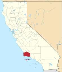 | |
| CDPs | ||
| Unincorporated communities | ||
| Indian reservation | ||
| Ghost towns | ||