Ready Token
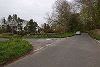
Ready Token is a hamlet in Gloucestershire, in the Cotswold Hills near Poulton, England. Despite comprising only a handful of houses it is located at a high point and is notable for being the meeting place of six country roads and nine parish boundaries.[1] It lies at the intersection of the ancient drove road known as the Welsh Way and the Roman Akeman Street.[2] It once possessed an inn, recorded in 1738 as under the sign Ready Token Ash.[3]
The name is a fusion of the Celtic word rhydd and the Saxon word tacen meaning the way to the ford. The ford being that across the River Coln at Fairford.[3]
Another explanation for the name is that the inn extended no credit and would only accept cash payment, i.e. "ready cash" or "tokens".[4]
It is the site of a house which has a butterfly shaped plan which mirrors the local butterfly shaped road pattern designed by the Arts and Crafts movement architect, Norman Jewson, built in 1928-1929.[5]
References
- ↑ Aston, Michael Interpreting the Landscape: Landscape Archaeology & Local History, Page 42, Psychology Press, 1997 ISBN 0415151406
- ↑ Copeland, Tim, Akeman Street, The History Press, 2009. ISBN 9780752447322
- 1 2 Gibbs, J. Arthur, A Cotswold Village Or Country Life and Pursuits in Gloucestershire,Echo Library, 2008, Page 51, ISBN 1406870676
- ↑ Poulton Cotwold District Council On line, Accessed Jan 2013
- ↑ Owlpen Manor Estate Norman Jewson, architect by Nicholas Mander, 2012 , List of architectural works
- Road travel and transport in Gloucestershire, 1722-1822: extracts - Page 25, N. M. Herbert, Publisher A. Sutton, 1985
External links
Coordinates: 51°44′21″N 1°50′54″W / 51.739109°N 1.84847°W