Rietfontein
| Rietfontein | |
|---|---|
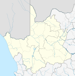  Rietfontein  Rietfontein  Rietfontein
| |
| Coordinates: 26°44′00″S 20°02′00″E / 26.7333°S 20.0333°ECoordinates: 26°44′00″S 20°02′00″E / 26.7333°S 20.0333°E | |
| Country | South Africa |
| Province | Northern Cape |
| District | ZF Mgcawu |
| Municipality | Dawid Kruiper |
| Area[1] | |
| • Total | 1.80 km2 (0.69 sq mi) |
| Population (2011)[1] | |
| • Total | 2,293 |
| • Density | 1,300/km2 (3,300/sq mi) |
| Racial makeup (2011)[1] | |
| • Black African | 5.6% |
| • Coloured | 92.5% |
| • Indian/Asian | 1.0% |
| • White | 0.5% |
| • Other | 0.3% |
| First languages (2011)[1] | |
| • Afrikaans | 95.5% |
| • Sign language | 1.4% |
| • English | 1.0% |
| • Tswana | 1.0% |
| • Other | 1.1% |
| Postal code (street) | n/a |
| PO box | n/a |
Rietfontein is a town in ZF Mgcawu District Municipality in the Northern Cape province of South Africa. It functions as the Rietfontein Borderpost with Namibia during the day hours of 08:00-16:30, that gives access to and from south-east Namibia via Aroab on the C16 main road.
References
- 1 2 3 4 "Main Place Rietfontein". Census 2011.
Municipalities and communities of ZF Mgcawu District Municipality, Northern Cape | ||
|---|---|---|
District seat: Upington | ||
| Kai !Garib | .svg.png) | |
| Kgatelopele | ||
| //Khara Hais | ||
| !Kheis | ||
| Mier | ||
| Tsantsabane | ||
This article is issued from Wikipedia - version of the 6/27/2016. The text is available under the Creative Commons Attribution/Share Alike but additional terms may apply for the media files.