Saginaw Trail
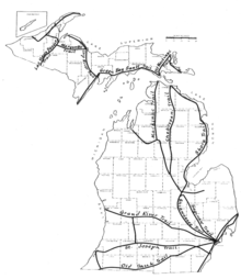
Saginaw Trail is the collective name for a set of connected roads in Southeastern Michigan that runs from Detroit to Saginaw through Pontiac and Flint. It was originally a tribal foot trail. On December 7, 1818, the Michigan Territorial government authorized the building of a road from Detroit to Saginaw along the trail.[1] In the early 20th century, it was used as part of the Dixie Highway[2] and the Theodore Roosevelt International Highway,[3] early auto trails in the state. It was later designated as a part of US Highway 10 (US 10) when the United States Numbered Highway System was created in 1926.[4] Since the Michigan portion of Interstate 75 (I-75) was completed in 1973, it has been a county road or part of other state highways.[5]
To drive it today, drivers would follow:
 M-1 (Woodward Avenue) from Detroit to Birmingham;
- Old Woodward Avenue through Birmingham;
- M-1 (Woodward Avenue) from Birmingham to Pontiac;

 Bus. US 24 (Woodward Avenue) into downtown Pontiac;
- US 24 (Dixie Highway) north of Pontiac to Clarkston;
- Dixie Highway, a set of various county roads that were previously US 10 from Clarkston to near Grand Blanc;
- Saginaw Road and Saginaw Street through Grand Blanc, Burton, and Flint to north of Mount Morris;
 M-54 (Dort Highway) from north of Mount Morris into Saginaw County;
- Dixie Highway and Genesee Avenue into Saginaw.[6]
See also
 Michigan Highways portal
References
- ↑ Barnett, LeRoy (2004). A Drive Down Memory Lane: The Named State and Federal Highways of Michigan. Allegan Forest, MI: Priscilla Press. pp. 192–3. ISBN 1-886167-24-9..
- ↑ Dixie Highway Association (1922). Outline of the Dixie Highway (Map). Scale not given. Dixie Highway. Retrieved March 14, 2009 – via WikiMedia Commons.
- ↑ Skidmore, Max J. (2007). Moose Crossing: Portland to Portland on the Theodore Roosevelt International Highway. Lanham, MD: Hamilton Books. pp. 71–4. ISBN 978-0-7618-3510-3.
- ↑ Bureau of Public Roads & American Association of State Highway Officials (November 11, 1926). United States System of Highways Adopted for Uniform Marking by the American Association of State Highway Officials (Map). 1:7,000,000. Washington, DC: U.S. Geological Survey. OCLC 32889555. Retrieved November 7, 2013 – via University of North Texas Libraries.
- ↑ Michigan Department of State Highways and Transportation (1974). Michigan, Great Lake State: Official Transportation Map (Map). c. 1:918,720. Lansing: Michigan Department of State Highways and Transportation. §§ J12–M13. OCLC 12701177, 83138602.
- ↑ Google (March 15, 2009). "Saginaw Trail" (Map). Google Maps. Google. Retrieved March 15, 2009.
