Sahwat al-Khudr
| Sahwat al-Khudr سهوة الخضر | |
|---|---|
| Village | |
  Sahwat al-Khudr | |
| Coordinates: 32°36′8″N 36°42′27″E / 32.60222°N 36.70750°E | |
| Country |
 Syria Syria |
| Governorate | Suwayda |
| District | Suwayda |
| Subdistrict | Suwayda |
| Population (2004 census) | |
| • Total | 3,625 |
| Time zone | EET (UTC+2) |
| • Summer (DST) | EEST (UTC+3) |
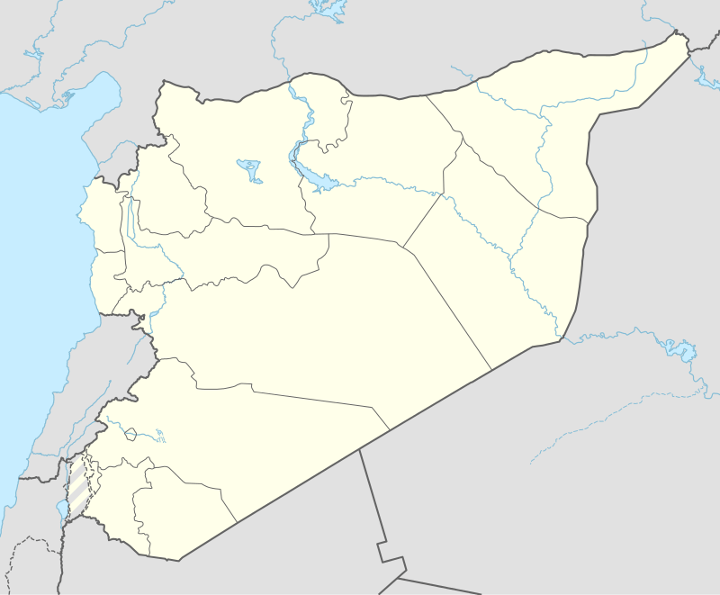
Sahwat al-Khudr (Arabic: سهوة الخضر; also spelled Sahwat al-Khidr or Sahwet el-Khodar) is a village in southern Syria, administratively part of the al-Suwayda District of the al-Suwayda Governorate, located south of al-Suwayda. In the 2004 census, it had a population of 3,625.[1] The village is named after a Byzantine-era church named dedicated to Saint George (known by local Muslims as "al-Khudr"). It was resettled by Druze in the mid-19th century after a period of abandonment.
History
Sahwat al-Khudr receives its name from an ancient Byzantine church dedicated to Saint George, who is identified with "al-Khudr" by Muslims. An inscription on a monument in the church dates back to 306 CE.[2]
In 1596 it appeared in the Ottoman tax registers under the name of Sahut al-Qamh, located in the Nahiya of Bani Nasiyya of the Qada of Hawran. The population was 142 households and 54 bachelors, all Muslim. They paid a fixed tax-rate of 40 % on agricultural products, including wheat, barley, summer crops, vineyards, goats and beehives; in addition to occasional revenues and a water mill; a total of 31,300 Akçe.[3]
Sahwat al-Khudr had been abandoned for a time, but was settled by Druze between 1857 and 1860 at the encouragement of Ismail al-Atrash, a prominent Druze sheikh (chieftain) in the Hauran.[4] In the mid-19th-century, Albert Socin, a European orientalist noted that Sahwat al-Khudr was "a dilapidated town with a castle and a church" surrounded by a forested area. The shrine of al-Khudr in the village was revered by all the religious sects of the vicinity.[5]
In the late 1960s, French geographer Robert Boulanger described Sahwat al-Khudr as "a very picturesque place" with an old mosque that was formerly a pagan temple in Antiquity.[6] The mosque's prayer room contained a column with Nabataean inscriptions.[6] The people of the village slaughtered sheep outside of the mosque annually.[6]
Geography
Nearby localities include Salah to the northeast, Miyamas to the north, Hubran to the northwest, Salkhad to the southwest and Orman to the south.
References
- ↑ "General Census of Population 2004.". Retrieved 2014-07-10.
- ↑ Porter, 1868, pp. 488-9
- ↑ Hütteroth and Abdulfattah, 1977, p. 210
- ↑ Firro, 1992, p. 189
- ↑ Socin, Albert (1876). Baedeker, Karl, ed. Palestine and Syria: Handbook for Travellers. Karl Baedeker. p. 412.
- 1 2 3 Boulanger, Robert (1966). The Middle East, Lebanon, Syria, Jordan, Iraq, Iran. Hachette.
Bibliography
- Firro, Kais (1992). A History of the Druzes. 1. BRILL. ISBN 9004094377.
- Hütteroth, Wolf-Dieter; Abdulfattah, Kamal (1977). Historical Geography of Palestine, Transjordan and Southern Syria in the Late 16th Century. Erlanger Geographische Arbeiten, Sonderband 5. Erlangen, Germany: Vorstand der Fränkischen Geographischen Gesellschaft. ISBN 3-920405-41-2.
- Porter, Josias Leslie (1868). A Handbook for Travellers in Syria and Palestine. 2. Murray.
External links
- Map of the town, Google Maps
|   | ||||||||||||||||||||||||
|
| |||||||||||||||||||||||||