Schwülme
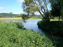 | |
| Confluence of the Schwülme and Weser near Lippoldsberg | |
| Location | Hesse, Lower Saxony, Germany |
|---|---|
| Reference no. | DE: 436 |
| Length | 29 km |
| Source | West of Hettensen 51°37′34″N 9°44′57″E / 51.6261556°N 9.7492250°ECoordinates: 51°37′34″N 9°44′57″E / 51.6261556°N 9.7492250°E |
| Source height | ca. 332 m above sea level (NN) |
| Mouth | Near Lippoldsberg into the Weser 51°37′39″N 9°33′14″E / 51.627398°N 9.553830°E |
| Mouth height | ca. 106 m above sea level (NN) |
| Descent | ca. 226 m |
| Basin | Weser |
| Progression | Weser → North Sea |
| Catchment | 289.753 km² [1] |
The Schwülme is a 29-kilometre-long, right-hand and eastern tributary of the River Weser in Lower Saxony and Hesse, Germany.
See also
- ↑ Water map service of the Hessian Ministry for the Environment, Energy, Agriculture and Consumer Protection (Hessisches Ministerium für Umwelt, Energie, Landwirtschaft und Verbraucherschutz
This article is issued from Wikipedia - version of the 5/22/2016. The text is available under the Creative Commons Attribution/Share Alike but additional terms may apply for the media files.