State road D750 (Turkey)
| D.750 | |
|---|---|
 | |
| Route information | |
Part of  | |
| Length: | 722 km (449 mi) |
| Major junctions | |
| North end: | Zonguldak |
| South end: | Tarsus |
| Highway system | |
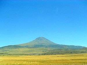
View of the volcano Hasandağı from the D750 state road, south of Aksaray.
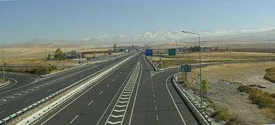
Turkish state road D 750 at Konya junction. Toros Mountains in the background
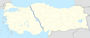
D.750 is a north to south state road in Turkey. It starts at Zonguldak at the Black sea coast and ends at the junction of  near Tarsus in the Mediterranean Region. It crosses many state roads (like
  ,
,  ,
,  ,
,  and
and  ).[1]
).[1]
Itinerary
| Province | Location | Distance from Zonguldak (km) |
Distance from Zonguldak (mile) |
Distance from Tarsus (D400) (km) |
Distance from Tarsus (D400) (mile) |
|---|---|---|---|---|---|
| Zonguldak | |||||
| Zonguldak | 0 | 0 | 722 | 449 | |
| Devrek | 45 | 28 | 677 | 421 | |
| Bolu | |||||
| Mengen | 102 | 63 | 620 | 385 | |
| D100 | 122 | 76 | 600 | 373 | |
| Gerede[2] | 133 | 83 | 589 | 366 | |
| Ankara | |||||
| Kızılcahamam [2] | 195 | 121 | 527 | 327 | |
| Ankara (D140) | 272 | 169 | 450 | 280 | |
| Konya | D715 | 371 | 231 | 351 | 218 |
| Ankara | Şereflikoçhisar | 418 | 260 | 304 | 189 |
| Aksaray | Aksaray[2] (D300) | 496 | 308 | 226 | 140 |
| Konya | |||||
| D330 (north)[3] | 565 | 351 | 157 | 98 | |
| D330 (south)[4] | 587 | 365 | 135 | 84 | |
| Niğde | |||||
| Ulukışla | 602 | 374 | 120 | 75 | |
| D805 | 607 | 377 | 115 | 71 | |
| Adana | Pozantı | 645 | 401 | 77 | 48 |
| Mersin | Tarsus (D400) | 722 | 449 | 0 | 0 |
Connections to motorways
There are a number of connections to motorways of Turkey [5]
. Connections to  are in Bolu and Ankara provinces. Connections to
  are in Konya, Adana and Mersin provinces and connection to
  is in Mersin province.
References and notes
- ↑ Vatan Türkiye Turizm Atlası, Boyut Yayıncılık, İstanbul, 2009 ISBN 978-975-23-0634-9
- 1 2 3 Actually the ring road.
- ↑ To east (Niğde)
- ↑ To west (Konya)
- ↑ Page of General Directorate of Highways (Turkey)
 State roads in Turkey State roads in Turkey | |||||||
|---|---|---|---|---|---|---|---|
| West–east highways |
| ||||||
| North–south highways |
| ||||||
This article is issued from Wikipedia - version of the 2/10/2016. The text is available under the Creative Commons Attribution/Share Alike but additional terms may apply for the media files.