Stonehall (civil parish)
| Stonehall Tigh Cloiche | |
|---|---|
| Civil parish | |
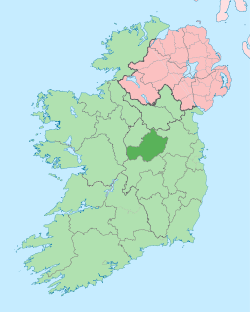
  Stonehall Location of Stonehall within County Westmeath in the Republic of Ireland | |
| Coordinates: 53°36′37″N 7°19′51″W / 53.61028°N 7.33083°WCoordinates: 53°36′37″N 7°19′51″W / 53.61028°N 7.33083°W | |
| Country |
 Republic of Ireland Republic of Ireland |
| Province | Leinster |
| County | County Westmeath |
| Irish grid reference | N443625 |
Stonehall (Irish: Tigh Cloiche)[1] is a civil parish in County Westmeath, Ireland. It is located about 9.6 kilometres (6 mi) north of Mullingar. This name also applies to the townland of Stonehall.
Stonehall is one of 8 civil parishes in the barony of Corkaree in the Province of Leinster. The civil parish covers 3,183.1 acres (12.882 km2).
Stonehall civil parish comprises 11 townlands: Blackmiles, Galmoylestown Lower, Galmoylestown Upper, Garrysallagh, Killintown, Knockbody, Larkinstown, Martinstown, Monintown, Multyfarnham or Fearbranagh and Stonehall.
The neighbouring civil parishes are: Faughalstown to the north, Taghmon to the east, Tyfarnham to the south and Multyfarnham to the west and north.[2][3]
References
- ↑ Stonehall civil parish The Placenames Database of Ireland Retrieved on 13 June 2015.
- ↑ Stonehall civil parish, Co. Westmeath Townlands.ie Retrieved on 13 June 2015.
- ↑ Stonehall civil parish, Co. Westmeath The IreAtlas Townland Data Base Retrieved on 13 June 2015.
External links
- Map of Stonehall civil parish at openstreetmap.org
- Stonehall civil parish at the IreAtlas Townland Data Base
- Stonehall civil parish at Townlands.ie
- Stonehall civil parish at The Placenames Database of Ireland