Sunnybrook State Park
| Sunnybrook State Park | |
| Connecticut State Park | |
| Country |  United States United States |
|---|---|
| State |  Connecticut Connecticut |
| County | Litchfield |
| Town | Torrington |
| Elevation | 791 ft (241 m) [1] |
| Coordinates | 41°50′10″N 73°07′13″W / 41.83611°N 73.12028°WCoordinates: 41°50′10″N 73°07′13″W / 41.83611°N 73.12028°W [1] |
| Area | 464 acres (188 ha) |
| Established | Unspecified |
| Management | Connecticut Department of Energy and Environmental Protection |
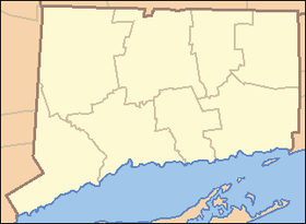  Location in Connecticut | |
| Website: Sunnybrook State Park | |
Sunnybrook State Park is a Connecticut state park located in the town of Torrington. The park is suited for hiking, picnicking, hunting, and fishing along the East Branch Naugatuck River.[2]
The park is the southwestern terminus for the blue-blazed John Muir Trail which crosses Paugnut State Forest for two miles to the loop trail at Burr Pond State Park.[3]
References
- 1 2 "East Branch Dam". Geographic Names Information System. United States Geological Survey.
- ↑ "Sunnybrook State Park". State Parks and Forests. Connecticut Department of Energy and Environmental Protection. Retrieved February 5, 2013.
- ↑ "Paugnut State Forest: John Muir Trail" (PDF). State Parks and Forests. Connecticut Department of Energy and Environmental Protection. Retrieved April 16, 2014.
External links
- Sunnybrook State Park Connecticut Department of Energy and Environmental Protection
This article is issued from Wikipedia - version of the 4/17/2014. The text is available under the Creative Commons Attribution/Share Alike but additional terms may apply for the media files.