Tandil Airport
| Tandil Airport Aeropuerto de Tandil | |||||||||||
|---|---|---|---|---|---|---|---|---|---|---|---|
| IATA: TDL – ICAO: SAZT | |||||||||||
| Summary | |||||||||||
| Airport type | Public / Militar | ||||||||||
| Operator | Government and Air Force | ||||||||||
| Serves | Tandil, Buenos Aires | ||||||||||
| Location | Charcas S/N. (B7000) TANDIL | ||||||||||
| Elevation AMSL | 574 ft / 175 m | ||||||||||
| Coordinates | 37°13′31.20″S 59°13′39.80″W / 37.2253333°S 59.2277222°WCoordinates: 37°13′31.20″S 59°13′39.80″W / 37.2253333°S 59.2277222°W | ||||||||||
| Map | |||||||||||
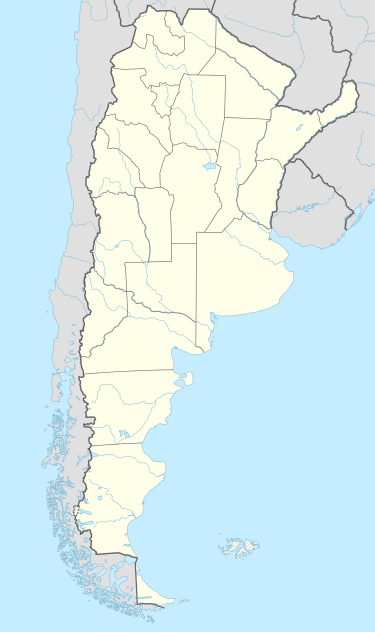  SAZT Location of Aeropuerto Tandil in Argentina | |||||||||||
| Runways | |||||||||||
| |||||||||||
Tandil Airport (Spanish: Aeropuerto Tandil, IATA: TDL, ICAO: SAZT), is an airport located 18 kilometers northwest from the city of Tandil, in the Province of Buenos Aires.
Its address is Sección Chacras – Acceso a Base Aérea S/N (B7000), exactly on 37° 13' 31" S and 59° 13' 40" W.
Its size is 513ha, and it has a passenger terminal of 2500 m². Most of flights are for military training.
See also
References
- ↑ Airport record for Aeropuerto Tandil at Landings.com. Retrieved 23 August 2013
- ↑ Google (23 August 2013). "location of Aeropuerto Tandil" (Map). Google Maps. Google. Retrieved 23 August 2013.
External links
- Airport record for Aeropuerto Tandil at Landings.com
- Current weather for SAZT at NOAA/NWS
This article is issued from Wikipedia - version of the 11/10/2016. The text is available under the Creative Commons Attribution/Share Alike but additional terms may apply for the media files.